Severe Thunderstorm Warning for Parts of Autauga, Elmore, & Montgomery Co Until 8:15pm
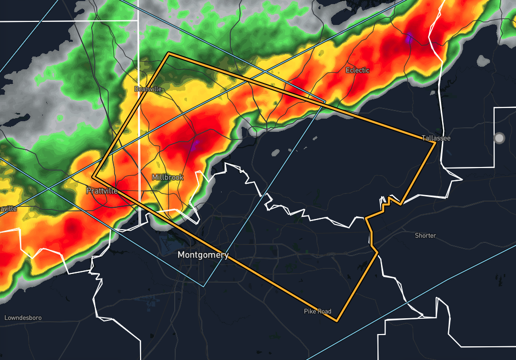
The National Weather Service in Birmingham has issued a Severe Thunderstorm Warning for east central Autauga County in central Alabama, southern Elmore County in east central Alabama, and northeastern Montgomery County in south central Alabama, effective until 8:15 PM CDT. As of 7:47 PM CDT, radar indicated a severe thunderstorm near Deatsville, or near Millbrook, moving east at 45 mph. This storm poses a significant threat with hazards including 60 mph wind gusts and quarter-size hail. These conditions are likely to result in hail damage to vehicles and wind damage to roofs, siding, and trees.
Residents in the impacted areas, including northeastern Montgomery, Prattville, Millbrook, Wetumpka, Tallassee, Elmore, Coosada, Deatsville, Montgomery Zoo, Boylston, Auburn University in Montgomery, Bob Woodruff Lake, Emerald Mountain, Waugh, Lagoon Park, Eastdale Mall, Mount Meigs, Blue Ridge, Gunter Air Force Base, and Jordan Lake, should take immediate safety precautions. For your protection, it is advised to move to an interior room on the lowest floor of a building. This will help shield you from the potential damage caused by the high winds and hail associated with this severe thunderstorm.
Stay alert and closely monitor weather updates as the situation evolves. Ensuring you are in a safe location is crucial to avoid injury from flying debris, falling trees, or other storm-related hazards. Taking these precautions seriously can help protect you and your loved ones during this severe weather event.
Category: Alabama's Weather, ALL POSTS, Severe Weather
About the Author (Author Profile)
Scott Martin is an operational meteorologist, professional graphic artist, musician, husband, and father. Not only is Scott a member of the National Weather Association, but he is also the Central Alabama Chapter of the NWA president. Scott is also the co-founder of Racecast Weather, which provides forecasts for many racing series across the USA. He also supplies forecasts for the BassMaster Elite Series events including the BassMaster Classic.Subscribe
If you enjoyed this article, subscribe to receive more just like it.


