Alabama Weather Update: 11 a.m. Sunday
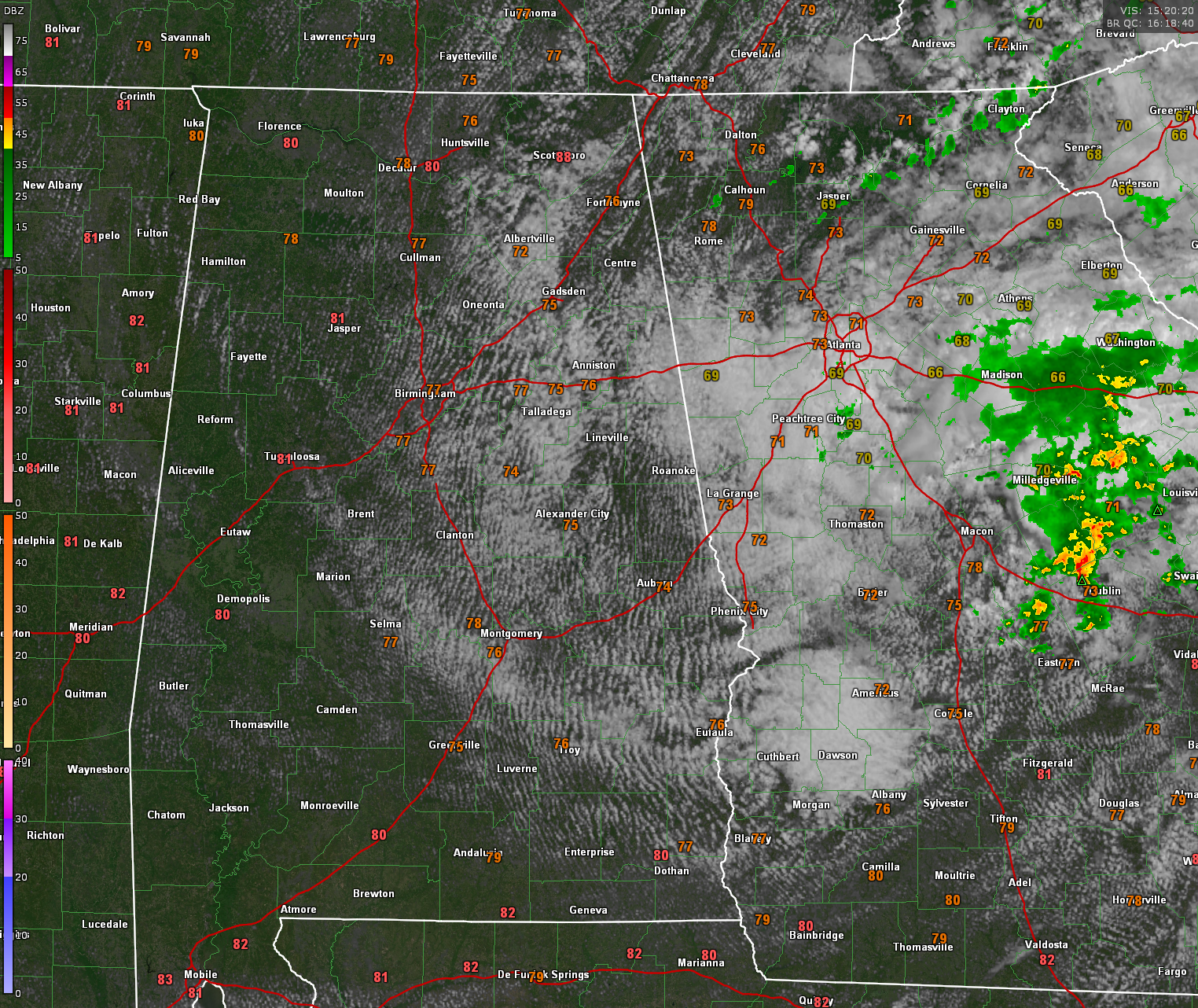
Alabama finds itself on the west side of a small upper low between Atlanta and Savannah. A nice field of stratocumulus covers the eastern half of the state with a mix of clouds and sun. The western half of the state is just beginning to see some of those clouds form.
The nearest rain to Alabama is a batch of light to moderate showers over Central Georgia east of Atlanta.
There could be a rash of a few small showers under that heavier SC deck over eastern Alabama this afternoon, and an isolated shower is not out of the question overnight, but rain chances at any one location are very low and rainfall amounts will generally be a trace.
Temperatures over Alabama are in the 70s statewide except in Mobile and Baldwin Counties, where readings are in the low 80s. Dewpoints are in the middle 60s generally, making it feel a little muggy. They will mix down into the lower 60s this afternoon. Afternoon highs should be in the 80s everywhere in the state. Lows tonight will be in the lower and middle 60s.
A little bit of drier air will filter into eastern Alabama through midweek, with some dewpoints in the upper 50s over that part of the state. That might even allow a stray low in the upper 50s in some place like Heflin or Wedowee in Cleburne or Randolph Counties
But moisture levels will rise later in the week and that mugginess is with us for the foreseeable future, with dewpoints rising into the upper 60s to near 70F by late in the week into the weekend.
Monday through Wednesday look pretty sunny, with clouds not increasing until Wednesday night into Thursday. The first significant rain chances should not return to Alabama until Thursday afternoon and night. And then it will be only for the Tennessee Valley. The northern half of the state could see a shower or storm Friday. Isolated fairly random showers and storms will be around on Saturday.
Sunday looks like it will be mainly dry, but rain will increase on Sunday night into Memorial Day. The week two period which will be the last few days of May looks unsettled with fairly plentiful mainly afternoon and evening showers and storms making their debut.
The GFS is even throwing what will probably be one of its phantom tropical lows into the mix by the end of the forecast period around June 3. It shows a system south of Cuba then. Probably not reality, but just a reminder that we a entering what is expected to be a very busy hurricane season.
Category: ALL POSTS
About the Author (Author Profile)
Bill Murray is the President of The Weather Factory. He is the site's official weather historian and a weekend forecaster. He also anchors the site's severe weather coverage. Bill Murray is the proud holder of National Weather Association Digital Seal #0001 @wxhistorianSubscribe
If you enjoyed this article, subscribe to receive more just like it.


