Midday Nowcast: Some Clouds and Sun
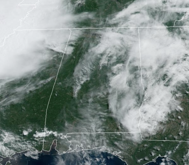
We will mention the chance for a few widely, scattered showers and storms across the northern third of the state this afternoon, but most locations will remain dry. Temperatures this afternoon are in the upper 80s and lower 90s.
BIRMINGHAM ALMANAC: For May 23rd, the average high for Birmingham is 88° and the average low is 63°. The record high is 95° set in 1996, while the record low is 47° set in 1954. We average 0.15” of precipitation on this date, and the record value is 3.12” set in 2020.
ACROSS THE USA: Heavy wet snow and gusty winds are expected in the higher elevations of Idaho, western Montana, and Wyoming Thursday. Meanwhile, another round of severe storms are expected to develop across the central and southern Plains. Damaging winds, tornadoes and large hail are the primary threats. Further west, dry conditions and gusty winds will lead to critical fire weather concerns in the Southwest.
SEC TOURNAMENT: Dry weather continues in Hoover for the SEC baseball tournament today. A few random, scattered showers or storms are possible tomorrow through Sunday, but the weather will be dry most of the time with highs between 87 and 90 degrees. If a shower passes over the Hoover Met the rain should last around 30 to 45 minutes before it moves on.
MEMORIAL DAY WEEKEND: A weakening cold front drops into the state tomorrow, and we will mention the chance of “scattered, mostly afternoon and evening showers and thunderstorms” over the northern half of the state tomorrow and Saturday. Chance of any one spot getting wet is in the 30-40% range, and most of the showers and storms will occur during the afternoon and evening hours; 2PM-10PM
Sunday looks mostly dry, although again a few isolated afternoon showers can’t be totally ruled out. Another front, this one with more southward push and more support, will bring showers and storms to Alabama late Sunday night into Monday. Memorial Day won’t be a wash-out, and still a decent part of the day will be dry. But, where thunderstorms develop over North Alabama, they could be strong. Highs Friday through Monday will remain in the upper 80s and lower 90s.
NEXT WEEK: Showers and storms will linger into Tuesday, especially the morning hours, then the rest of the week will feature a cooler, drier airmass. Highs drop into the low 80s by Wednesday, and many North Alabama communities will dip into the 50s by Thursday and Friday morning.
BEACH FORECAST CENTER: Get the latest weather and rip current forecasts for the beaches from Fort Morgan to Panama City on our Beach Forecast Center page. There, you can select the forecast of the region that you are interested in visiting.
WORLD TEMPERATURE EXTREMES: Over the last 24 hours, the highest observation outside the U.S. was 122.0F at Jacobabad, Pakistan. The lowest observation was -104.8F at Dome C, Antarctica.
CONTIGUOUS TEMPERATURE EXTREMES: Over the last 24 hours, the highest observation was 113F at Rio Grande Village, TX. The lowest observation was 15F at Kirk, OR.
Category: Alabama's Weather, ALL POSTS
About the Author (Author Profile)
Macon, Georgia Television Chief Meteorologist, Birmingham native, and long time Contributor on AlabamaWX. Stormchaser. I did not choose Weather, it chose Me. College Football Fanatic. @Ryan_StinnetSubscribe
If you enjoyed this article, subscribe to receive more just like it.


