Strong Storms Over Northwest Alabama
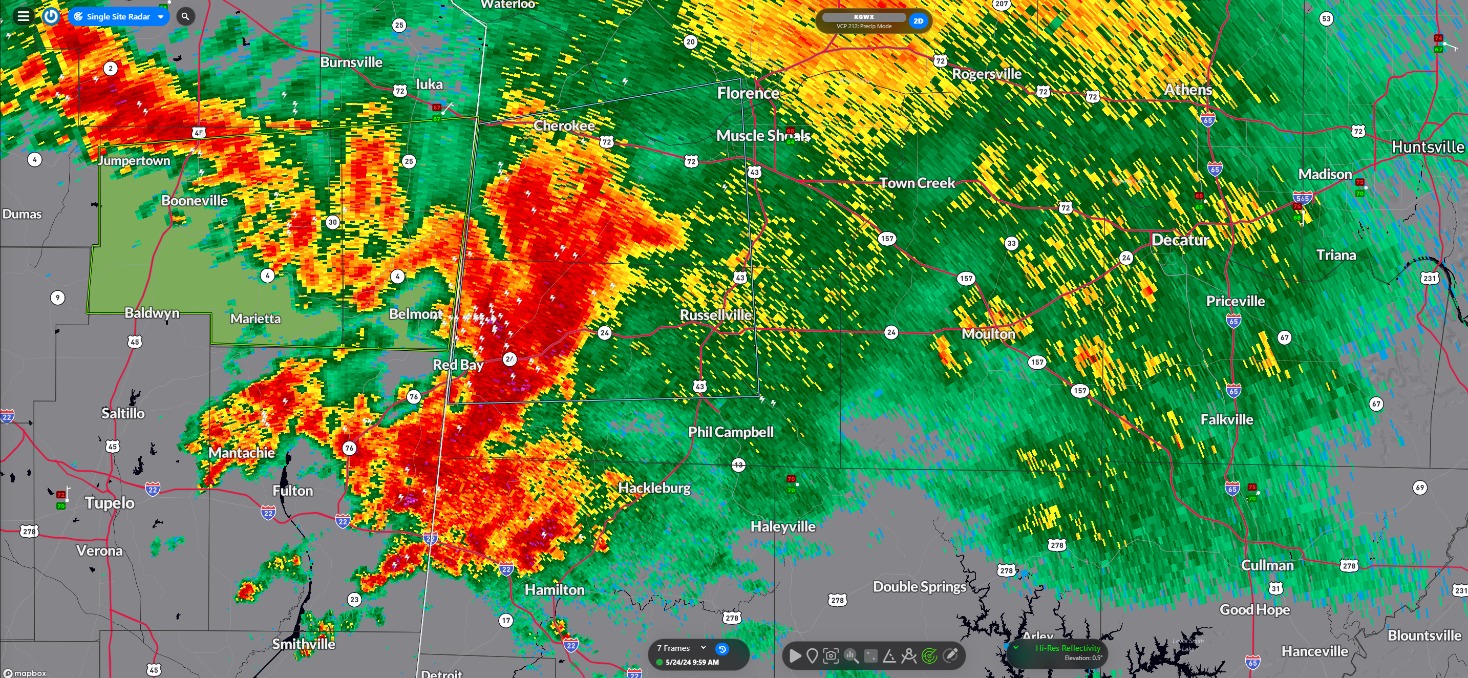
Strong storms over Northwest Alabama and Northeast Mississippi are producing heavy rain, lightning, gusty winds, and some small hail.
There is a flash flood warning for Prentiss and Tishomingo Counties. Nearly 2.5″ of rain has fallen in an hour near Boonville.
In Alabama, the heaviest are over western Colbert, Franklin, and Marion Counties.
The storms are not severe, but will continue to intensify as the heating of the day increases instability.
There is a slight risk for severe weather (level 2/5) over Northwest Alabama and a marginal risk (1/5) for the northern half of the area. Damaging winds of 60 mph and 1″ hail are possible. No tornado threat.
Severe weather is possible across parts of Alabama today, tomorrow, and Sunday. Sunday there is an enhanced risk to our north over the Ohio Valley, but that risk does extend down into the Tennessee Valley. There could even be a chance of a tornado on Sunday in North Alabama. Plenty of time to review the situation and refine that forecast.
So, not perfect weather for the Memorial Day holiday, but not a washout for sure.
Category: Alabama's Weather, ALL POSTS, Severe Weather
About the Author (Author Profile)
Bill Murray is the President of The Weather Factory. He is the site's official weather historian and a weekend forecaster. He also anchors the site's severe weather coverage. Bill Murray is the proud holder of National Weather Association Digital Seal #0001 @wxhistorianSubscribe
If you enjoyed this article, subscribe to receive more just like it.


