Midday Nowcast: Sun, Clouds, and Storms on a Daily Basis
SUN, CLOUDS, & STORMS: Hot and humid weather highlights the forecast for Alabama today and through the Memorial Day weekend. Highs close to 90° are providing plenty of fuel for showers and storms which are expected later today and this evening. Where storms do form, they will be strong over the northern half of the state with potential for some small hail and gusty winds.
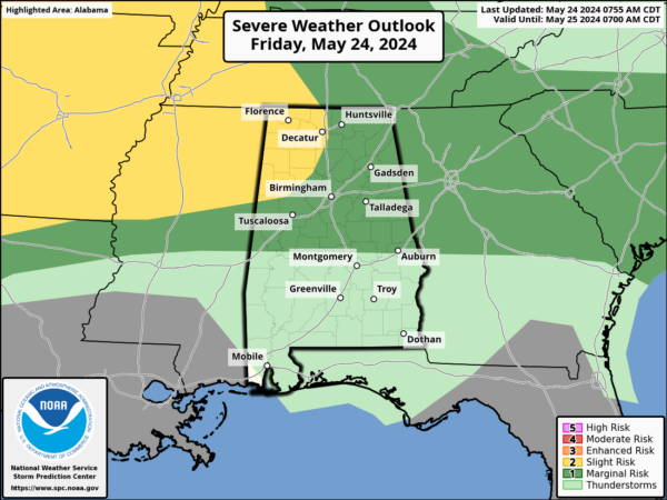
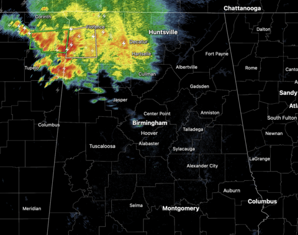
The chance of any one spot getting wet over North Alabama is 30-40%. Late this morning, we are watching a cluster of showers ands storms over northern portions of Alabama. These aren’t moving much, but we are likely to see additional showers and storms develop across the Alabama landscape through the afternoon hours.
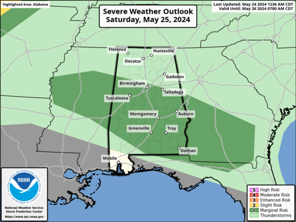
The weather will not change much tomorrow through Monday as we expect partly sunny days with the chance of a passing shower or storm in spots each day. While much of the weekend will be dry, keep in mind a few storms could be strong producing hail and gusty winds.
Also, summer storms are prolific lightning producers, remember “when thunder roars, go indoors!”.
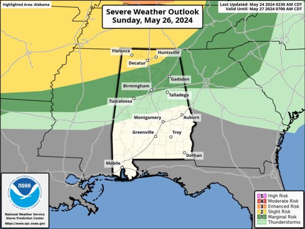
The better chances for rain and storms will remain over the northern half of the state, and highs will remain in the upper 80s to lower 90s all weekend. Late Monday night, showers and storms will be more numerous Monday night as a cold front pushes into the state.
BIRMINGHAM ALMANAC: For May 24th, the average high for Birmingham is 88° and the average low is 63°. The record high is 96° set in 1996, while the record low is 46° set in 1917. We average 0.16” of precipitation on this date, and the record value is 1.73” set in 1907.
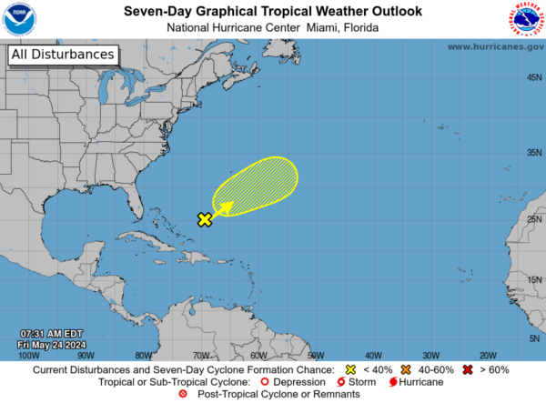
TROPICS: A trough of low pressure is producing disorganized showers and thunderstorms a few hundred miles to the northeast of the central Bahamas. An area of low pressure is expected to form within this system roughly halfway between Bermuda and Hispaniola later today. Although environmental conditions are not conducive, some slight subtropical or tropical development is possible over the next couple of days while the system moves northeastward. Formation chance through 7 days…low…10 percent.
SEC TOURNAMENT: The SEC baseball tournament continues through Sunday out at the Hoover Met. A few random, scattered showers or storms are possible tomorrow through Sunday, but the weather will be dry most of the time with highs close to 90°. If a shower of storm passes over the Hoover Met the rain should last around 30 to 45 minutes before it moves on.
NEXT WEEK: Showers and storms will linger into Tuesday, especially the morning hours, then the rest of the week will feature a cooler, drier airmass. Highs drop into the low 80s by Wednesday, and many North Alabama communities will dip into the 50s by Thursday and Friday morning.
BEACH FORECAST CENTER: Get the latest weather and rip current forecasts for the beaches from Fort Morgan to Panama City on our Beach Forecast Center page. There, you can select the forecast of the region that you are interested in visiting.
WORLD TEMPERATURE EXTREMES: Over the last 24 hours, the highest observation outside the U.S. was 122.0F at Jacobabad, Pakistan. The lowest observation was -104.8F at Vostok, Antarctica.
CONTIGUOUS TEMPERATURE EXTREMES: Over the last 24 hours, the highest observation was 111F at Rio Grande Village, TX. The lowest observation was 5F at Peter Sinks, UT.
Category: Alabama's Weather, ALL POSTS
About the Author (Author Profile)
Macon, Georgia Television Chief Meteorologist, Birmingham native, and long time Contributor on AlabamaWX. Stormchaser. I did not choose Weather, it chose Me. College Football Fanatic. @Ryan_StinnetSubscribe
If you enjoyed this article, subscribe to receive more just like it.


