Severe Thunderstorm Warning for Northern Tuscaloosa County
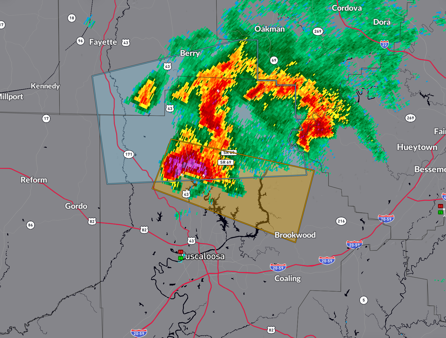
The storm in northern Tuscaloosa County has become severe.
Hail of at least quarter size is likely, which could damage property and vehicles. It could approach half dollars in some places.
It is well north of Northport, the City of Tuscaloosa, and the University of Alabama campus.
Some of the communities in the path include Skelton Bend, North Riviera, Lake Cover, Rising Tide, and eventually Kellerman and Searles.
Lightning is about 5-6 flashes per minute. Winds could gust to 60 mph.
A storm in western Jefferson County is intensifying west of Rock Creek. It will move toward Sylvan Springs and eventually Fultondale. It could become severe as well. The Tuscaloosa County storm could get into western parts of the Birmingham Metro area after 5 p.m.
Movement is east or east-southeast at 20-25 mph.
Category: Alabama's Weather, ALL POSTS, Severe Weather
About the Author (Author Profile)
Bill Murray is the President of The Weather Factory. He is the site's official weather historian and a weekend forecaster. He also anchors the site's severe weather coverage. Bill Murray is the proud holder of National Weather Association Digital Seal #0001 @wxhistorianSubscribe
If you enjoyed this article, subscribe to receive more just like it.


