Tornado Warning in Mississippi
UPDATE
A potential debris signature appeared on the radar on the Panola/Lafayette county line at 6:55 pm. The NWS has issued a severe thunderstorm warning with a TORNADO…POSSIBLE tag on it.
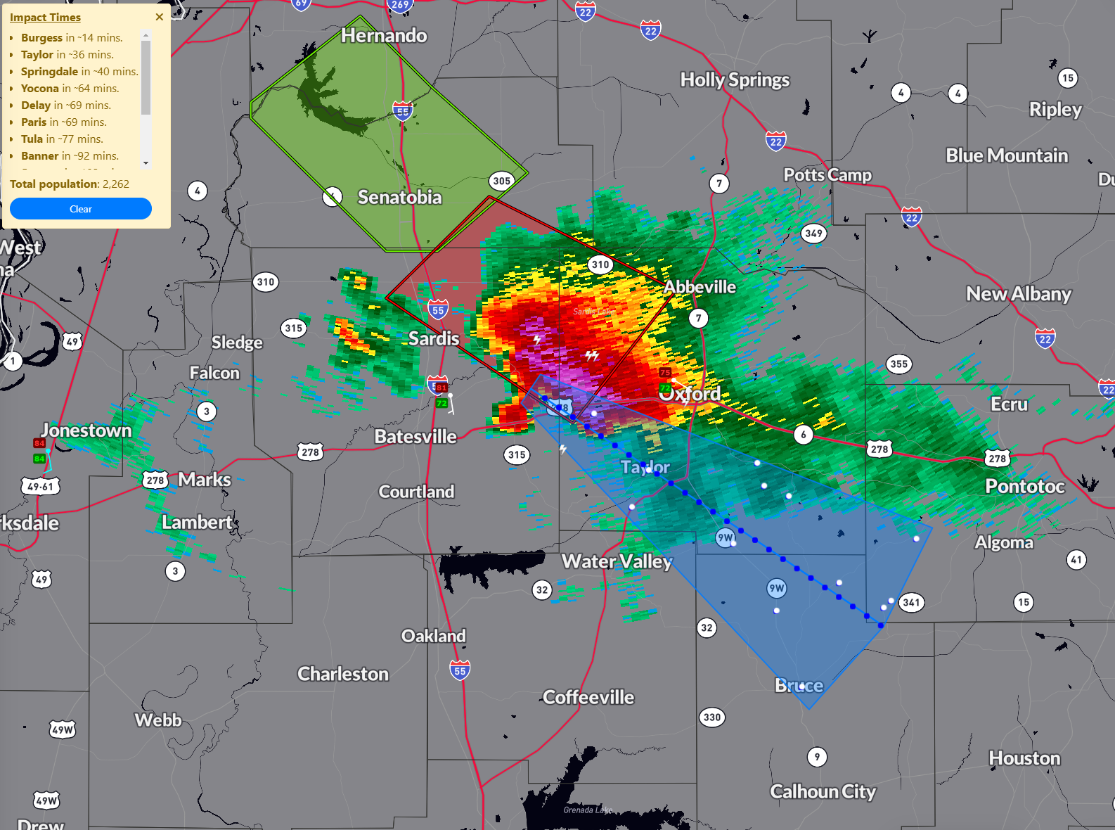
The NWS in Memphis has a tornado warning on a severe storm northwest of Oxford.
The storm is rotating and shows a high probability of severe hail. Shear is a little higher than here in Alabama, and instability is very high. The Precipitable Water is near 2 inches, and the storm is producing a large area of 1-2 inches of rainfall per hour. The lightning rate is 33 per minute. No debris signature.
It is moving southeast at 18 mph. Large hail, rain, and high winds will hit Oxford around 7:30. The NWS will have to do somethign with the tornado warning shortly, as it doesn’t expire for 22 minutes but the storm will move out of the polygon well before then.
The town of Taylor is on the track of the potential tornado.
Category: Alabama's Weather, ALL POSTS, Severe Weather
About the Author (Author Profile)
Bill Murray is the President of The Weather Factory. He is the site's official weather historian and a weekend forecaster. He also anchors the site's severe weather coverage. Bill Murray is the proud holder of National Weather Association Digital Seal #0001 @wxhistorianSubscribe
If you enjoyed this article, subscribe to receive more just like it.


