Line of Storms Marching East
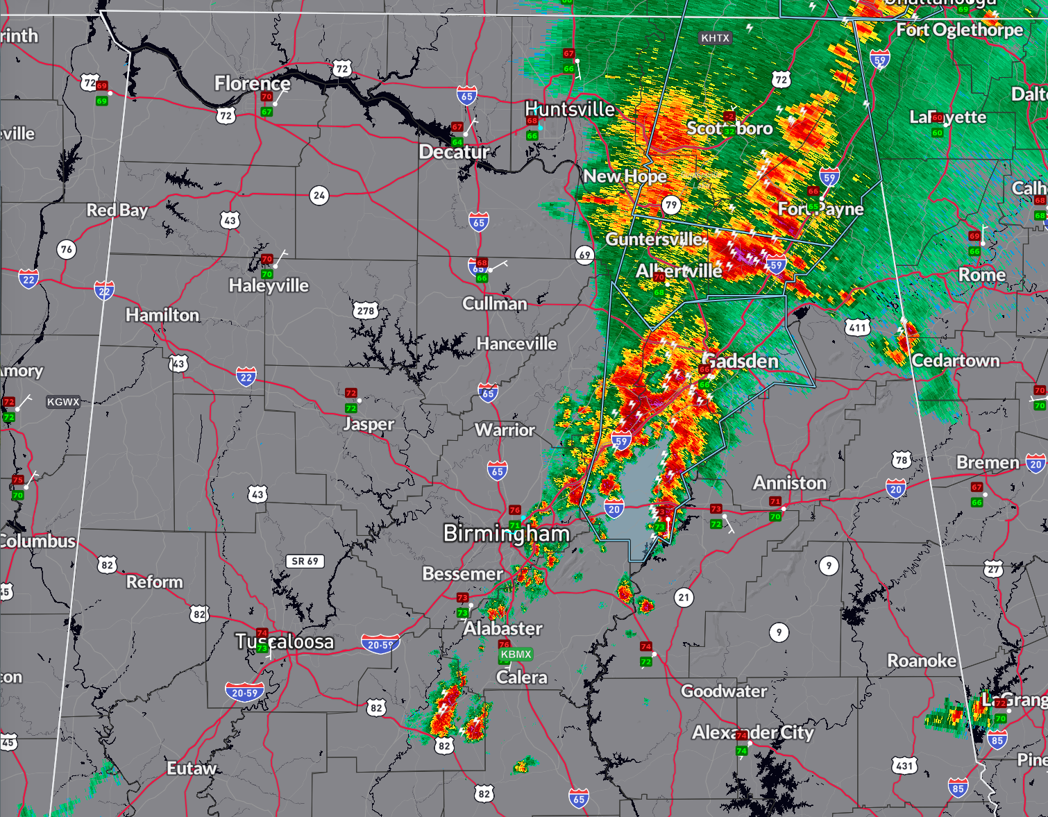
A line of storms extends from Huntsville, Scottsboro, and Fort Payne southwest through Guntersville and Albertville, where it splits into two lines. One runs down through Pell City. The other extends southwest through eastern and southern parts of the Birmingham Metro area, through northern Shelby County, and into Bibb County west of Centreville.
No warnings currently in effect for Alabama, but there are a string of significant weather advisories along the storms from Jackson and DeKalb Counties into Etowah, Blount, and St. Clair Counties. Heavy rain, gusty winds, lightning and some small hail will accompany the storms.
Teh strongest storm is near Collinsville in DeKalb county. It extends to nearly 50,000 feet in the atmosphere.
The line of storms should continue to grow in coverage and intensity as it pushes east and builds southeast. It will work its way into Georgia early this afternoon.
Additional storms will form between 2-8 pm this afternoon and those storms could be strong to severe.
Category: Alabama's Weather, ALL POSTS, Severe Weather
About the Author (Author Profile)
Bill Murray is the President of The Weather Factory. He is the site's official weather historian and a weekend forecaster. He also anchors the site's severe weather coverage. Bill Murray is the proud holder of National Weather Association Digital Seal #0001 @wxhistorianSubscribe
If you enjoyed this article, subscribe to receive more just like it.


