Alabama Weather Update at 525 pm
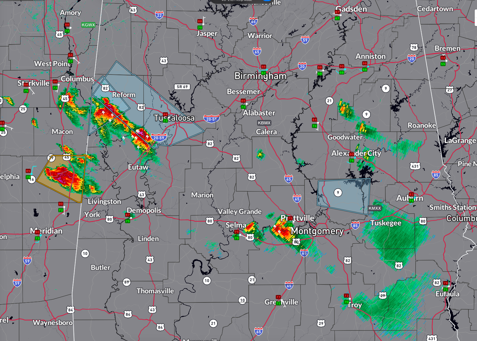
Strong storms continue across Central Alabama and eastern Mississippi at this hour.
None of the Alabama storms are severe, but the two in Lowndes and Kemper Counties in Mississippi are.
The same cluster of storms extends into Pickens and Green Counties in Alabama. The strongest storms are from Pickensville to Aliceville and to Union. The eastern Mississippi storms will move into Pickens and Sumter Counties soon.
Hail may be approaching severe limits in Pickens County now. The hail core is north of AL-86 between Pickensville and Carrollton. The lightning flash rate is 21 flashes per minute.
All of this activity is moving toward Tuscaloosa, and a significant weather advisory is in effect.
Lots of CAPE for the storms to feed on at 3674 joules. Decent bulk shear at 38 knots. Low level helicity is low, so tornado threat is low.
Elsewhere across Central Alabama, storms are strong between Selma and Montgomery.
Storms in Clay and Tallapoosa Counties are encountering an outflow boundary and could strengthen.
Category: Alabama's Weather, ALL POSTS, Severe Weather
About the Author (Author Profile)
Bill Murray is the President of The Weather Factory. He is the site's official weather historian and a weekend forecaster. He also anchors the site's severe weather coverage. Bill Murray is the proud holder of National Weather Association Digital Seal #0001 @wxhistorianSubscribe
If you enjoyed this article, subscribe to receive more just like it.


