Severe Thunderstorm Warning for Tuscaloosa
Hail indicators showing over 2″ hail on the COlumbus radar, but may be melting some. NWS says 0.75″ hail possible. Winds to 60 mph. Will reach Tuscaloosa around 6 p.m.
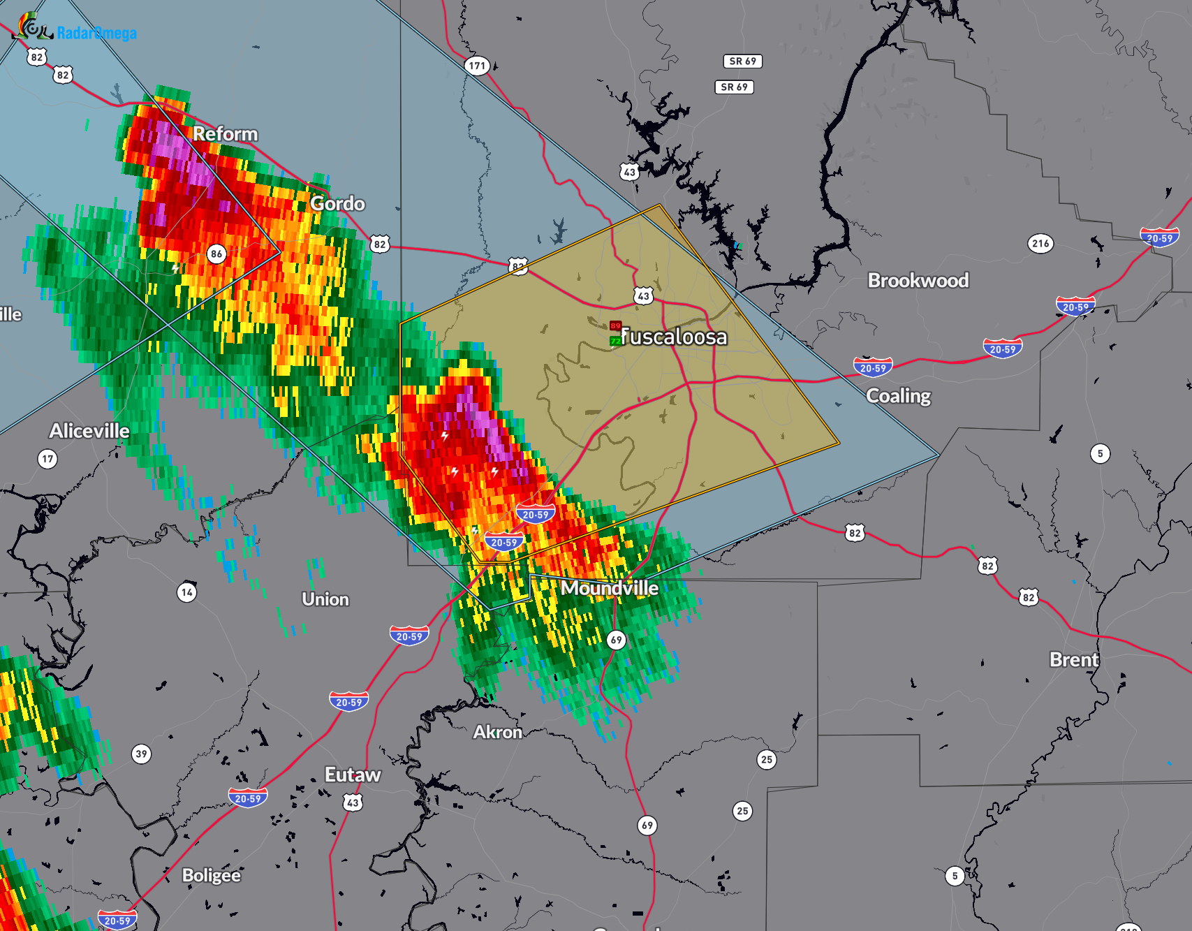
The National Weather Service in Birmingham has issued a
* Severe Thunderstorm Warning for…
Southwestern Tuscaloosa County in west central Alabama…
* Until 615 PM CDT.
* At 532 PM CDT, a severe thunderstorm was located near Jena, or 13
miles southwest of Northport, moving northeast at 25 mph.
HAZARD…60 mph wind gusts and penny size hail.
SOURCE…Radar indicated.
IMPACT…Expect damage to roofs, siding, and trees.
* Locations impacted include…
Tuscaloosa, Northport, Holt, Coker, University Mall, McFarland
Mall, Shelton State Community College, Tuscaloosa Amphitheater,
Bryant Denny Stadium, Tuscaloosa Regional Airport, Englewood,
Ralph, Little Sandy, Flatwoods, Maxwell, University Of Alabama
Quad, Taylorville, Fosters Boat Landing, Palmore Park, and Stillman
College.
Category: Alabama's Weather, ALL POSTS, Severe Weather
About the Author (Author Profile)
Bill Murray is the President of The Weather Factory. He is the site's official weather historian and a weekend forecaster. He also anchors the site's severe weather coverage. Bill Murray is the proud holder of National Weather Association Digital Seal #0001 @wxhistorianSubscribe
If you enjoyed this article, subscribe to receive more just like it.


