A Quick Evening Weather Check; Severe Storms Possible Overnight
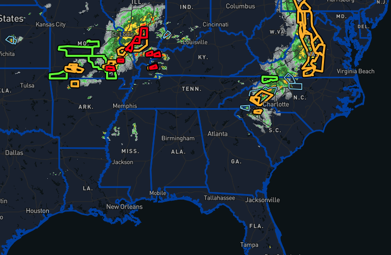
As of 7:26 pm this evening, the entire state of Alabama is rain-free, with only a few clouds. However, we are starting to see rain develop back into Mississippi, and we will need to watch that as we continue to have a severe weather threat during the pre-dawn and early morning hours. The main action right now is taking place over the southeastern portions of Missouri and the southern parts of Illinois.
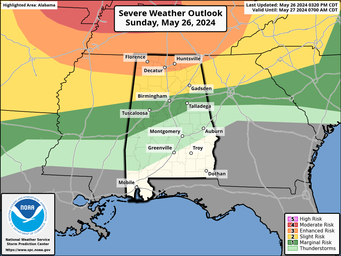
At this point, there has been no changes to the severe weather outlook for Alabama. An enhanced risk is up for the northern parts of the state, including locations north of a line from Phil Campbell to Somerville to Ider. South of that, a slight risk is up to as far south as Reform to Birmingham to the Anniston Army Depot. And a marginal risk is up south of that to as far south as Demopolis to Jemison to Lineville. The main window for that threat of severe storms will be from around 2 am to right at or just around 8 am. All modes of severe weather will be possible.
Tonight, the weather will become more suitable for storms as a cold front moves in on Monday. The northwest part of the state will experience the most changes, with more unstable air, high moisture, and strong winds. A line of storms is expected to move east and southeast overnight into early Monday morning. When these storms reach northwestern Alabama, there will be a lot of moisture in the air, and the atmosphere will be very unstable. Wind speeds in the upper atmosphere will be strong, which could make the storms severe. These storms could bring damaging winds, large hail, and possibly tornadoes.
As the storms move east and south in the morning, they will lose some of their strength. By the time they reach the I-20 corridor, the severe threat will be much lower. Areas south of I-20 might still get some strong storms if the line moves in quickly, but otherwise, they will mostly see scattered showers and a few isolated thunderstorms.
By around 8 am Monday, the main storm activity should be out of the area, leaving the rest of the morning and early afternoon dry. The weather forecast for Monday afternoon is less certain. Most weather models (except one) do not show many storms developing in the afternoon. As the cold front moves southeast, the conditions will become less favorable for storms in the northwest part of the state.
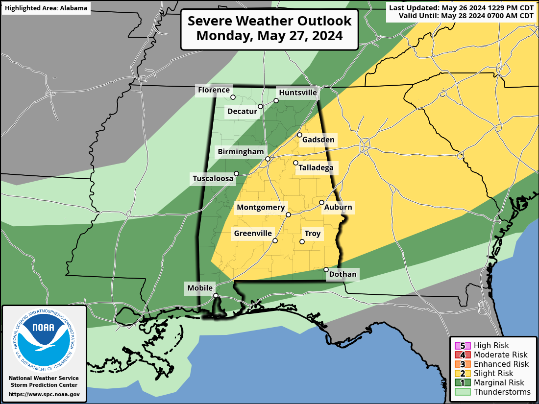
However, the southeastern half of the state will have high instability and very unstable air. While wind speeds will be weaker, there could still be some ingredients in place that support storm development. We expect some severe thunderstorms with damaging winds and large hail in these areas if storms do form. Most models suggest limited storm coverage, but areas south of I-85 could see a line of storms forming in the mid to late afternoon and lasting into the evening.
The storm system will move out of Central Alabama faster than initially thought. While there is still a risk of severe storms on Monday, it will likely be limited to the far southeastern counties in the evening.
Category: Alabama's Weather, ALL POSTS, Severe Weather
About the Author (Author Profile)
Scott Martin is an operational meteorologist, professional graphic artist, musician, husband, and father. Not only is Scott a member of the National Weather Association, but he is also the Central Alabama Chapter of the NWA president. Scott is also the co-founder of Racecast Weather, which provides forecasts for many racing series across the USA. He also supplies forecasts for the BassMaster Elite Series events including the BassMaster Classic.Subscribe
If you enjoyed this article, subscribe to receive more just like it.


