EXPIRED Tornado Warning — Parts of Jackson, Madison, Marshall Co. Until 3:45 am
The National Weather Service in Huntsville, Alabama, has issued a Tornado Warning for northeastern Marshall County, Jackson County, and east-central Madison County in Alabama.
Affected Areas:
Northeastern Marshall County
Jackson County
East-central Madison County
Remains in Effect Until:
The warning is in effect until 3:45 AM CDT.
Details:
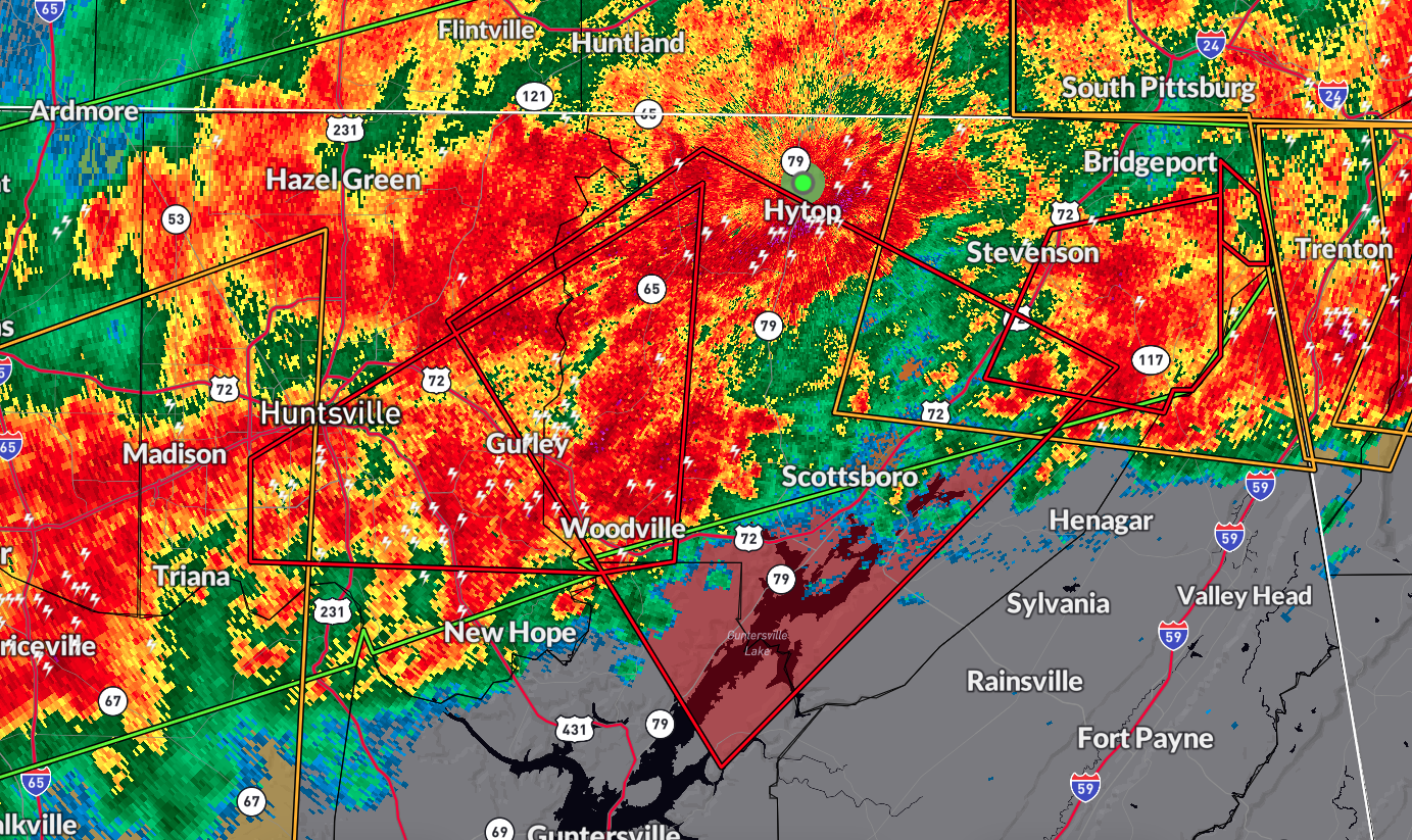
At 3:10 AM CDT, a severe thunderstorm capable of producing a tornado was identified 7 miles north of Gurley, or 11 miles east of Moores Mill, moving east at 50 mph. The storm brings a hazard of a tornado and quarter-size hail, with radar indicating rotation.
Impact:
This dangerous storm poses risks of flying debris, damage to mobile homes, roofs, windows, vehicles, and trees. The storm is expected to be near Skyline around 3:20 AM CDT, Scottsboro around 3:25 AM CDT, Hollywood around 3:30 AM CDT, and Pisgah around 3:40 AM CDT.
Locations Impacted:
Paint Rock, Maysville, Langston, Martintown, Princeton, Lim Rock, Estillfork, Fackler, Hytop, Larkin, and surrounding areas may also be affected.
Precautionary/Preparedness Actions:
Take cover immediately. Move to a basement or an interior room on the lowest floor of a sturdy building.
Avoid windows and protect yourself from flying debris.
If you are outdoors, in a mobile home, or in a vehicle, seek the nearest substantial shelter immediately. Stay safe and follow weather updates closely.
Category: Alabama's Weather, ALL POSTS, Severe Weather
About the Author (Author Profile)
Scott Martin is an operational meteorologist, professional graphic artist, musician, husband, and father. Not only is Scott a member of the National Weather Association, but he is also the Central Alabama Chapter of the NWA president. Scott is also the co-founder of Racecast Weather, which provides forecasts for many racing series across the USA. He also supplies forecasts for the BassMaster Elite Series events including the BassMaster Classic.Subscribe
If you enjoyed this article, subscribe to receive more just like it.


