EXPIRED Severe T-Storm Warning — Parts of DeKalb, Jackson Co. Until 4:15 am
The National Weather Service in Huntsville Alabama has issued a Severe Thunderstorm Warning for Central Jackson County and DeKalb County in northeastern Alabama. This warning is in effect until 4:15 AM CDT.
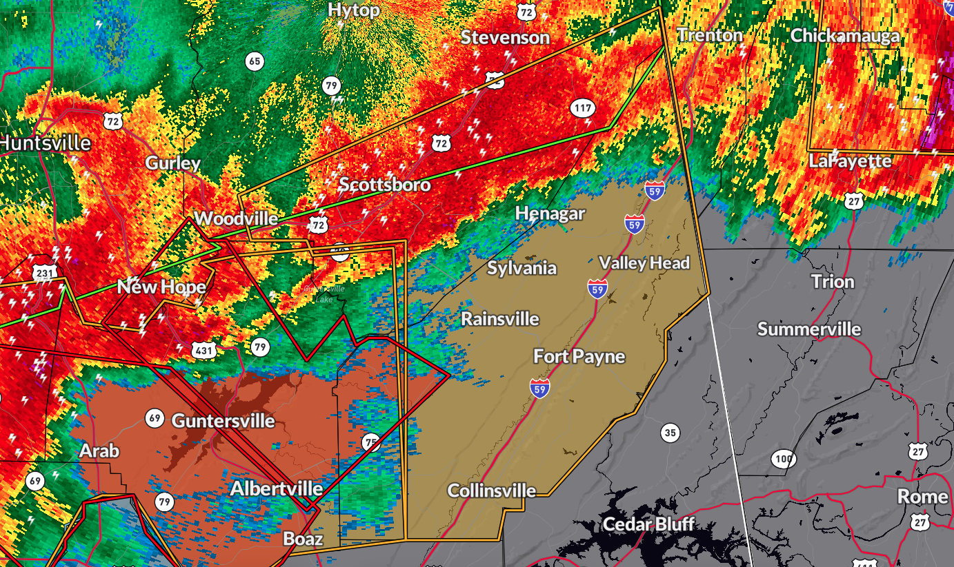
At 3:40 AM CDT, severe thunderstorms were located along a line extending from 6 miles southwest of Section to 8 miles east of Ider, moving southeast at 45 mph. Multiple reports of trees and powerlines down have been associated with this line of storms. The hazard includes 60 mph wind gusts and penny-size hail, with the source being public reports. The impact is expected to cause damage to roofs, siding, and trees.
Locations impacted by these severe thunderstorms include Scottsboro, Fort Payne, Rainsville, Henagar, Crossville, Sylvania, Fyffe, Hollywood, Powell, and Geraldine.
PRECAUTIONARY/PREPAREDNESS ACTIONS:
Remain alert for a possible tornado as tornadoes can develop quickly from severe thunderstorms.
If you spot a tornado, go at once into the basement or a small central room in a sturdy structure.
For your protection, move to an interior room on the lowest floor of a building.
A Tornado Watch remains in effect until 5:00 AM CDT for Middle Tennessee. Another Tornado Watch also remains in effect until 8:00 AM CDT for north central and northeastern Alabama.
Category: Alabama's Weather, ALL POSTS, Severe Weather
About the Author (Author Profile)
Scott Martin is an operational meteorologist, professional graphic artist, musician, husband, and father. Not only is Scott a member of the National Weather Association, but he is also the Central Alabama Chapter of the NWA president. Scott is also the co-founder of Racecast Weather, which provides forecasts for many racing series across the USA. He also supplies forecasts for the BassMaster Elite Series events including the BassMaster Classic.Subscribe
If you enjoyed this article, subscribe to receive more just like it.


