Brief Update; More Counties Removed from Current Tornado Watch
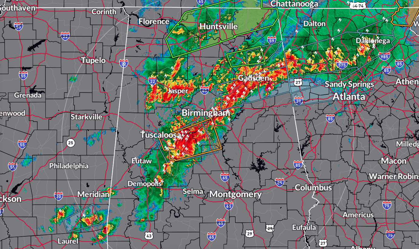
Rain and storms continue to push southward across portions of Central Alabama, while some showers remain over portions of North Alabama. The severe weather threat has ended for the northern Alabama counties.
The storms continue to pack a punch with strong winds and hail, but they are a little calmer than just a couple of hours ago. However, there are plenty of lightning strikes putting on Mother Nature’s Light Show.
Storms are expected to weaken, and the severe weather threat should be over for this first round around or just before 8 am. However, if the atmosphere is able to recover from this morning’s action, strong to severe storms will be possible south of I-59, with that risk going from 12 pm to 9 pm. No tornado threat this time, but damaging winds and large hail will be possible.
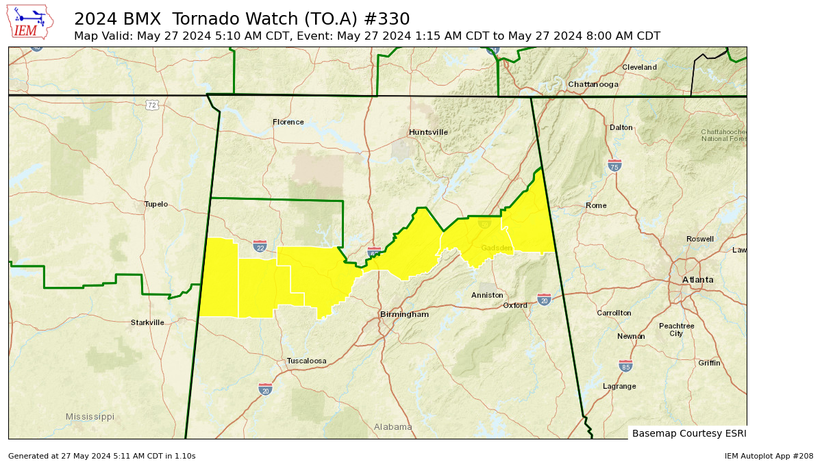
NWS Birmingham has cancelled the Tornado Watch for Marion and Winston counties, and continues the watch until 8 am for Blount, Cherokee, Etowah, Fayette, Lamar, and Walker counties in Central Alabama.
NWS Huntsville has cancelled the Tornado Watch for Cullman, DeKalb, Jackson, Madison, Marshall, and Morgan counties. No other North Alabama counties remain in the watch.
Category: Alabama's Weather, ALL POSTS, Severe Weather
About the Author (Author Profile)
Scott Martin is an operational meteorologist, professional graphic artist, musician, husband, and father. Not only is Scott a member of the National Weather Association, but he is also the Central Alabama Chapter of the NWA president. Scott is also the co-founder of Racecast Weather, which provides forecasts for many racing series across the USA. He also supplies forecasts for the BassMaster Elite Series events including the BassMaster Classic.Subscribe
If you enjoyed this article, subscribe to receive more just like it.


