Severe T-Storm Warning — Parts of Jefferson, Shelby, St. Clair, Talladega Co. Until 6:30 am
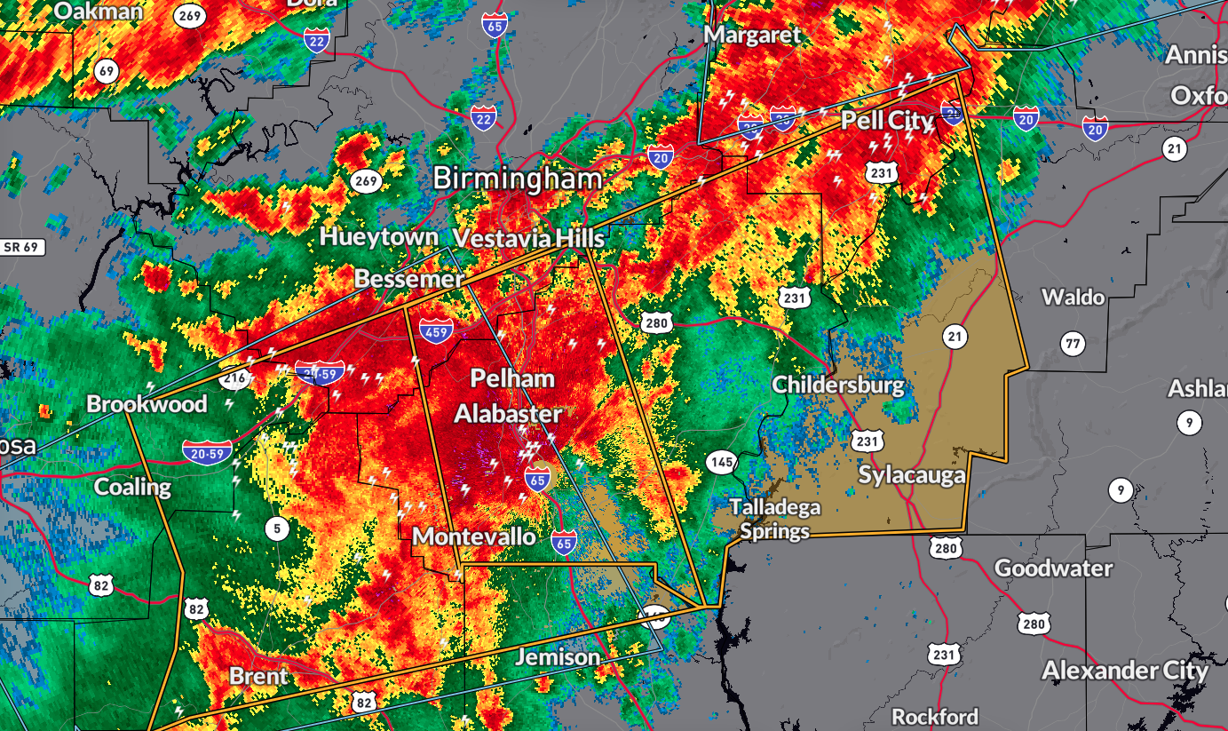
The National Weather Service in Birmingham has issued a Severe Thunderstorm Warning impacting western Talladega County, Shelby County, southeastern Jefferson County, and southwestern St. Clair County in central Alabama until 6:30 AM CDT.
As of 5:39 AM CDT, a severe thunderstorm was detected over Alabaster, moving eastward at 50 mph.
Hazards and Impact
The primary hazard is 70 mph wind gusts, which can cause considerable damage to trees and structures like mobile homes, roofs, and outbuildings.
Locations Impacted
Communities such as Hoover, Vestavia Hills, Alabaster, Bessemer, Pelham, Helena, Talladega, Sylacauga, Pell City, Calera, Chelsea, Montevallo, Childersburg, Columbiana, Wilsonville, Talladega Springs, Lincoln, Indian Springs Village, Vincent, and Harpersville are expected to be impacted by this severe thunderstorm.
Precautionary Measures
Seek Shelter: Move to an interior room on the lowest floor of a building for protection against the severe winds.
Stay Alert: Keep monitoring updates from local authorities and weather services for any further developments.
Take necessary precautions to ensure safety and minimize damage during this severe thunderstorm warning period.
Category: Alabama's Weather, ALL POSTS, Severe Weather
About the Author (Author Profile)
Scott Martin is an operational meteorologist, professional graphic artist, musician, husband, and father. Not only is Scott a member of the National Weather Association, but he is also the Central Alabama Chapter of the NWA president. Scott is also the co-founder of Racecast Weather, which provides forecasts for many racing series across the USA. He also supplies forecasts for the BassMaster Elite Series events including the BassMaster Classic.Subscribe
If you enjoyed this article, subscribe to receive more just like it.


