Severe T-Storm Warning — Parts of Jefferson, St. Clair Co. Until 6:30 am
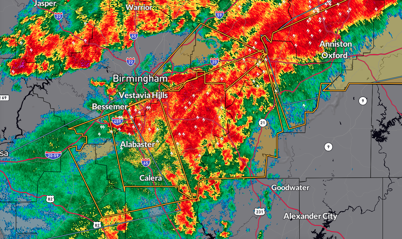
The National Weather Service in Birmingham has issued a Severe Thunderstorm Warning affecting east central Jefferson County and southwestern St. Clair County in central Alabama until 6:30 AM CDT.
As of 5:57 AM CDT, a severe thunderstorm was located near Leeds, moving northeast at a rapid pace of 65 mph.
Hazards and Impact
The primary hazard is 60 mph wind gusts, which can cause damage to roofs, siding, and trees.
Locations Impacted
Areas such as northeastern Birmingham, Vestavia Hills, Trussville, Pell City, Irondale, Leeds, Moody, Springville, Odenville, Margaret, Argo, Shops of Grand River, Bald Rock, Barber Motorsports Park, Harrisburg, Branchville, Alton, Lake Purdy, Logan Martin Lake, and Camp Winnataska are expected to be impacted.
Precautionary Measures
Seek Shelter: Move to an interior room on the lowest floor of a building for protection against strong winds.
Stay Alert: Stay updated with local weather updates and follow guidance from authorities to ensure safety.
Take necessary precautions and stay safe during this severe thunderstorm warning period.
Category: Alabama's Weather, ALL POSTS, Severe Weather
About the Author (Author Profile)
Scott Martin is an operational meteorologist, professional graphic artist, musician, husband, and father. Not only is Scott a member of the National Weather Association, but he is also the Central Alabama Chapter of the NWA president. Scott is also the co-founder of Racecast Weather, which provides forecasts for many racing series across the USA. He also supplies forecasts for the BassMaster Elite Series events including the BassMaster Classic.Subscribe
If you enjoyed this article, subscribe to receive more just like it.


