Midday Nowcast: Drier Air Dropping into Alabama
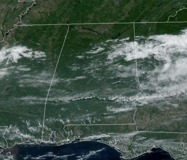
At the midday hours, the radar is mainly quiet across the state, with only a few light showers over East Alabama. Through the afternoon hours, drier air pushes into the northern half of the state we should see more sun than clouds with highs in the 80s. Across southern portions of the state, a few strong thunderstorms will be possible with gusty winds and some hail.
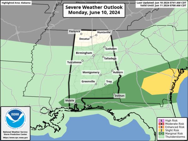
The Storm Prediction Center maintains a “marginal risk” (level 1/5) for areas south of a line from Jackson to Troy. Tonight, will be very nice with a clear sky and lows in the upper 50s and lower 60s.
BIRMINGHAM ALMANAC: For June 10th, the average high for Birmingham is 87° and the average low is 68°. The record high is 97° set in 2011, while the record low is 50° set in 1988. We average 0.16” of precipitation on this date, and the record value is 1.67” set in 1985.
REST OF THE WEEK: The weather will be generally dry for the rest of the week across Alabama. Expect lower humidity but, heat levels rise by the end of the week with highs in the low to mid 90s. A few spotty showers are possible near the Gulf Coast late in the week, but nothing especially widespread is expected for now.
THE ALABAMA WEEKEND: Much of North and Central Alabama will likely stay dry with only very isolated showers Saturday and Sunday; showers are more likely over the far southern part of the state and along the Gulf Coast, but the weekend won’t be a wash-out there. It should be the hottest weekend so far this year with highs in the mid 90s thanks to a heat ridge overhead. Some communities could reach the upper 90s. The pattern continues to look relatively dry for the following week with only widely scattered showers and storms around; highs will be in the low to mid 90s on most days.
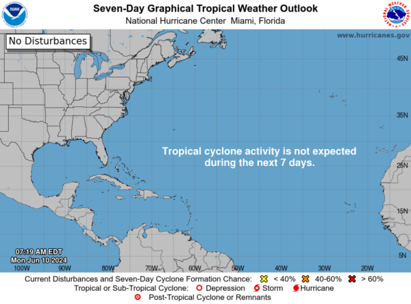
IN THE TROPICS: For the North Atlantic, Caribbean Sea, and the Gulf of Mexico: Tropical cyclone formation is not expected during the next seven days.
BEACH FORECAST CENTER: Get the latest weather and rip current forecasts for the beaches from Fort Morgan to Panama City on our Beach Forecast Center page. There, you can select the forecast of the region that you are interested in visiting.
WORLD TEMPERATURE EXTREMES: Over the last 24 hours, the highest observation outside the U.S. was 119.5F at Al Ahsa, Saudi Arabia. The lowest observation was -92.4F at Concordia, Antarctica.
CONTIGUOUS TEMPERATURE EXTREMES: Over the last 24 hours, the highest observation was 112F at Death Valley, CA. The lowest observation was 26F at Covington, MI.
Category: Alabama's Weather, ALL POSTS
About the Author (Author Profile)
Macon, Georgia Television Chief Meteorologist, Birmingham native, and long time Contributor on AlabamaWX. Stormchaser. I did not choose Weather, it chose Me. College Football Fanatic. @Ryan_StinnetSubscribe
If you enjoyed this article, subscribe to receive more just like it.


