Midday Nowcast: Hot and Getting Hotter
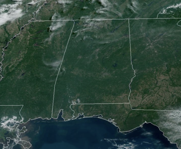
HOT AND GETTING HOTTER: Mainly dry weather continues across Alabama with hot and generally sunny conditions. Humidity levels are beginning to rise and that will cause heat index values to climb as well. Highs are in the mid to upper 90s and heat index values are climbing over 100°. Rain chances are low, but not zero, and a few isolated showers are possible the next few days.
BIRMINGHAM ALMANAC: For June 14th, the average high for Birmingham is 88° and the average low is 68°. The record high is 98° set in 1971, while the record low is 51° set in 1995. We average 0.16” of precipitation on this date, and the record value is 3.21” set in 1929.
CODE ORANGE OZONE ALERT: The Alabama Department of Environmental Management, ADEM, has issued an Air Quality Alert for Jefferson and Shelby Counties. Under Code Orange conditions, ground level ozone concentrations are expected to reach levels that are unhealthy for sensitive groups. Children and people with asthma are individuals most at risk under these expected conditions.
THE ALABAMA WEEKEND: Much of North and Central Alabama will likely stay dry with only very isolated showers tomorrow and Sunday; showers are more likely over the far southern part of the state and along the Gulf Coast, but the weekend won’t be a wash-out there. It should be the hottest weekend so far this year with highs in the mid 90s thanks to a heat ridge overhead. Some communities could reach the upper 90s. The pattern continues to look relatively dry for the following week with only widely scattered showers and storms around; highs will be in the low to mid 90s on most days.
NEXT WEEK: We will maintain the chance of a few showers on a daily basis through the week, but the deepest moisture will likely be west of Alabama. Rain amounts will be light and spotty; the higher rain coverage will be over the southern counties, but even there no wash-out. Heat levels drop with highs in the upper 80s and low 90s through the week.
IN THE TROPICS: Two areas the National Hurricane Center is monitoring:
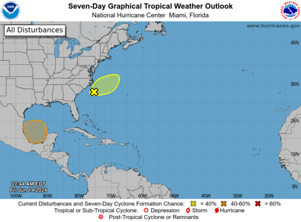
1. Offshore of the Southeastern U.S. (AL90): Satellite data and surface observations indicate that the low pressure area offshore of the southeastern U.S. coast has become a little better organized since yesterday. However, upper-level winds remain strong, and the system is forecast to merge with a front over the western Atlantic Saturday or Sunday. Regardless of development, heavy rainfall is forecast to continue across portions of the Florida peninsula through Saturday. Formation chance through 7 days…low…20 percent.
2. Southwestern Gulf of Mexico: A broad area of low pressure is forecast to form over the southwestern Gulf of Mexico late this weekend or early next week. Environmental conditions appear conducive for gradual development of
this system, and a tropical depression could form during the early or middle part of next week while it moves slowly westward or west-northwestward. Formation chance through 7 days…medium…50 percent.
BEACH FORECAST CENTER: Get the latest weather and rip current forecasts for the beaches from Fort Morgan to Panama City on our Beach Forecast Center page. There, you can select the forecast of the region that you are interested in visiting.
WORLD TEMPERATURE EXTREMES: Over the last 24 hours, the highest observation outside the U.S. was 118.9F at In-Salah, Algeria. The lowest observation was -99.9F at Vostok, Antarctica.
CONTIGUOUS TEMPERATURE EXTREMES: Over the last 24 hours, the highest observation was 113F at Stovepipe Wells, CA. The lowest observation was 29F at Crescent, OR.
Category: Alabama's Weather, ALL POSTS
About the Author (Author Profile)
Macon, Georgia Television Chief Meteorologist, Birmingham native, and long time Contributor on AlabamaWX. Stormchaser. I did not choose Weather, it chose Me. College Football Fanatic. @Ryan_StinnetSubscribe
If you enjoyed this article, subscribe to receive more just like it.


