Showers More Numerous Over South Alabama Tomorrow/Sunday
**We are on a holiday schedule, so no afternoon video today**
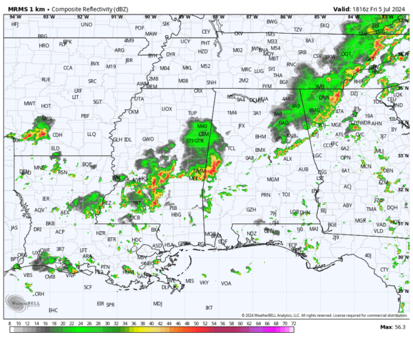
RADAR CHECK: Clusters of showers and strong thunderstorms continue across Alabama early this afternoon ahead of a surface front. Temperatures are in the 80s over North Alabama, with 90s to the south. Showers will slowly fade late tonight.
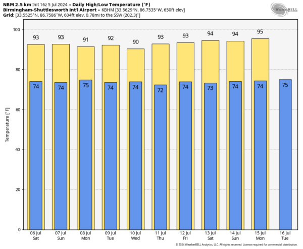
THE ALABAMA WEEKEND: Drier air will temporarily enter the northern counties of the state, meaning the best chance of scattered showers and storms tomorrow and Sunday will across South Alabama. Highs will remain in the low to mid 90s, but lower dew points over North Alabama will make the heat a little more bearable.
NEXT WEEK: Moisture levels rise statewide, and we will mention scattered showers and storms on a daily basis through the week with highs between 90 and 94 degrees. We could see an increase in the coverage of showers and storms by mid-week as deeper tropical moisture associated with the remnants of Beryl move in. See the video briefing for maps, graphics, and more details.
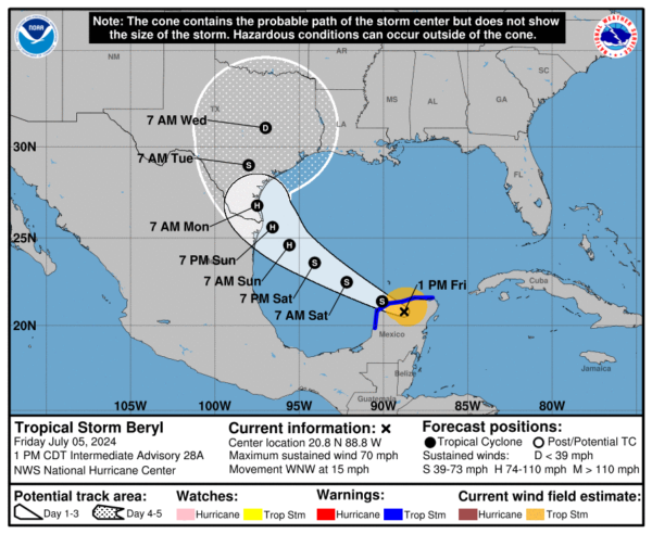
TROPICS: Hurricane Beryl is inland over Mexico’s Yucatan Peninsula with winds of 85 mph. It should weaken to a tropical storm this afternoon before moving into the Southwest Gulf of Mexico. It could take 12-24 hours for the cyclone’s structure to recover over the Gulf of Mexico before re-intensification can begin in earnest. Based on this and the overall trends of the intensity guidance, the new forecast calls for gradual strengthening to start after 24 hours and continue until landfall.
The current NHC forecast has Beryl moving into the southern tip of Texas Monday morning with sustained winds of 85 mph. One important note is that global models suggest that ongoing westerly shear could decrease after 48-60 hours, accompanied by an increase in upper-level divergence. Should this occur, Beryl could strengthen more than currently forecast, especially if the center stays over water longer than forecast.
Users are reminded that the average NHC track error at day 3 is around 100 miles, and it remains too soon to pinpoint where the greatest impacts will be. However, hurricane watches for portions of northeastern Mexico and South Texas will likely be required later today.
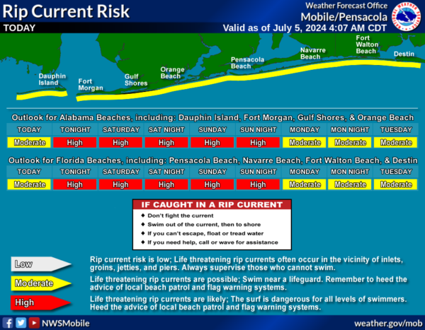
While there will be no weather impact on the Central Gulf Coast (Gulf Shores to Panama City Beach), there will be a high danger of rip currents there tomorrow and Sunday.
The rest of the Atlantic basin is quiet, and additional tropical storm formation is not expected through next week.
ON THIS DATE IN 1916: Winds were rising in Mobile as a hurricane approached. The category 3 storm would make landfall near the AL/MS border around 4pm with top winds of 120 mph/central pressure of 950 MB. At Mobile, peak winds 106 mph with an 11.6′ surge, the city’s highest.
ON THIS DATE IN 1937: The temperature at Medicine Lake, Montana soared to 117 degrees to tie the state record. Glendive, Montana reached 117 degrees on July 20th, 1893.
Look for my next video briefing here by 6:00 a.m. Monday… enjoy the weekend!
Category: Alabama's Weather, ALL POSTS


