7am CDT TD #4 Update: Strengthening to a tropical storm expected late today/tonight…
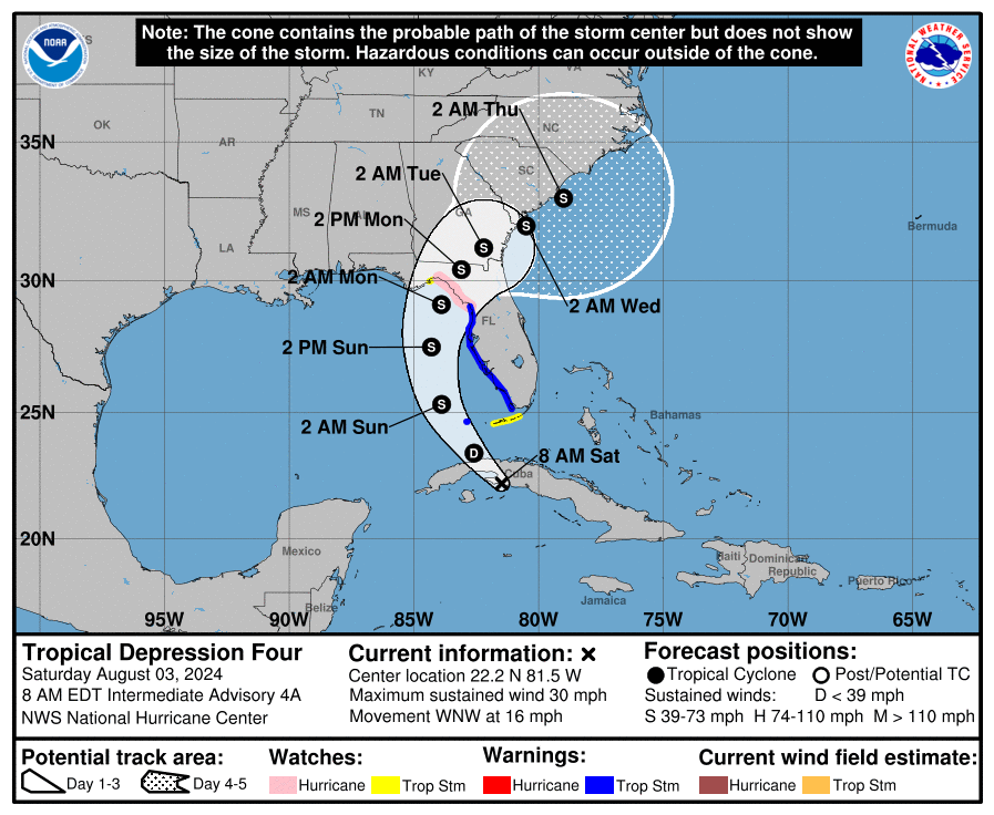
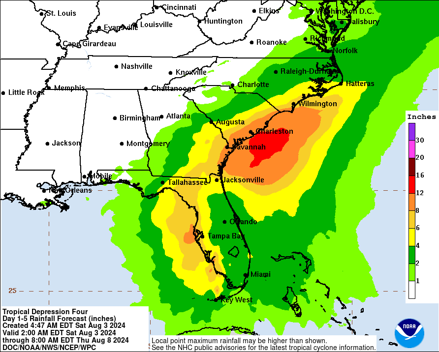
Quick update on the tropical depression. The overall strength of the system has not changed much. The 4am CDT update from the NHC center stated that some of the strongest winds were to the south and east of the center, which is now offshore the southern coast of Cuba. TD #4 should move into the eastern Gulf of Mexico later today and then toward the Florida Big Bend area Sunday and Sunday night. After landfall, the models show slowing steering currents and the system will slow down while moving across north Florida and Georgia. Still no major impacts expected to the state of Alabama. Based on the latest track, the state will stay on the dry, offshore side of the system. Swells will increase rip current risk esp for Florida Panhandle beaches. We will have a fuller update with the 10am CDT NHC advisory.
Category: Alabama's Weather, ALL POSTS, Tropical
About the Author (Author Profile)
Owner of Tornado Talk. Radio broadcast meteorologist with The Storm Report. WeatherBrains Panelist. B.S. Meteorology from Penn State University.Subscribe
If you enjoyed this article, subscribe to receive more just like it.


