7pm CDT: Debby Nearing Hurricane Strength…
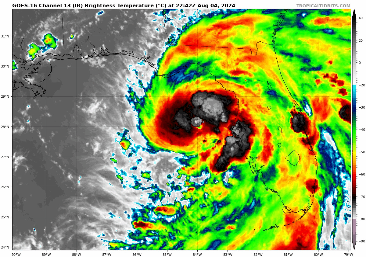
The latest advisory from the National Hurricane Center has been posted. As expected, Tropical Storm Debby is flourishing in the extremely warm Gulf waters and is looking very healthy via radar and satellite imagery. Maximum sustained winds are now at 70 mph with higher gusts. When we have sustained winds at 74 mph….Debby will be upgraded to hurricane status. From there, we watch to see how much Debby could strengthen before landfall.
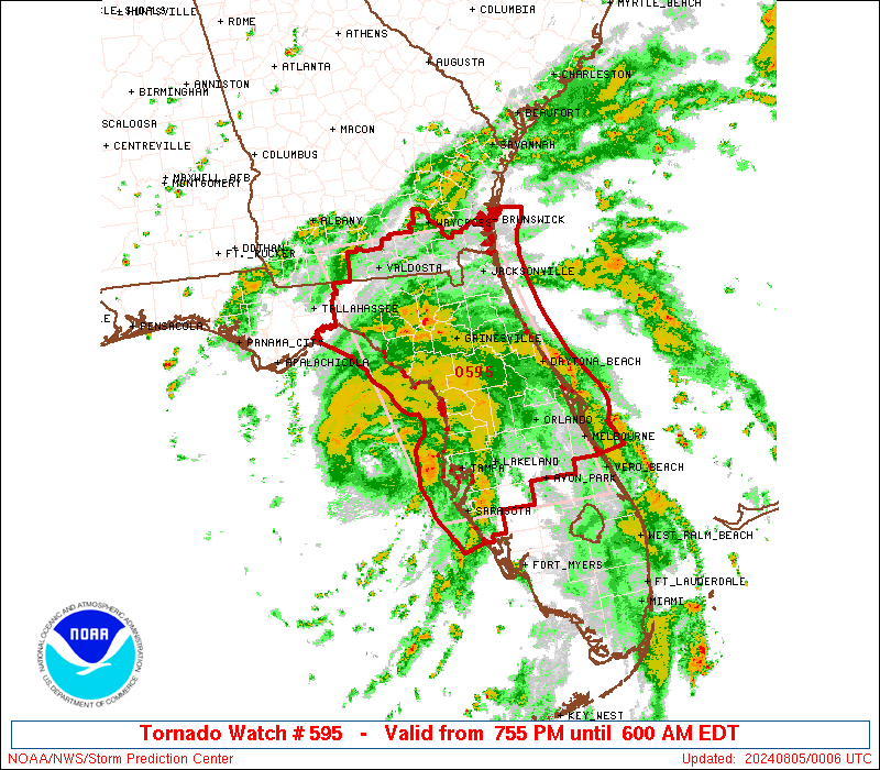
A new tornado watch has been posted by The Storm Prediction Center from south Georgia through Central Florida until 5am CDT. The rainbands associated with Debby still pose the threat of embedded supercells and the risk of tornadoes.
Here are the stats from the NHC as of 7pm CDT:
SUMMARY OF 800 PM EDT…0000 UTC…INFORMATION
———————————————-
LOCATION…28.1N 84.1W
ABOUT 100 MI…160 KM W OF TAMPA FLORIDA
ABOUT 90 MI…150 KM SW OF CEDAR KEY FLORIDA
MAXIMUM SUSTAINED WINDS…70 MPH…110 KM/H
PRESENT MOVEMENT…N OR 360 DEGREES AT 12 MPH…19 KM/H
MINIMUM CENTRAL PRESSURE…992 MB…29.30 INCHES
The NOAA Hurricane Hunters continue to fly through Debby this evening and we will be anxiously awaiting their readings on what appears to be a strengthening Debby. Coverage will continue through the duration of the event here on The Alabama Weather Blog and on our X channel.
About the Author (Author Profile)
Owner of Tornado Talk. Radio broadcast meteorologist with The Storm Report. WeatherBrains Panelist. B.S. Meteorology from Penn State University.Subscribe
If you enjoyed this article, subscribe to receive more just like it.


