10 pm CDT Advisory: Debby Now a Hurricane
Debby continues to slowly organize and is now a hurricane according to the National Hurricane Center. Top winds are now 75 mph.
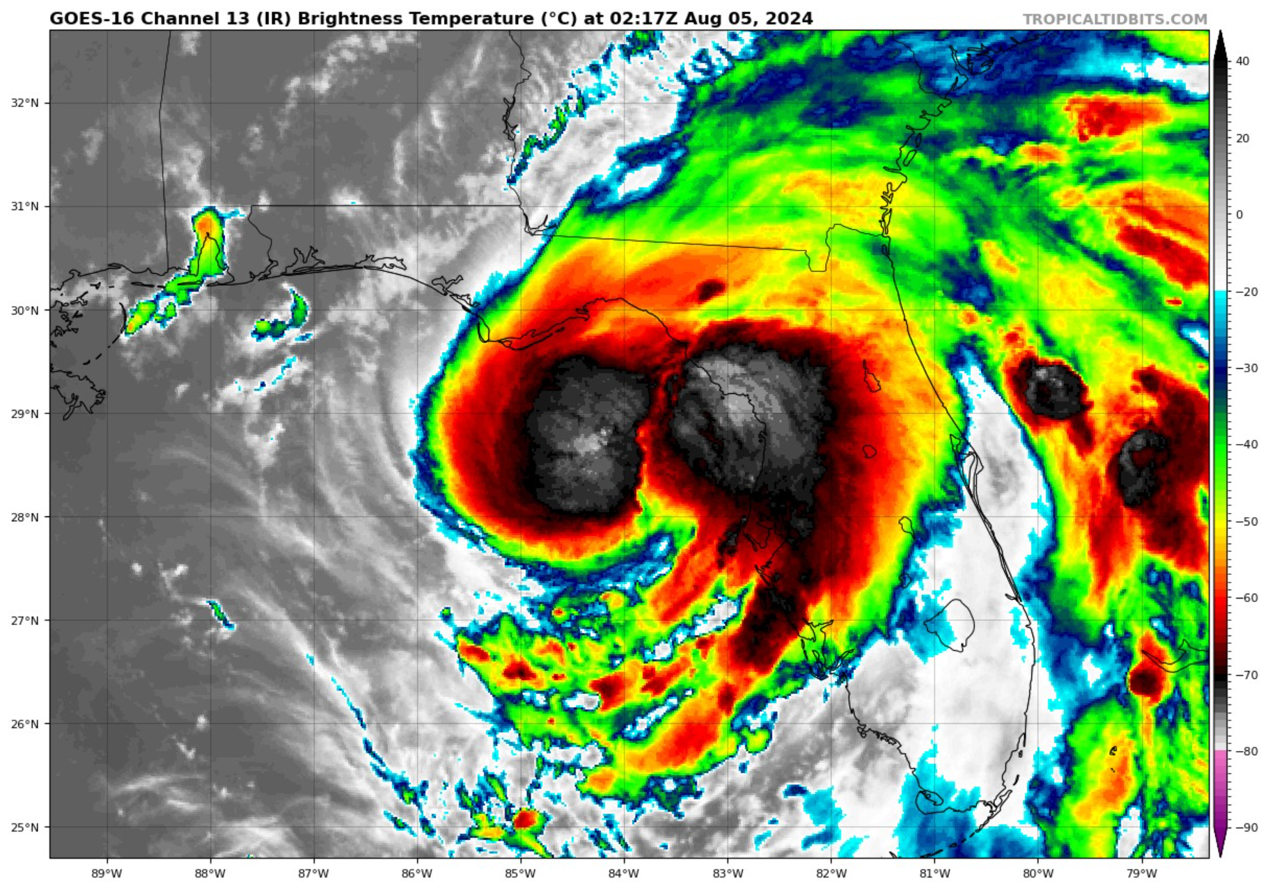
Air Force Hurricane Hunters found a pressure of 986 millibars at 9:36 pm CDT. The wind wasn’t completely calm, so the pressure was a tad lower, or around 985 mb says the NHC.
FAST FACTS AT 10 PM
———————————————–
LOCATION…28.6N 84.0W
ABOUT 65 MI…105 KM WSW OF CEDAR KEY FLORIDA
ABOUT 100 MI…160 KM WNW OF TAMPA FLORIDA
MAXIMUM SUSTAINED WINDS…75 MPH…120 KM/H
PRESENT MOVEMENT…N OR 360 DEGREES AT 12 MPH…19 KM/H
MINIMUM CENTRAL PRESSURE…985 MB…29.09 INCHES
The track is shifted slightly to the east. The center of the remnants should emerge off the Georgia coast by noon on Tuesday and only make it to a point parallel to Myrtle Beach by Thursday. The slow movement will produce historic rainfall for portions of Georgia and South Carolina.
Here are the key points from the NHC discussion:
1. Debby has strengthened into a 65-knot hurricane, with a ragged eye becoming apparent. The storm’s pressure has dropped to around 985 mb. Strong flight-level winds have been observed, indicating a well-defined convective band to the east-northeast of the center.
2. The hurricane is expected to continue strengthening overnight and into Monday due to favorable upper-level winds and high sea surface temperatures. It is forecasted to make landfall along the northeastern Gulf of Mexico coast on Monday. After landfall, Debby is expected to weaken as it moves inland but may restrengthen slightly over the western Atlantic.
3. Potentially historic heavy rainfall is anticipated across southeast Georgia and South Carolina, with the possibility of catastrophic flooding. Significant rainfall is also expected in portions of central and northern Florida and the Coastal Plain of the Carolinas through Friday.
4. Life-threatening storm surge is expected along the Gulf Coast of Florida, with inundation of 6 to 10 feet above ground level possible. Hurricane conditions are expected along the Florida Big Bend region, with tropical storm conditions extending south to the Tampa Bay area. Dangerous storm surge and wind impacts are also anticipated along portions of the southeastern U.S. coast, from northeastern Florida to North Carolina.
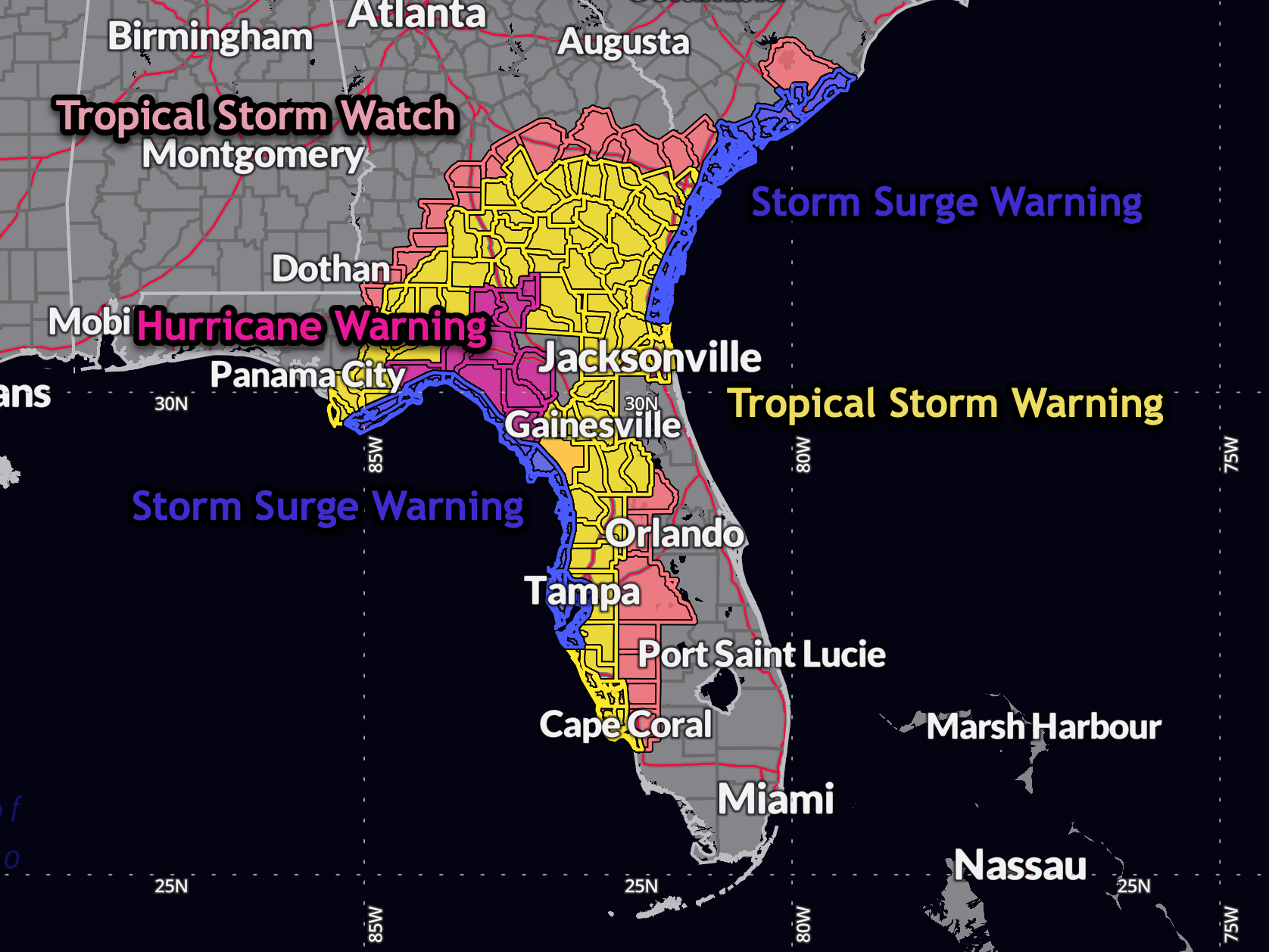
CHANGES IN WARNINGS
A Hurricane Warning has been issued for the Florida Gulf coast from
Suwannee River to Yankeetown.
The Tropical Storm Watch along the coast of South Carolina from the
Savannah River to South Santee River has been changed to a Tropical
Storm Warning.
The Tropical Storm Warning south of Boca Grande has been
discontinued.
The Storm Surge Watch south of Englewood has been discontinued.
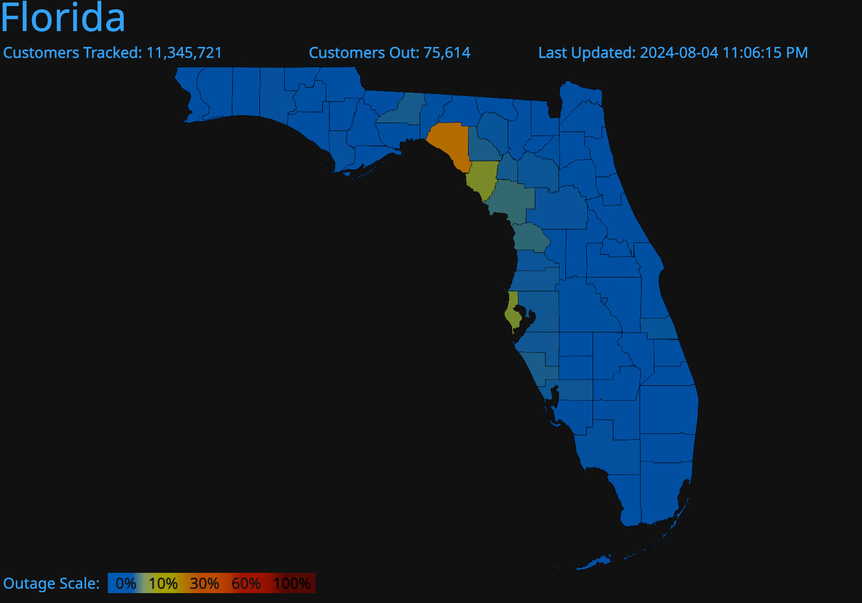
POWER OUTAGES
Lots of power outages already in Florida. Taylor County, where I am, has the most with 13,990 customers without power.
About the Author (Author Profile)
Bill Murray is the President of The Weather Factory. He is the site's official weather historian and a weekend forecaster. He also anchors the site's severe weather coverage. Bill Murray is the proud holder of National Weather Association Digital Seal #0001 @wxhistorianSubscribe
If you enjoyed this article, subscribe to receive more just like it.


