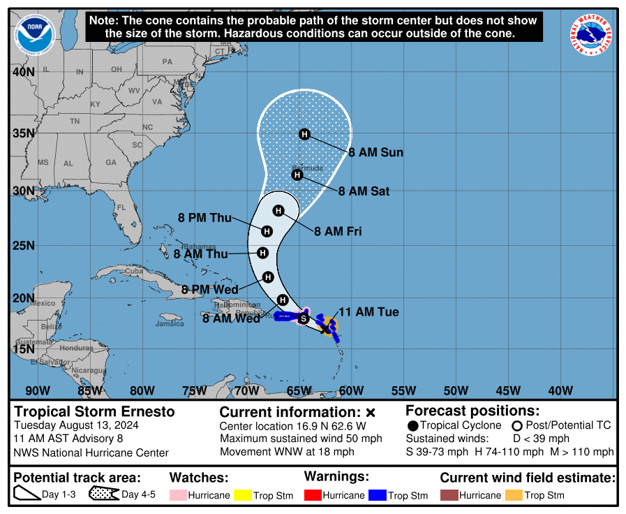
10am CDT: The Latest On Tropical Storm Ernesto; Hurricane Watches now for the U.S. Virgin Islands, Culebra, and Vieques.
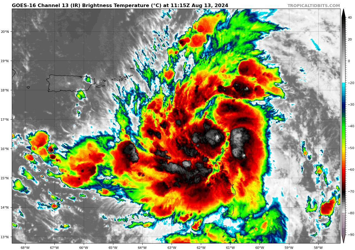
IR Satellite Loop via Tropical Tidbits.
—–
Latest Stats as of 10am CDT:
LOCATION…16.9N 62.6W
ABOUT 155 MI…250 KM ESE OF ST. CROIX
ABOUT 250 MI…405 KM ESE OF SAN JUAN PUERTO RICO
MAXIMUM SUSTAINED WINDS…50 MPH…85 KM/H
PRESENT MOVEMENT…WNW OR 290 DEGREES AT 18 MPH…30 KM/H
MINIMUM CENTRAL PRESSURE…1003 MB…29.62 INCHES
—–
The center of Tropical Storm Ernesto was located near Guaeloupe per the latest advisory. As you see on the infrared satellite above, this is a healthy storm with increased convection. Strengthening of the storm has and continues to occur and this storm is forecast to become a hurricane within 24 hours. The NHC intensity forecast is more aggressive based on latest models showing the potential for rapid intensification. Max winds at the center are up to 50 mph per the latest advisory. Ernesto will pass near or over the Virgin Islands this evening, and then pass just to the northeast and north of Puerto Rico tonight and on Wednesday. Here is the latest forecast track map as of 10am CDT:
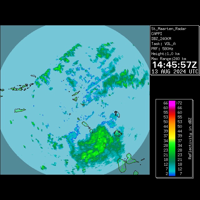
The biggest concerns in the near term will be for tropical storm force winds and torrential rain over portions of the Leewards and Virgin Islands and then eventually into Puerto Rico. Currently 6-8 inches or rain with locally up to 10 inches possible for southeastern Puerto Rico. Below is a radar snapshot from The Meteorological Department of St. Maarten showing some of the rain bands around the islands.
Swells from Ernesto will impact this region for the rest of today. Tonight, swells could reach the Dominican Republic. Through Wed/Thu, increased swells possible for the southeast Bahamas.
What about Bermuda? The latest forecast track continues to bring Ernesto near the island by early Saturday. From the NHC discussion: “A northward to north-northeastward
motion is forecast after 48 hours as Ernesto interacts with a deep-layer trough off the U.S. East Coast, but this trough ends up bypassing Ernesto, resulting in the storm slowing down a bit when
it is in the vicinity of Bermuda. The track guidance has been very consistent, and no changes were required to the official track forecast compared to the previous issuance.”
About the Author (Author Profile)
Owner of Tornado Talk. Radio broadcast meteorologist with The Storm Report. WeatherBrains Panelist. B.S. Meteorology from Penn State University.Subscribe
If you enjoyed this article, subscribe to receive more just like it.


