Severe Thunderstorm Warning for Chilton County
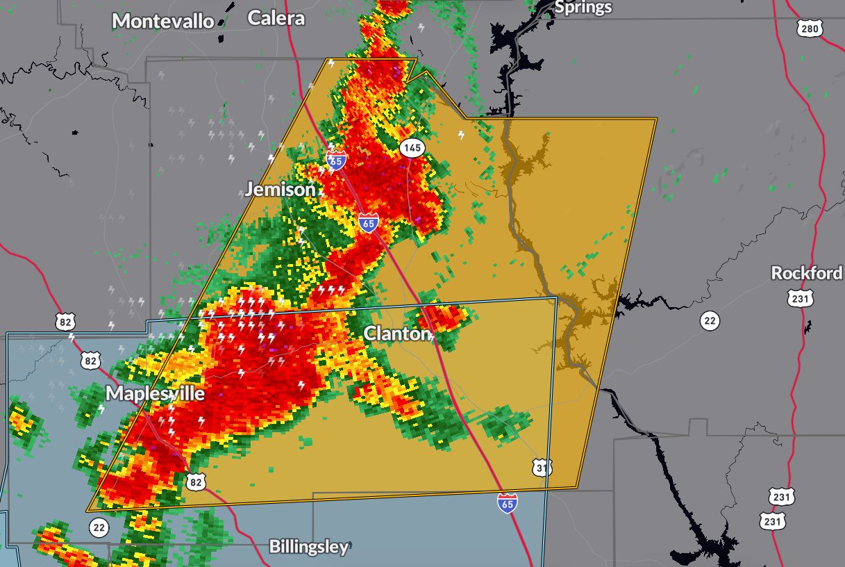
The National Weather Service in Birmingham has issued a
* Severe Thunderstorm Warning for…
Chilton County in central Alabama…
Southwestern Coosa County in east central Alabama…
* Until 500 PM CDT.
* At 419 PM CDT, severe thunderstorms were located along a line
extending from 6 miles west of Lay Lake to near Gap Of The Mountain
to near Pooles Crossroads, moving east at 25 mph.
HAZARD…60 mph wind gusts and penny size hail.
SOURCE…Radar indicated.
IMPACT…Expect damage to roofs, siding, and trees.
* Locations impacted include…
Clanton, Jemison, Thorsby, Maplesville, Plecher, Mitchell Lake,
Dollar, Gap Of The Mountain, Parnell, Lay Lake Dam, Chilton County
Motor Sports Park, Higgins Ferry Park, Verbena, Pooles Crossroads,
Lay Lake, Lomax, Stanton, Waxahatchee Creek, Paint Creek, and I 65
Rest Area.
Category: Alabama's Weather, ALL POSTS, Severe Weather
About the Author (Author Profile)
Bill Murray is the President of The Weather Factory. He is the site's official weather historian and a weekend forecaster. He also anchors the site's severe weather coverage. Bill Murray is the proud holder of National Weather Association Digital Seal #0001 @wxhistorianSubscribe
If you enjoyed this article, subscribe to receive more just like it.


