Severe Thunderstorm Warning for Parts of Shelby County
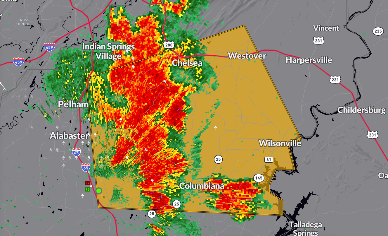
The National Weather Service in Birmingham has issued a
* Severe Thunderstorm Warning for…
Central Shelby County in central Alabama…
* Until 500 PM CDT.
* At 409 PM CDT, a severe thunderstorm was located near Pelham,
moving east at 20 mph.
HAZARD…60 mph wind gusts and penny size hail.
SOURCE…Radar indicated.
IMPACT…Expect damage to roofs, siding, and trees.
* Locations impacted include…
Alabaster, Pelham, Calera, Chelsea, Columbiana, Wilsonville,
Westover, Oak Mountain State Park, Lay Lake, Beeswax Creek Park,
Alabama 4H Center, Ballantrae, Camp Branch, Saddle Lake Farms,
Bounds Lake, and Gaston Steam Plant.
Category: Alabama's Weather, ALL POSTS, Severe Weather
About the Author (Author Profile)
Bill Murray is the President of The Weather Factory. He is the site's official weather historian and a weekend forecaster. He also anchors the site's severe weather coverage. Bill Murray is the proud holder of National Weather Association Digital Seal #0001 @wxhistorianSubscribe
If you enjoyed this article, subscribe to receive more just like it.


