Severe Thunderstorm Watch Until 9 p.m. CDT for East Central
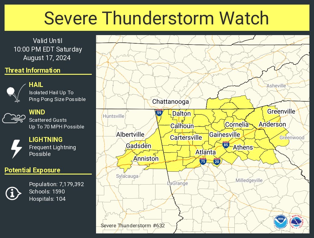
Recent thunderstorms in the area have intensified, showing signs of supercell characteristics due to the presence of a remnant MCV (Mesoscale Convective Vortex). This has resulted in a narrow corridor of 30-40 kts of deep layer shear, contributing to a more organized storm mode. With temperatures in the low to mid-90s and dew points in the mid to upper 70s, the environment is very moist and unstable, supporting MLCAPE values of 2000-2500 J/kg. This setup favors the potential for wet downbursts and possibly large hail, with the risk of damaging winds from more organized storms. The activity is expected to increase in coverage, possibly clustering along outflows into northern Georgia and South Carolina through the afternoon and evening. As a result, the Slight Risk area has been expanded southward, and a watch may be issued to address this threat.
Category: Alabama's Weather, ALL POSTS, Severe Weather
About the Author (Author Profile)
Bill Murray is the President of The Weather Factory. He is the site's official weather historian and a weekend forecaster. He also anchors the site's severe weather coverage. Bill Murray is the proud holder of National Weather Association Digital Seal #0001 @wxhistorianSubscribe
If you enjoyed this article, subscribe to receive more just like it.


