305pm CDT Update on Severe Weather Across Alabama
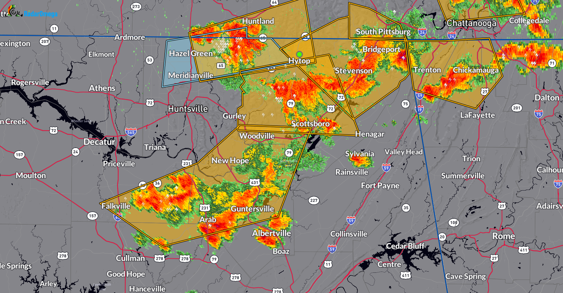
Storms continue to fire across parts of Alabama with the focus of the severe weather from the north central and northeastern part of the state. Clusters of storms with potential damaging wind gusts, very heavy rain, embedded hail and frequent lightning continue from near Hazel east to the GA line and then south through Scottsboro down to New Home and Arab and west to Somerville.
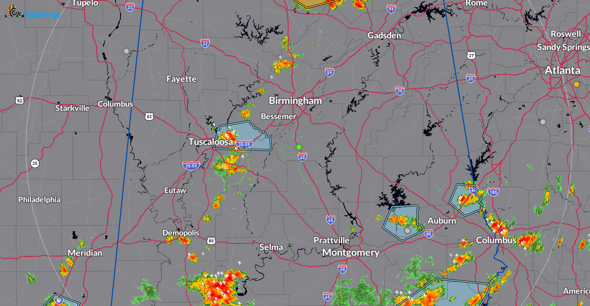
Further south, across the central parts of Alabama we have a line of storms from south of Cullman to Dora and then angling down to Tuscaloosa and south into Hale County.
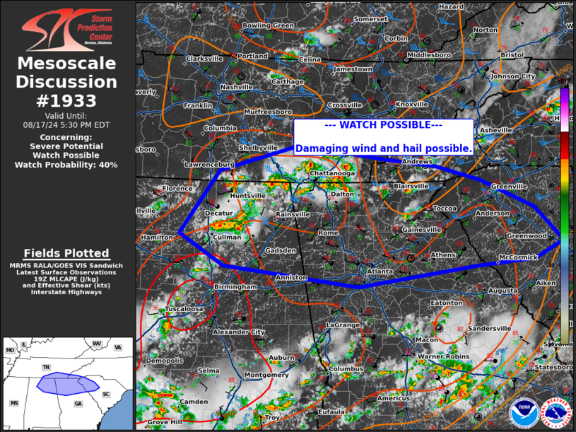
The Storm Prediction Center has posted a mesoscale discussion about these storms. There is a 40% chance of a watch issuance. They are stating the coverage could increase with the damaging wind and hail threat continuing.
Category: Alabama's Weather, ALL POSTS, Severe Weather
About the Author (Author Profile)
Owner of Tornado Talk. Radio broadcast meteorologist with The Storm Report. WeatherBrains Panelist. B.S. Meteorology from Penn State University.Subscribe
If you enjoyed this article, subscribe to receive more just like it.


