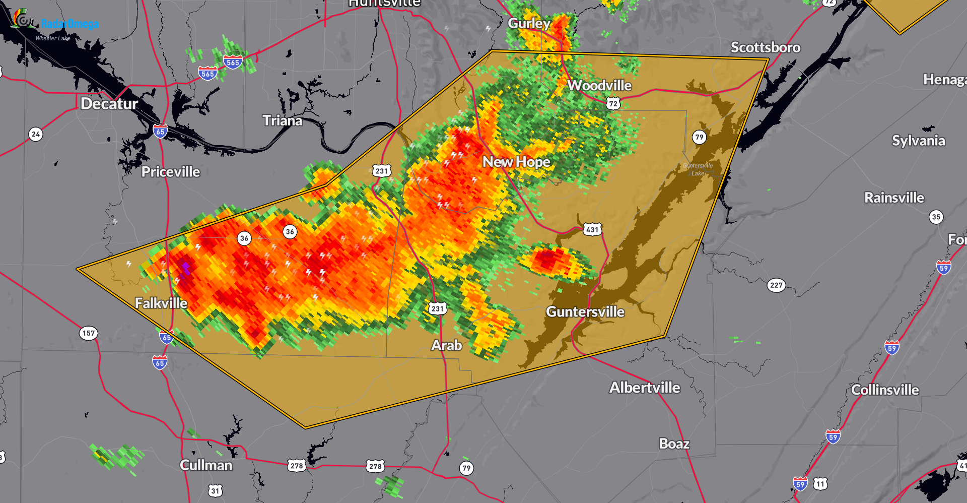
New Severe Thunderstorm Warning for Several Counties in Northeastern and North Central Alabama until 330pm CDT
Large storm from Falkville to New Hope and down to Arab. New warning up from the NWS. Quarter size hail and 60 mph wind gusts are a possibility. This storm is moving to the east at 20 mph. Take cover if you are in this area.
———-
The National Weather Service in Huntsville Alabama has issued a
* Severe Thunderstorm Warning for…
Marshall County in northeastern Alabama…
Southwestern Jackson County in northeastern Alabama…
Southeastern Madison County in north central Alabama…
Northeastern Cullman County in north central Alabama…
Southern Morgan County in north central Alabama…
* Until 330 PM CDT.
* At 238 PM CDT, severe thunderstorms were located along a line
extending from near Owens Cross Roads to Morgan City to Falkville,
moving east at 20 mph.
HAZARD…60 mph wind gusts and quarter size hail.
SOURCE…Radar indicated.
IMPACT…Hail damage to vehicles is expected. Expect wind damage
to roofs, siding, and trees.
* Locations impacted include…
Southern Huntsville, Scottsboro, Hartselle, Guntersville, Arab,
Owens Cross Roads, Falkville, Grant, Woodville, and Morgan City.
Category: Alabama's Weather, ALL POSTS, Severe Weather
About the Author (Author Profile)
Owner of Tornado Talk. Radio broadcast meteorologist with The Storm Report. WeatherBrains Panelist. B.S. Meteorology from Penn State University.Subscribe
If you enjoyed this article, subscribe to receive more just like it.


