Severe Thunderstorm Warning for Talladega, Coosa, and Clay Counties Until 5:45 PM; Severe Reports from St. Clair and Shelby
The National Weather Service in Birmingham has issued a Severe Thunderstorm Warning for southeastern Talladega, northeastern Coosa, and western Clay counties until 5:45 PM CDT.
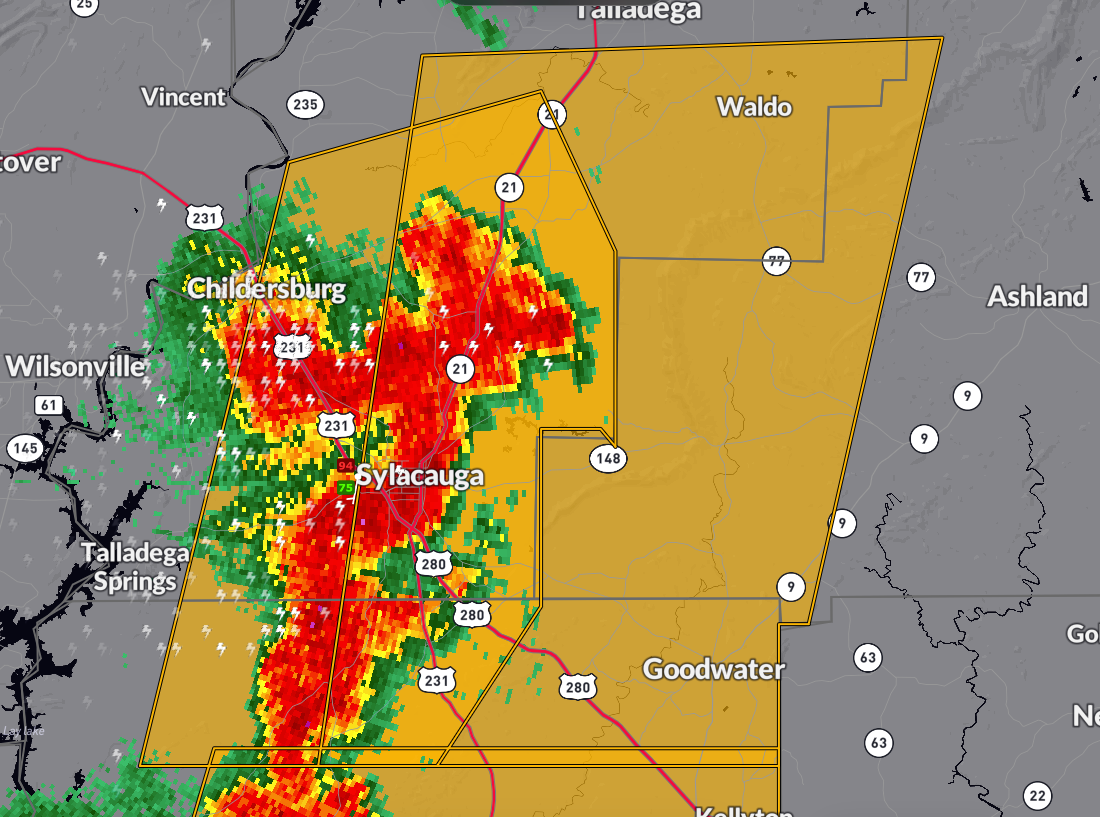
At 5:00 PM CDT, severe thunderstorms were detected along a line from Winterboro to Weogufka, moving east at 25 mph. These storms bring 60 mph wind gusts and penny-sized hail, with potential damage to roofs, siding, and trees. Areas impacted include Talladega, Sylacauga, Goodwater, and surrounding communities. Residents should take shelter in an interior room on the lowest floor.
Recent storm reports indicate significant wind damage, with trees blown down between Moody and Leeds in St. Clair County at 4:27 PM CDT, and additional trees downed along CR 47/Chelsea Road, south of Chelsea in Shelby County at 4:25 PM CDT.
Category: Alabama's Weather, ALL POSTS, Severe Weather
About the Author (Author Profile)
Bill Murray is the President of The Weather Factory. He is the site's official weather historian and a weekend forecaster. He also anchors the site's severe weather coverage. Bill Murray is the proud holder of National Weather Association Digital Seal #0001 @wxhistorianSubscribe
If you enjoyed this article, subscribe to receive more just like it.


