Midday Nowcast: Sun-Filled Hump Day
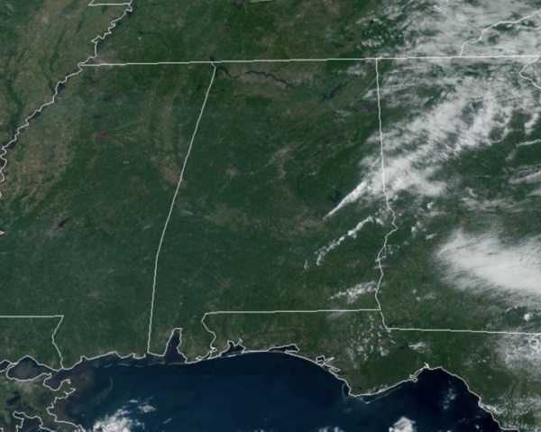
Plenty of sunshine today across the state as the drier air mass remains in place across the state. Highs today are in the 80s for the northern half of the state, while 90s are more common across the southern half of the state. Tomorrow, some moisture begins to work in from the southeast, and we will mention a few isolated showers over our eastern and southeastern counties, but these will be few and far between. Highs tomorrow will again range from the upper 80s to lower 90s.
BIRMINGHAM ALMANAC: For August 20th, the average high for Birmingham is 90° and the average low is 71°. The record high is 102° set in 1983, while the record low is 55° set in 1927. We average 0.14” of precipitation on this date, and the record value is 2.69” set in 1992.
ACROSS THE USA: Strong to severe thunderstorms are expected across the northern and central High Plains Wednesday afternoon, with severe winds and large hail as the primary threats. A dangerous heat wave will continue across the Southern Plains and Gulf Coast through much of this week. Monsoonal thunderstorms across the Four Corners region may result in excessive rainfall and flash flooding.
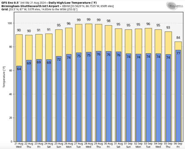
FRIDAY AND THE WEEKEND The pattern will not change much, so the weekend looks great. It will be generally dry with only isolated showers across the southern counties. Highs will be mostly in the upper 80s to low 90s all three days, with the lower humidity levels it will remain tolerable for late August. That also means morning low will remain the 60s.
NEXT WEEK: Heat levels rise, as an upper-ridge build in over the Deep South. Afternoon temperatures likely climb back into the mid and upper 90s next week. And, the pattern continues to look dry with only isolated showers and storms on a daily basis.
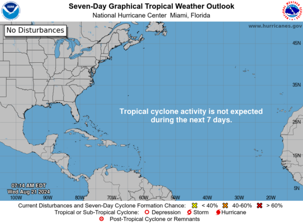
IN THE TROPICS: All is quiet for now, but it won’t last has we are now entering the heart of hurricane season, which statistically peaks on September 10th.
WORLD TEMPERATURE EXTREMES: Over the last 24 hours, the highest observation outside the U.S. was 119.5F at Basrah-Hussen, Iraq. The lowest observation was -80.0F at Vostok, Antarctica.
CONTIGUOUS TEMPERATURE EXTREMES: Over the last 24 hours, the highest observation was 120F at Death Valley, CA. The lowest observation was 30F at Mackay, ID.
Category: Alabama's Weather, ALL POSTS
About the Author (Author Profile)
Macon, Georgia Television Chief Meteorologist, Birmingham native, and long time Contributor on AlabamaWX. Stormchaser. I did not choose Weather, it chose Me. College Football Fanatic. @Ryan_StinnetSubscribe
If you enjoyed this article, subscribe to receive more just like it.


