Midday Nowcast: Very Hot End to August
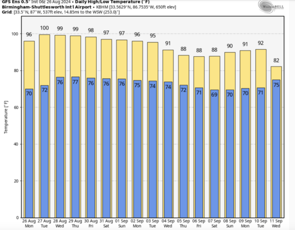
SUMMER’S LAST HURRAH?: We shall see as it will be a very hot week of weather across Alabama. Highs will be in the mid to upper 90s, while some spots are likely to reach 100 degree mark Wednesday over North and West Alabama under a strong upper ridge. The weather will be generally dry through Wednesday. Afternoon temperatures will remain in the 90s Thursday and Friday, but on these days we will mention some risk of isolated afternoon showers or storms, which could provide some temporary heat relief, but still most location will remain dry. Hopefully, this will be last time this year we have to deal with the triple digit heat levels, but we know we can see triple digit heat through out September and even into early October in Alabama.
BIRMINGHAM ALMANAC: For August 26th, the average high for Birmingham is 90° and the average low is 70°. The record high is 103° set in 1943, while the record low is 55° set in 1966. We average 0.13” of precipitation on this date, and the record value is 2.94” set in 1967.
ACROSS THE USA: Hot to excessively hot temperatures stretch from the central Plains into the Upper Midwest and Midwest Monday. Excessive Heat Warnings and Heat Advisories issued. Severe thunderstorms are expected from the northern/central High Plains eastward to Wisconsin Monday afternoon into the nighttime hours. A few severe storms producing strong gusts and hail are also expected across southern New England.
LABOR DAY WEEKEND: Expect highs in the mid 90s Saturday, and low 90s Sunday and Monday as heat levels slowly begin to come down as the upper ridge weakens. We will bring the chance for random, scattered showers ands thunderstorms all three days. Most of the showers and storms will come during the afternoon and evening hours, generally between 2PM-10PM. Odds of any one spot seeing rain each day is in the 30-40 percent range, nothing unusual for the start of September in Alabama.
FOOTBALL WEATHER: College football is back! UAB kicks off their season Thursday night; they take on Alcorn State at Protective Stadium in downtown Birmingham (7:00p CT kickoff)… just a small risk of a shower during the first quarter, otherwise the sky will be mostly fair with temperatures falling through the 80s, reaching the 70s by the fourth quarter.
Alabama hosts Western Kentucky Saturday evening at Bryant-Denny Stadium (6:00p CT kickoff)… a brief shower or storm can’t be ruled out during the first half, otherwise mostly fair with temperatures falling from near 89 degrees at kickoff to the upper 70s by the final whistle.
Auburn will host Alabama A&M at Jordan-Hare Stadium (6:30p CT kickofF)… again a shower or storm is possible during the first half, otherwise mostly fair with upper 80s at kickoff, and upper 70s by the fourth quarter.
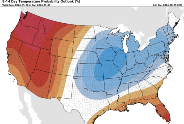
NEXT WEEK: The heat ridge will continue to shift to the west, and the Climate Prediction Center’s temperature outlook shows temperatures near normal to slightly below average for the northern half of the state, with slightly above average temperatures for the southern half of the state. We are forecasting highs in the 80s over the northern half of Alabama Tuesday through Friday… South Alabama will see low 90s. The risk of scattered, mostly afternoon and evening showers and thunderstorms will continue through the week, again, pretty typical of early September in Alabama.
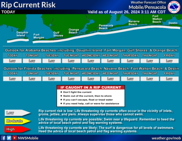
AT THE BEACH: Routine late summer weather for the Alabama and Northwest Florida Gulf Coast. Random, daily afternoon showers and storms and highs in the upper 80s and lower 90s. Rip current threats remain low for most locations this week, but of course pay attention to the Rip Current Flag Warning System at each beach as conditions can change through out the day.
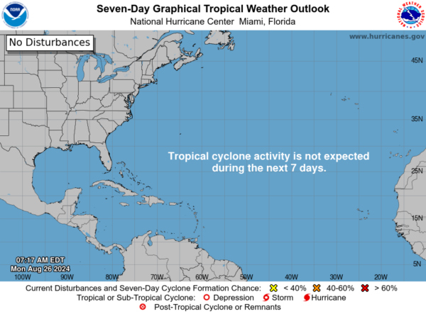
IN THE TROPICS: All is quiet for now, which is very odd since we are the heart of hurricane season, which statistically peaks on September 10th. Nothing is expected to develop the next seven days.
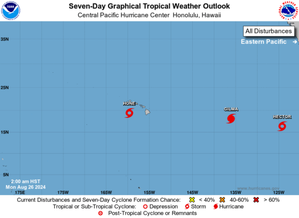
While the Atlantic is quiet, the Central and Eastern Pacific are active with three active tropical cyclones.
WORLD TEMPERATURE EXTREMES: Over the last 24 hours, the highest observation outside the U.S. was 124.0F at Nasiriya, Iraq. The lowest observation was -94.2F at Concordia, Antarctica.
CONTIGUOUS TEMPERATURE EXTREMES: Over the last 24 hours, the highest observation was 109F at Freedom, OK. The lowest observation was 28F at Incline Village, NV.
Category: Alabama's Weather, ALL POSTS
About the Author (Author Profile)
Macon, Georgia Television Chief Meteorologist, Birmingham native, and long time Contributor on AlabamaWX. Stormchaser. I did not choose Weather, it chose Me. College Football Fanatic. @Ryan_StinnetSubscribe
If you enjoyed this article, subscribe to receive more just like it.


