No Major Tropics Headaches…Still Monitoring
Watching a couple of features in the Atlantic and the Gulf of Mexico.
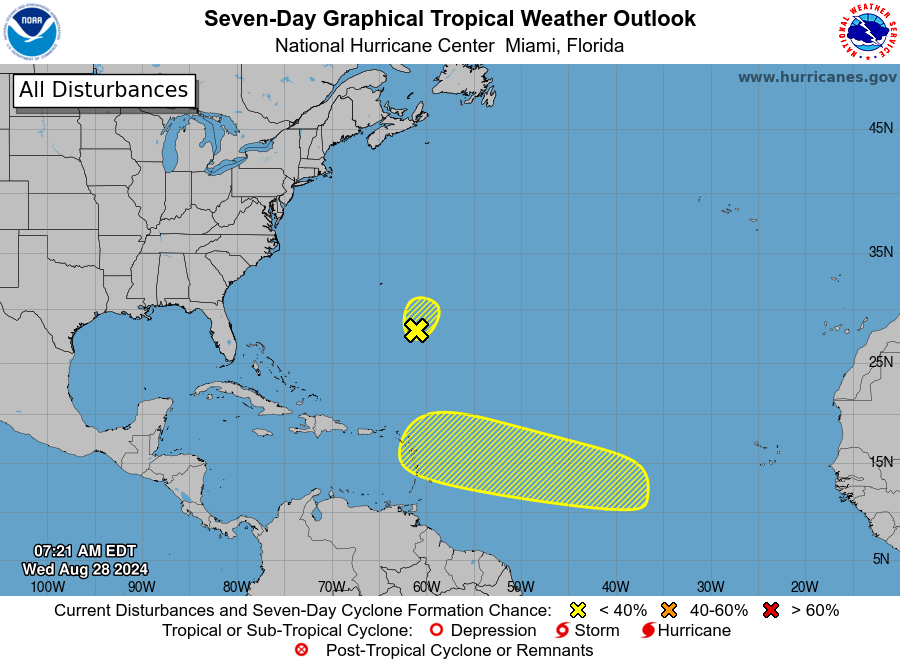
The NHC has highlighted two areas in their 7-day outlook.
- Area of low pressure has developed a few hundred miles SE of Bermuda. It is encountering a lot of dry air and shear and development of this is not looking too likely in the near term.
- Still watching the central tropical Atlantic for low pressure to form. IF it does then conditions seem favorable for slow development. It would move W/WNW from this region. Some of the models are showing a low does eventually form.
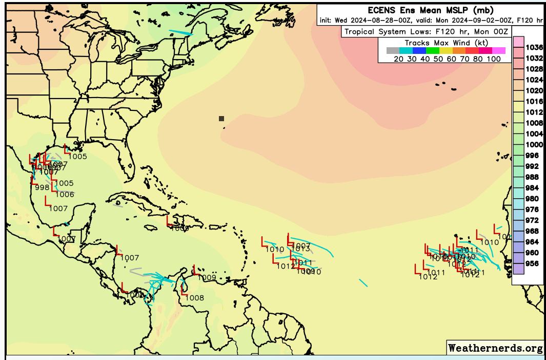
Here is a snapshot from weathernerds.org of the ECENS model on Monday. This global model is showing that low in the central Atlantic followed by something trying to come off of Africa.
There have been a few mid to upper level disturbances forming in the Gulf heading into Texas and that trend may continue.
A pattern of daily local heavy downpours is setting up along the upper TX, LA Gulf Coasts into at least early next week.
Per usual in hurricane season, we’ll keep an eye on the Gulf. pic.twitter.com/r4I6goNYN8
— Jonathan Erdman (@wxjerdman) August 28, 2024
Certainly a lot to monitor as we continue to move into peak hurricane season but at least for now things are more on the quiet side across the Atlantic and Gulf of Mexico.
Meanwhile, we still have 3 named storms in the Pacific with the main player for Hawaii, Tropical Storm Gilma. It looks to be a minor player though.
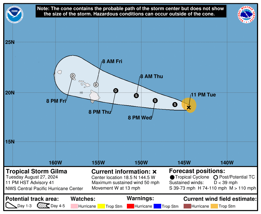
This system with max winds of 50 mph is steadily moving to the west and should approach the Hawaiian Islands on Friday. It is expected to weaken tremendously and may actually dissipate near Hawaii. The main threat for the islands would be heavy rain.
About the Author (Author Profile)
Owner of Tornado Talk. Radio broadcast meteorologist with The Storm Report. WeatherBrains Panelist. B.S. Meteorology from Penn State University.Subscribe
If you enjoyed this article, subscribe to receive more just like it.


