Tropics Update: Then There Were Two….
Happy Friday Evening! Taking a quick look at the tropics to see what is being monitored. Most of the week there have been anywhere from 3, 4 and even 5 areas of disorganized showers and storms being monitored by the NHC. With the latest outlook, we are down to two main areas, and one has a chance of developing into a tropical depression sometime next week.
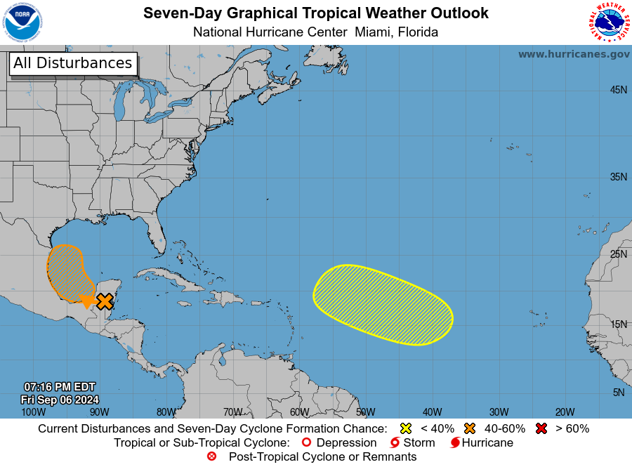
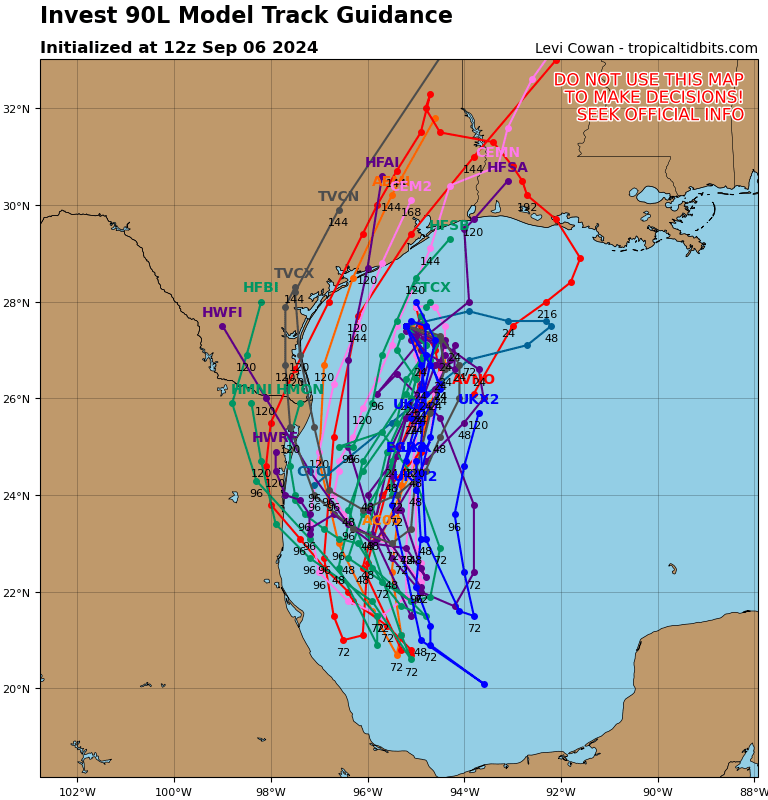
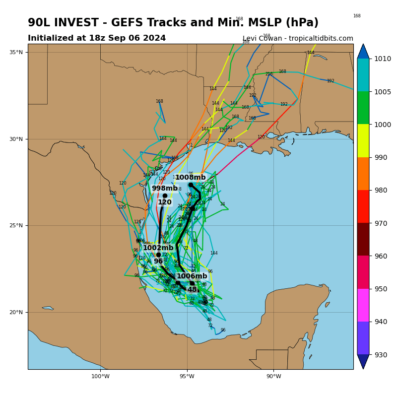
- There is a wave of low pressure over Belize, Guatemala and the Yucatan Peninsula of Mexico that is producing some showers and thunderstorms. It is forecast to move into the Bay of Campeche on Saturday and meet up with a front. As it moves northwest across the southwestern Gulf, it could get a bit more organized. There is a 50% chance for development through 7 days. Where it goes….we really don’t know for sure at this point. The models don’t have a good handle on what could happen with this in terms of exact track and intensity. Below is track guidance (not a forecast): The first is from Global + Hurricane Models and the second are the GFS Ensembles, both from Tropical Tidbits. All we can do is watch at this point and see where this may go. Regardless, by early and mid next week, bigger push of tropical moisture moving right back into parts of the Gulf Coast.
2. The other spot has a lower chance for development. It is over the eastern and central tropical Atlantic. The system is supposed to slow and big IF on anything getting too organized over the next 7 days.
About the Author (Author Profile)
Owner of Tornado Talk. Radio broadcast meteorologist with The Storm Report. WeatherBrains Panelist. B.S. Meteorology from Penn State University.Subscribe
If you enjoyed this article, subscribe to receive more just like it.


