1pm Tropics Update: Francine Now Moving Northeast and a Little Quicker….
Quick update on Francine. We have the latest NHC update and Francine is still a tropical storm but could become a hurricane at any point.
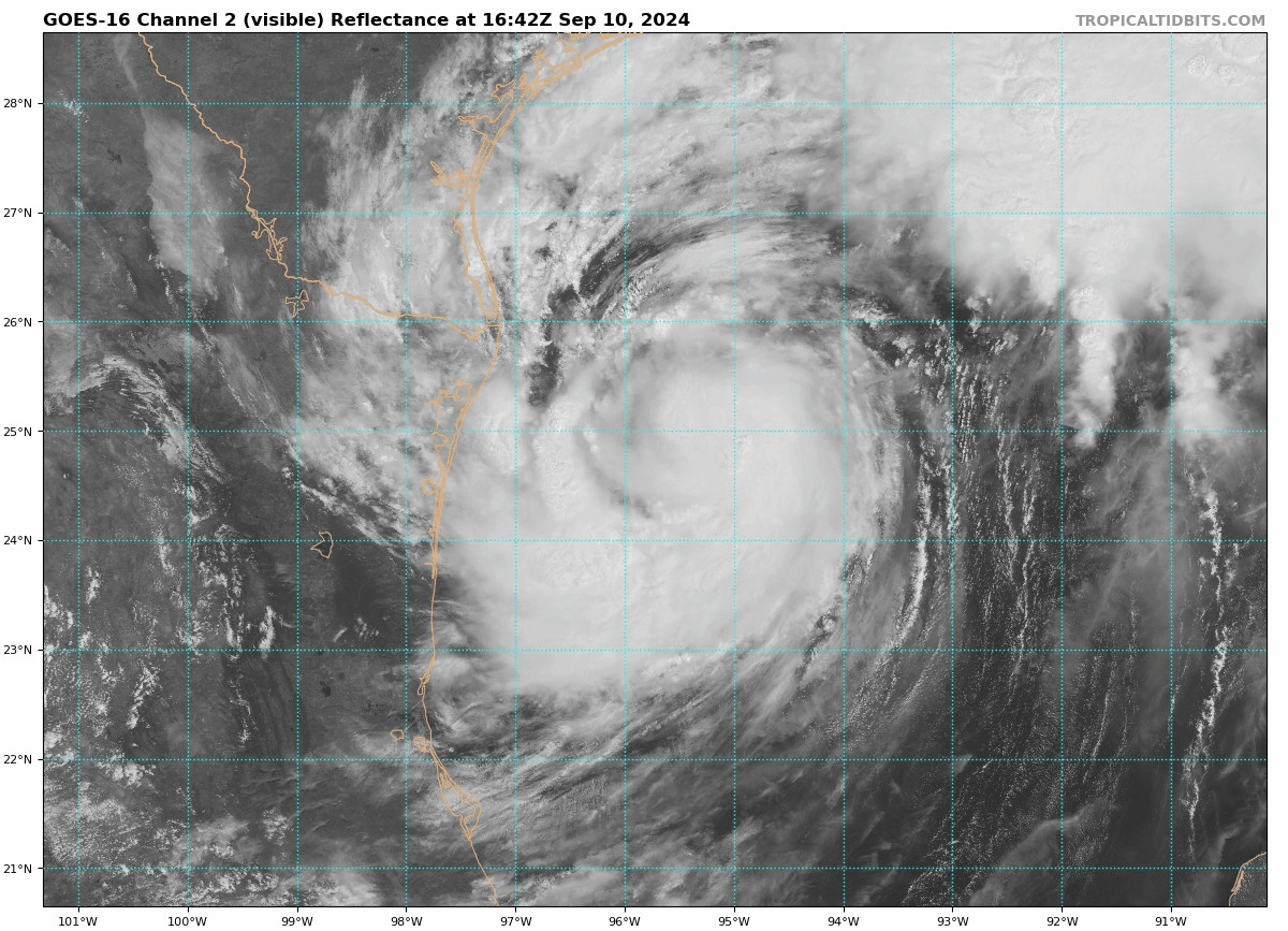
Stats:
LOCATION…25.3N 95.2W
ABOUT 130 MI…210 KM ESE OF MOUTH OF THE RIO GRANDE
ABOUT 380 MI…610 KM SW OF MORGAN CITY LOUISIANA
MAXIMUM SUSTAINED WINDS…65 MPH…100 KM/H
PRESENT MOVEMENT…NE OR 35 DEGREES AT 9 MPH…14 KM/H
MINIMUM CENTRAL PRESSURE…988 MB…29.18 INCHES
Biggest change here is the movement, now northeast and slightly up in forward speed to 9 mph. There have been a couple of changes to advisories:
All warnings and watches are discontinued for the Texas coast south
of Matagorda to the mouth of the Rio Grande River.
The Meteorological Service of Mexico has discontinued all warnings
and watches for the northeastern coast of Mexico.
This northeast movement, with an even faster speed is forecast and still anticipating Francine to cross the Louisiana coast Wed Pm/Eve and then ease up into parts of Mississippi. The center right now is poised to cross into St. Mary Parish and then just west of Morgan City.
NOTE: Some of the models are still showing even more of a shift to the east which could cause increasing problems for New Orleans. That is something to monitor and we will see how the NHC handles that in their bigger 4pm update.
Couple of X posts of interest:
Brian Emfinger posted this about Burns Point Park which is in St. Mary Parish.
Hwy 317 out to Burns Point Park is closing soon as workers close off Bayou Sale Levee. Current NHC max forecast surge exceeds the levee height so thousands of acres of Sugar Cane could flood. #lawx #francine pic.twitter.com/Kof6VUi9dQ
— Brian Emfinger (@brianemfinger) September 10, 2024
Surge reports from Jesse Ferrell:
First 2+ ft. storm surge from #Francine
Port Isabel, TX (NOT shown on the LSU chart) is now at +2.08 feet surge, just inches from Moderate Flooding. https://t.co/wktPobOBQL
South Padre Island (also not on LSU) is at 1.90 feet. pic.twitter.com/aI1BRuNFSJ
— Jesse Ferrell (@WeatherMatrix) September 10, 2024
About the Author (Author Profile)
Owner of Tornado Talk. Radio broadcast meteorologist with The Storm Report. WeatherBrains Panelist. B.S. Meteorology from Penn State University.Subscribe
If you enjoyed this article, subscribe to receive more just like it.


