What’s Ahead for South Alabama Tonight?
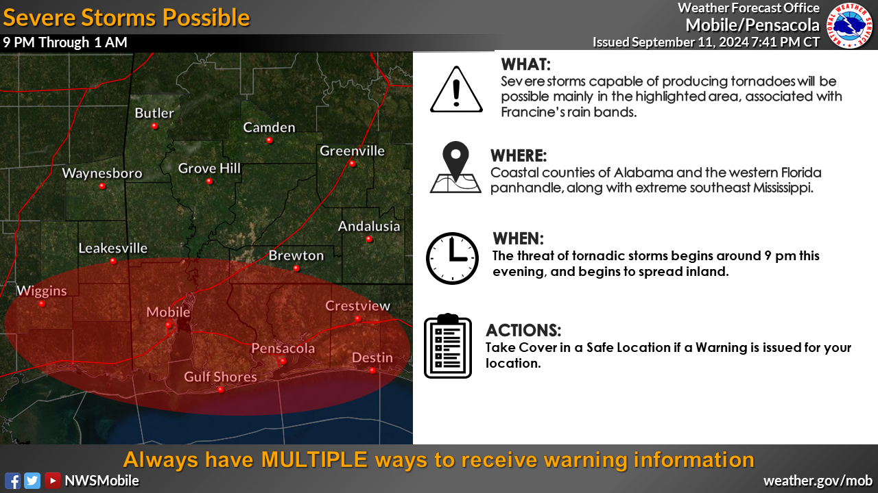
Tonight, from 9 PM to 1 AM, Environmental conditions are going to become favorable for severe storms, and South Alabama may experience severe storms that could produce tornadoes, particularly in the highlighted area due to rain bands from Tropical Storm Francine. This threat is expected to impact coastal Alabama, the western Florida Panhandle, and far southeast Mississippi.
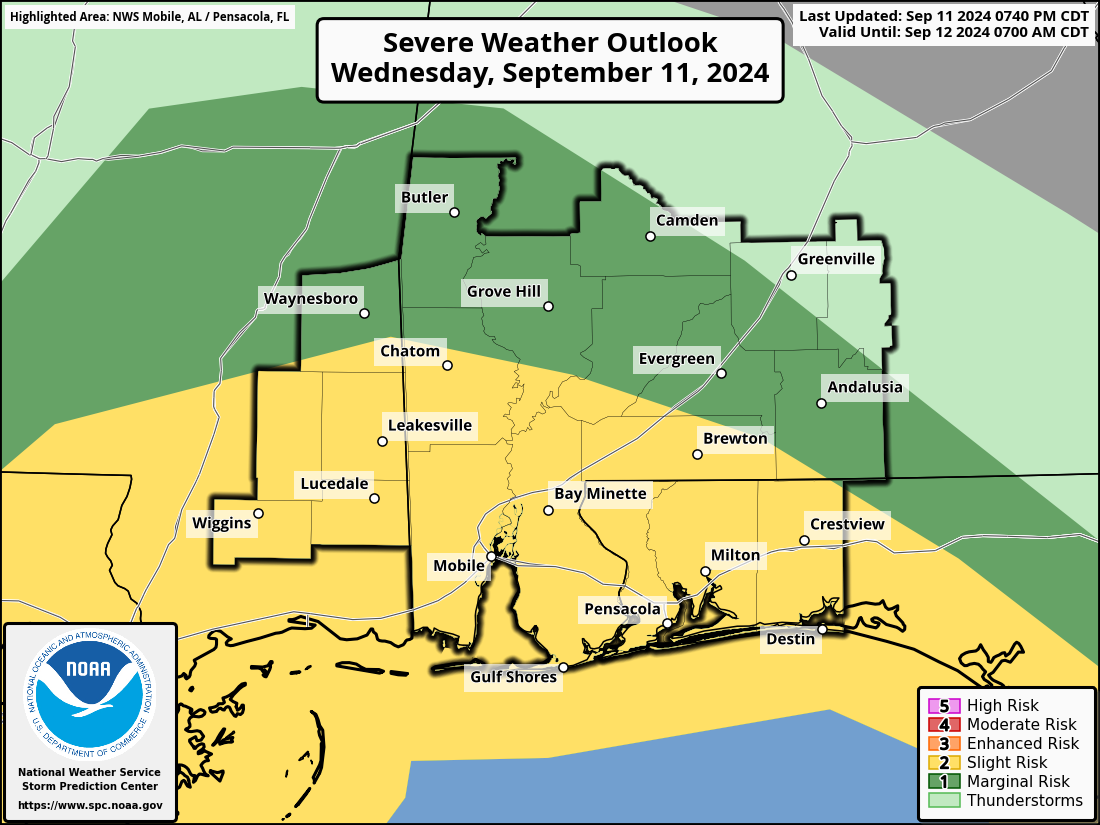
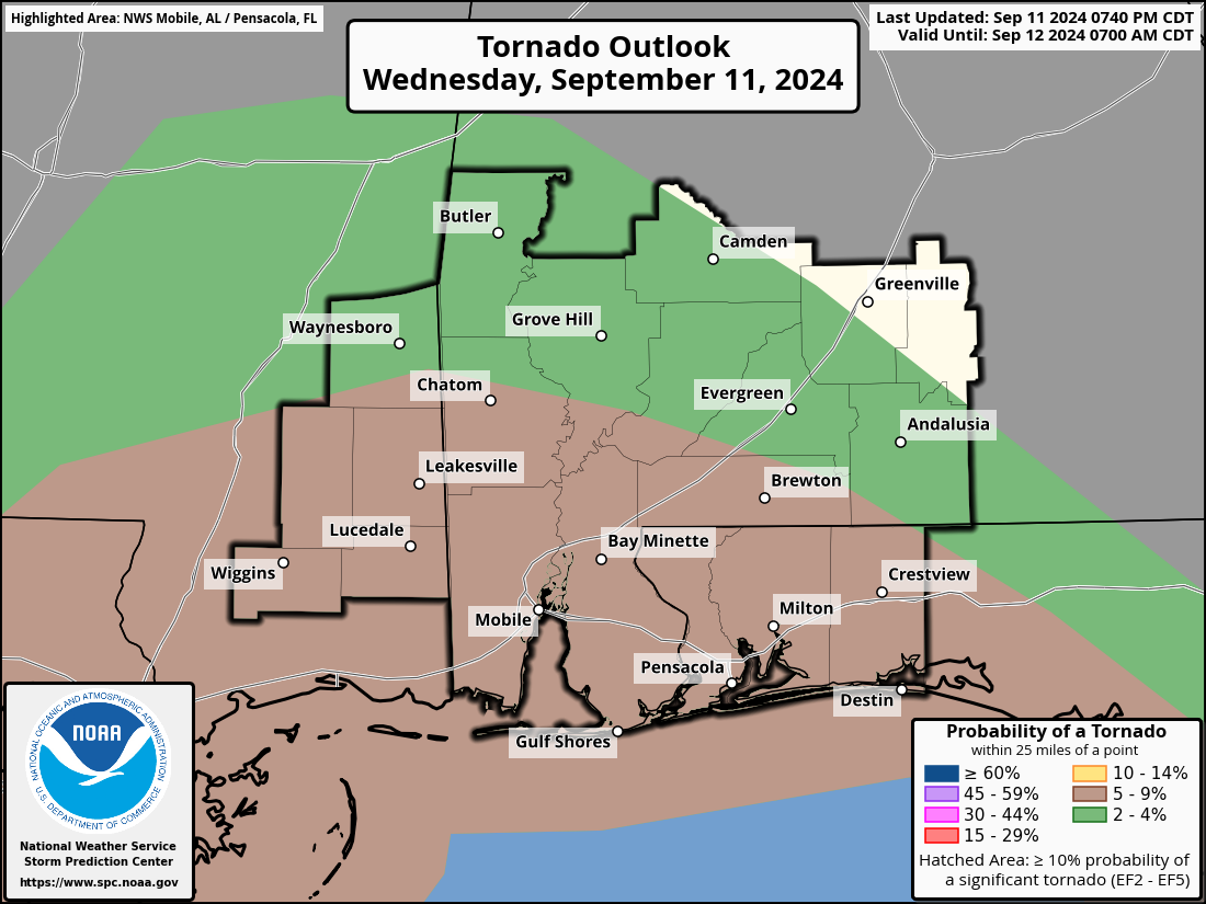
A Slight Risk continues for much of the extreme southwestern corner of Alabama, including the cities of Chatom, Mobile, Gulf Shores, Bay Minette, and Brewton. A Marginal Risk stretches several miles northward to include the cities of Butler, Grove Hill, Camden, Evergreen, and Andalusia.
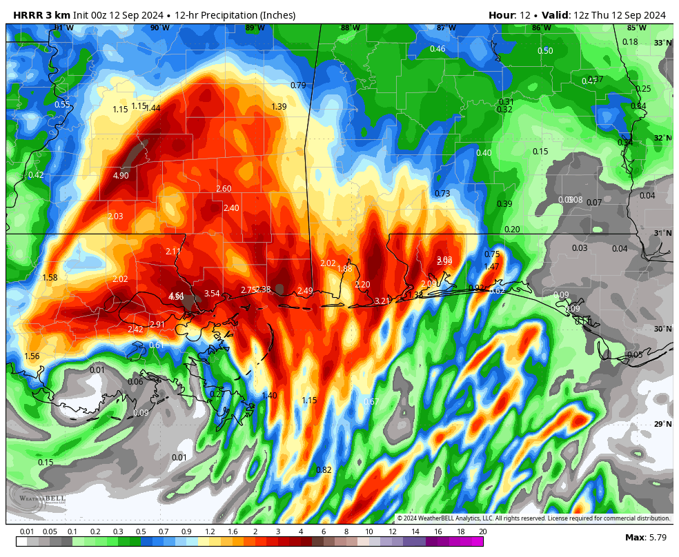
Projected rainfall totals through 7 am Thursday morning from the latest HRRR 12-hour Precipitation run shows totals from as low as 1/10th of an inch over on the eastern side of South Alabama, to as much as 2.50 inches over the extreme southwestern parts of South Alabama.
A High Surf Warning is in effect until 7 PM CDT Thursday, with dangerously large waves of 7 to 10 feet expected. A High Rip Current Risk continues through Friday afternoon, and a Coastal Flood Warning is in effect from 1 AM to 1 PM CDT Thursday. Expect numerous road closures, significant flooding in low-lying areas, and shoreline erosion. Breaking waves may sweep people off jetties and docks, creating life-threatening conditions. Rip currents could pull even strong swimmers away from shore. Flooding may reach around 3 feet, impacting Bienville Blvd on the west end of Dauphin Island and closing parts of the causeway. Many homes on the island will see water underneath them, and Shell Belt and Coden Belt Roads are expected to be impassable. Fort Morgan Road will also face flooding between mile markers 4 and 6.
Category: Alabama's Weather, ALL POSTS, Severe Weather, Tropical
About the Author (Author Profile)
Scott Martin is an operational meteorologist, professional graphic artist, musician, husband, and father. Not only is Scott a member of the National Weather Association, but he is also the Central Alabama Chapter of the NWA president. Scott is also the co-founder of Racecast Weather, which provides forecasts for many racing series across the USA. He also supplies forecasts for the BassMaster Elite Series events including the BassMaster Classic.Subscribe
If you enjoyed this article, subscribe to receive more just like it.


