Flood Watch Issued for Central Alabama Due to Tropical Storm Francine
Tropical Storm Francine is moving into the lower Mississippi Valley tonight, bringing with it waves of showers and thunderstorms that could produce heavy rainfall through Friday morning. This situation poses a significant risk of urban and flash flooding.
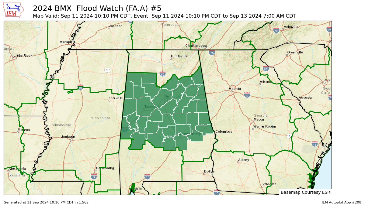
A Flood Watch is now in effect for several counties across central Alabama, including Autauga, Bibb, Blount, Calhoun, Chambers, Cherokee, Chilton, Clay, Cleburne, Coosa, Dallas, Elmore, Etowah, Fayette, Greene, Hale, Jefferson, Lamar, Lee, Lowndes, Macon, Marengo, Marion, Montgomery, Perry, Pickens, Randolph, Shelby, St. Clair, Sumter, Talladega, Tallapoosa, Tuscaloosa, Walker, and Winston. This watch will remain active through Friday morning.
Flash flooding is possible due to excessive rainfall. The flood watch is set to last until Friday morning. The anticipated heavy rain could lead to flooding in rivers, creeks, streams, and other low-lying areas. Urban areas with poor drainage are also at risk of significant flooding.
Locally heavy rainfall is expected across Central Alabama due to ongoing showers and thunderstorms from Francine. Rainfall amounts could range from two to four inches, with some areas potentially seeing up to six to nine inches, which may result in urban and flash flooding.
It is important to stay updated with the latest weather forecasts and be prepared to take action if Flash Flood Warnings are issued.
Category: Alabama's Weather, ALL POSTS, Tropical
About the Author (Author Profile)
Scott Martin is an operational meteorologist, professional graphic artist, musician, husband, and father. Not only is Scott a member of the National Weather Association, but he is also the Central Alabama Chapter of the NWA president. Scott is also the co-founder of Racecast Weather, which provides forecasts for many racing series across the USA. He also supplies forecasts for the BassMaster Elite Series events including the BassMaster Classic.Subscribe
If you enjoyed this article, subscribe to receive more just like it.


