10am Advisory: Francine Decreases More; Still Monitoring a Few Other Features….
Francine is expected to become post-tropical as it moves out of Central MS and drifts north. There are no coastal watches/warnings in effect.
LOCATION…32.5N 90.1W
ABOUT 15 MI…25 KM NNE OF JACKSON MISSISSIPPI
MAXIMUM SUSTAINED WINDS…35 MPH…55 KM/H
PRESENT MOVEMENT…N OR 360 DEGREES AT 14 MPH…22 KM/H
MINIMUM CENTRAL PRESSURE…996 MB…29.42 INCHES
The main problems now will be the risk of isolated flooding and still that tornado threat. Bill and I will have a detailed discussion about the threat for tornadoes for Alabama coming out soon!
What else is out there?
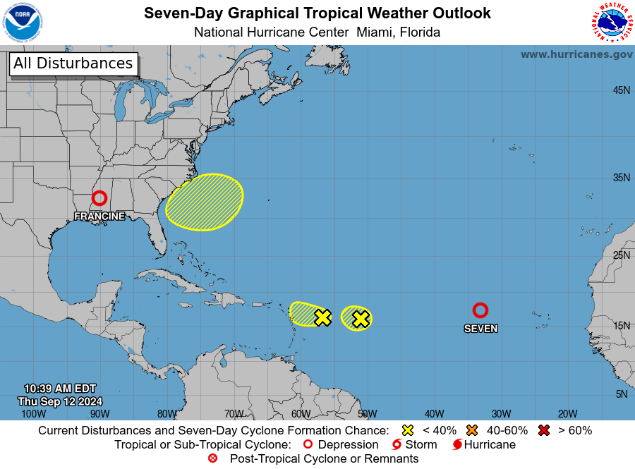
Watching several areas for possible development.
- We still have Tropical Depression #7.
- West of that depressions are two waves, neither of which has a big chance of developing.
- The area marked off the southeast US Coast is interesting. The models are hinting at an area of low pressure forming along a front a few hundred miles off the coast. Some development could occur so that is something to monitor especially early/mid next week.
About the Author (Author Profile)
Owner of Tornado Talk. Radio broadcast meteorologist with The Storm Report. WeatherBrains Panelist. B.S. Meteorology from Penn State University.Subscribe
If you enjoyed this article, subscribe to receive more just like it.


