10am CDT Update: We Now Have Tropical Storm Helene; Forecast to Reach Hurricane Strength Wednesday
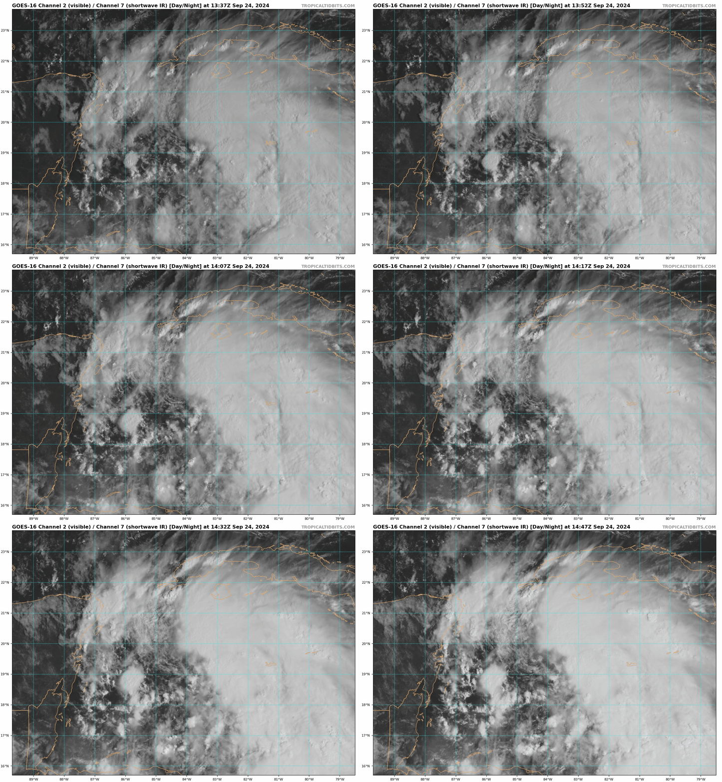
We have been waiting to see what the Hurricane Hunters have been observing and based on their reports and dropsonde data, we now have Tropical Storm Helene.
Stats:
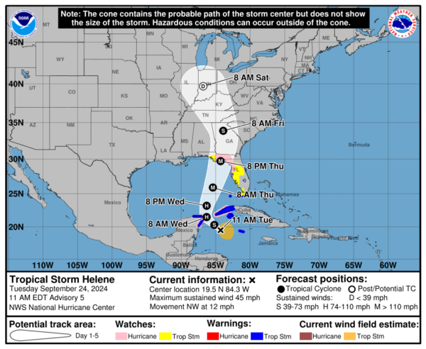
LOCATION…19.5N 84.3W
ABOUT 180 MI…295 KM ESE OF COZUMEL MEXICO
ABOUT 170 MI…275 KM SSE OF THE WESTERN TIP OF CUBA
MAXIMUM SUSTAINED WINDS…45 MPH…75 KM/H
PRESENT MOVEMENT…NW OR 310 DEGREES AT 12 MPH…19 KM/H
MINIMUM CENTRAL PRESSURE…1000 MB…29.53 INCHES
Couple of changes here: Pressure is down one millibar. Movement is quicker to the NW at 12 mph.
The Hurricane Hunters report a well-defined center now which it was struggling to have before due to wind shear. Max winds are at 45 mph.
Advisories:
NEW:
A Tropical Storm Warning has been issued for the Lower Florida Keys west of the Seven Mile Bridge and for the Dry Tortugas.
A Tropical Storm Watch has been issued for the Middle Florida Keys from the Seven Mile Bridge to the Channel 5 Bridge.
The rest of the advisories remain the same at this hour.
Things to Watch:
- Strengthening: Now that the shear is easing and we have a more defined center, significant strengthening is possible. The NHC is forecasting Helene to still become a major hurricane within 48 hours with winds near 115 mph at the center and higher gusts.
- Track: We are just now getting a solid center to form. Model consensus is still showing a track threading the needle between the Yucatan Peninsula and western Cuba and then turning north-northeast through the eastern Gulf with a landfall somewhere along the Big Bend of Florida. We can’t get too fixated on a landfall point for many reasons but one, we have to watch the model trends and see how they respond. There is a cone for a reason to highlight the uncertainty of landfall.
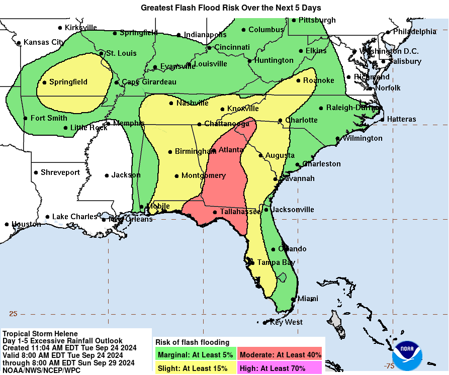
- Size and Speed: This was really key from the NHC discussion. “Helene’s forecast radii are at the 90th percentile of hurricane size at similar latitudes.” This is forecast to be a very big storm with impacts that will stretch far and wide. Also Helene is forecast to pick up the pace so impacts further inland will be greater. This includes Alabama with an increased wind and heavy rain threat.
Category: ALL POSTS, Social Media, Tropical


