4am Update: Helene Slightly Stronger and Expected to Become a Hurricane Today; New Advisories for Parts of the U.S.
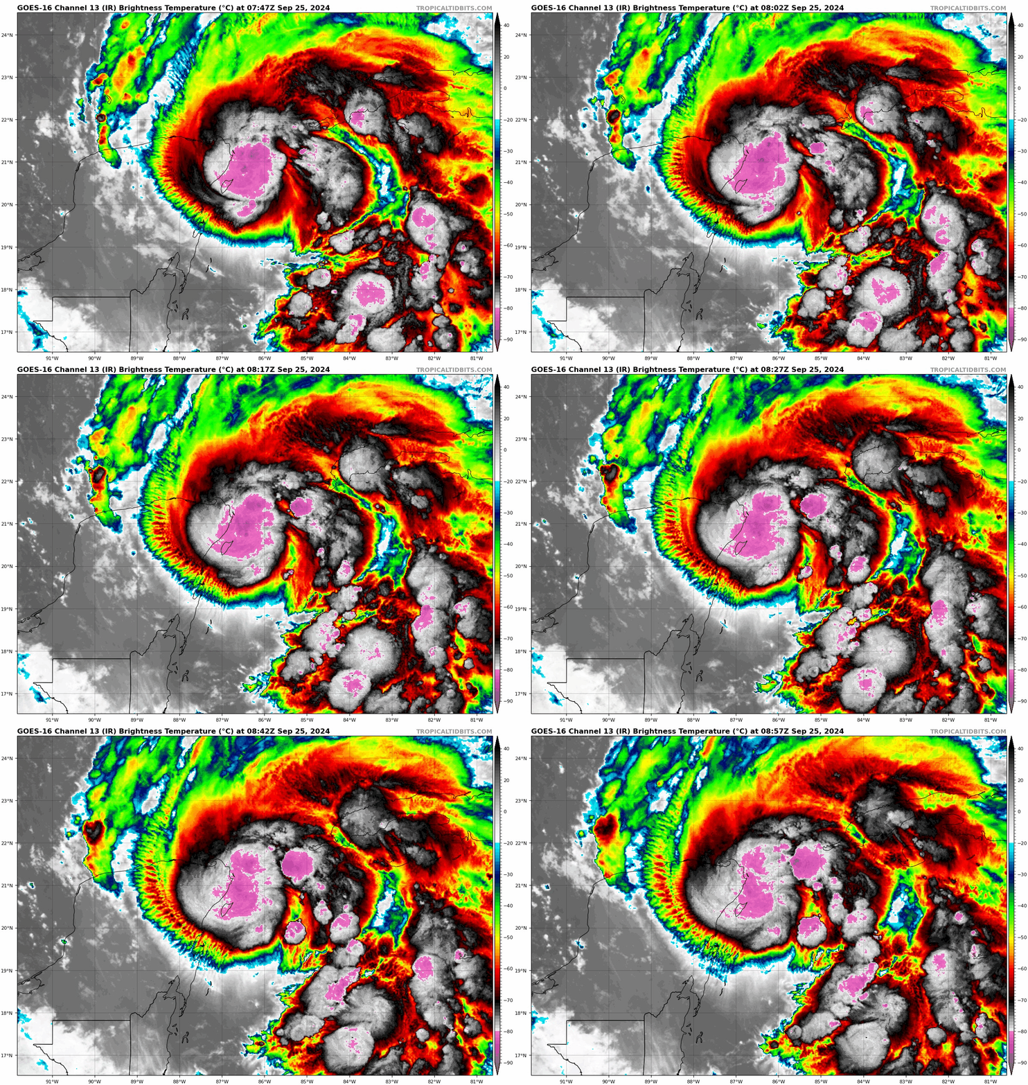
The NHC has issued their full 4am CDT Advisory. The Hurricane Hunters have been flying into the storm and have found lower pressure and increased winds. Helene has not YET formed a well-defined inner core. Here is the full update!
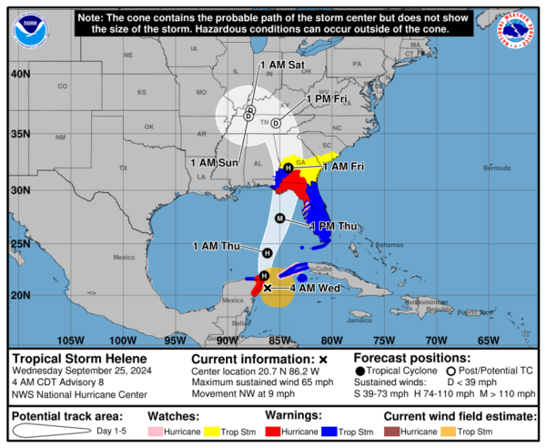
Stats
LOCATION…20.7N 86.2W
ABOUT 45 MI…75 KM ENE OF COZUMEL MEXICO
ABOUT 120 MI…190 KM SW OF THE WESTERN TIP OF CUBA
MAXIMUM SUSTAINED WINDS…65 MPH…100 KM/H
PRESENT MOVEMENT…NW OR 325 DEGREES AT 9 MPH…15 KM/H
MINIMUM CENTRAL PRESSURE…985 MB…29.09 INCHES
Advisories
NEW:
A Tropical Storm Warning is now in effect for the Upper Florida Keys from the Channel 5 Bridge to Ocean Reef and for the southern Florida Peninsula east of Flamingo to the Palm Beach/Martin County line.
A Tropical Storm Warning is now in effect for the northeast coast of Florida north of the Flagler/Volusia line to the mouth of the St. Mary’s River.
A Tropical Storm Watch is now in effect for the South Carolina coast north of the Savannah River to the South Santee River.
Discussion Notes
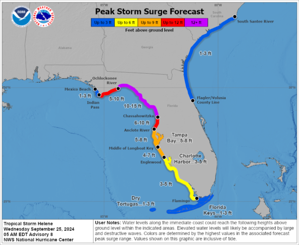
The hurricane hunters have been flying in and out of this storm gathering important data. They found pressure down to 985 mb. Flight-level winds were at 58 kts. Helene is getting very close to the NE Coast of the Yucatan Peninsula. It may barely skirt the coast while turning north and then eventually get pulled north to north-northeast. It is expected to accelerate through the eastern Gulf, strengthening quickly as it does so. The forecast landfall is still late Thursday into Thursday night around the Apalachicola vicinity. The cone extends from Parker, FL to Horseshoe Beach. The cone of course shows us projected landfall of the center and that is very important to know where the potential max of the storm may cross. But, this is a VERY large system and will continue to expand as it strengthens and there will be widespread impacts. Right now, tropical storm force winds extend out 175 miles from the center. Heavy rain, damaging winds will extend well inland. Storm surge impacts all across the Florida Gulf Coast and a rise along the SE coast.
The NHC continues to highlight rapid intensification of Helene and within 36 hours could have winds to 120 mph at the center. They state this is conservative as some model guidance has even higher winds.
Peak storm surge is still expected at 10-15 feet from Ochlockonee River, FL to Chassahowitzka, FL.
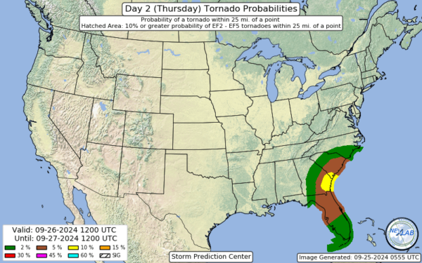
Increased tornado threat on Thursday. Here is the latest from the SPC.
We will continue with update throughout the day on Helene. There will be plenty of Alabama impacts as well and we will have real-time updates!
Category: ALL POSTS, Social Media, Tropical


