1PM CDT Helene Update: A Strong Helene Moving Closer to the Florida Coast
Here is a look at the 1PM CDT National Hurricane Center update, as well as a close look at the potential area of landfall.
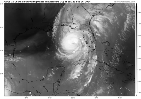
CURRENT SATELLITE IMAGE:
NEW NHC FACTS:
SUMMARY OF 100 PM CDT…1800 UTC…INFORMATION
———————————————-
LOCATION…26.4N 85.0W
ABOUT 195 MI…315 KM SW OF TAMPA FLORIDA
ABOUT 230 MI…365 KM S OF APALACHICOLA FLORIDA
MAXIMUM SUSTAINED WINDS…110 MPH…175 KM/H
PRESENT MOVEMENT…NNE OR 25 DEGREES AT 16 MPH…26 KM/H
MINIMUM CENTRAL PRESSURE…959 MB…28.32 INCHES
IMPORTANT UPDATES:
1. Helene has now strengthened to a very strong category 2 hurricane, with winds around 110 mph. The threshold for a category 3 status, and thus major hurricane status, is 111 mph. The storm is right there at that line, and it is expected to continue strengthening this afternoon.
2. The minimum central pressure of the storm has dropped to 959 mb.
3. Helene is less than 250 miles away from the predicated area of landfall.
4. The timing of landfall looks to have shifted a little later than what we earlier thought. Right now, models are showing a late evening landfall: sometime around 10pm CDT tonight.
4. Information regarding impacts such as storm surge, flash flooding, rainfall, and severe weather remain the same as the 10AM CDT update.
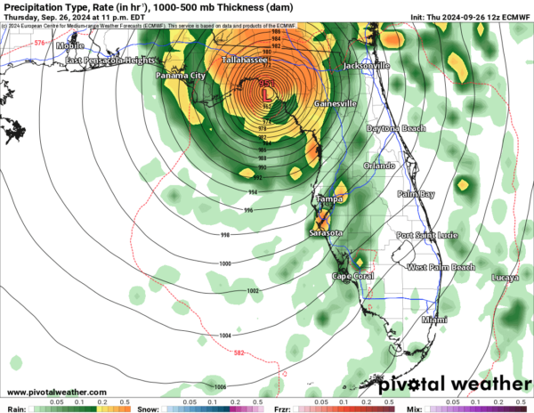
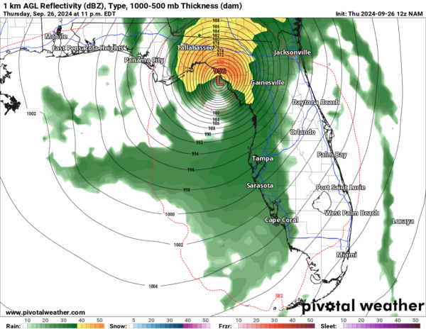
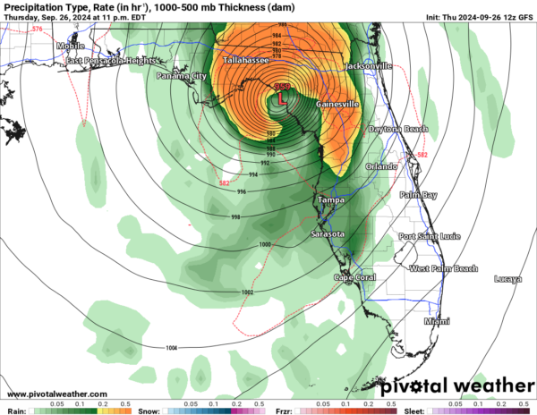
We have been forecasting for a while now that this storm would make landfall in the Big Bend region of Florida. However, let’s take a closer look at where exactly within this region the center could pass over. The Euro model shows the center of Helene passing directly over the middle of the Econfina River State Park, just to the west of the Hampton Springs/Perry area. However, both the GFS and NAM show a slightly more western track, with the center passing over the areas just east of Keaton Beach. These areas are given just as a general reference- please note that the forecasted track of the storm could change, especially once the next model runs come in. The main takeaway from this should be that the entire Big Bend region, and the Florida Gulf Coast, will feel devastating effects from this hurricane.
Both the GFS and Euro model are still in agreeance that the entire flow of Helene will continue to stay moist and produce rain, while the NAM shows some dry air being pulled into the Southwest quadrant of the storm.
The next NHC advisory will come out at 4PM CDT. Stay tuned as we will have a full breakdown of that advisory later today.
Category: ALL POSTS, Social Media, Tropical


