From Freeze to Showers: A Dynamic Week Ahead for Central Alabama
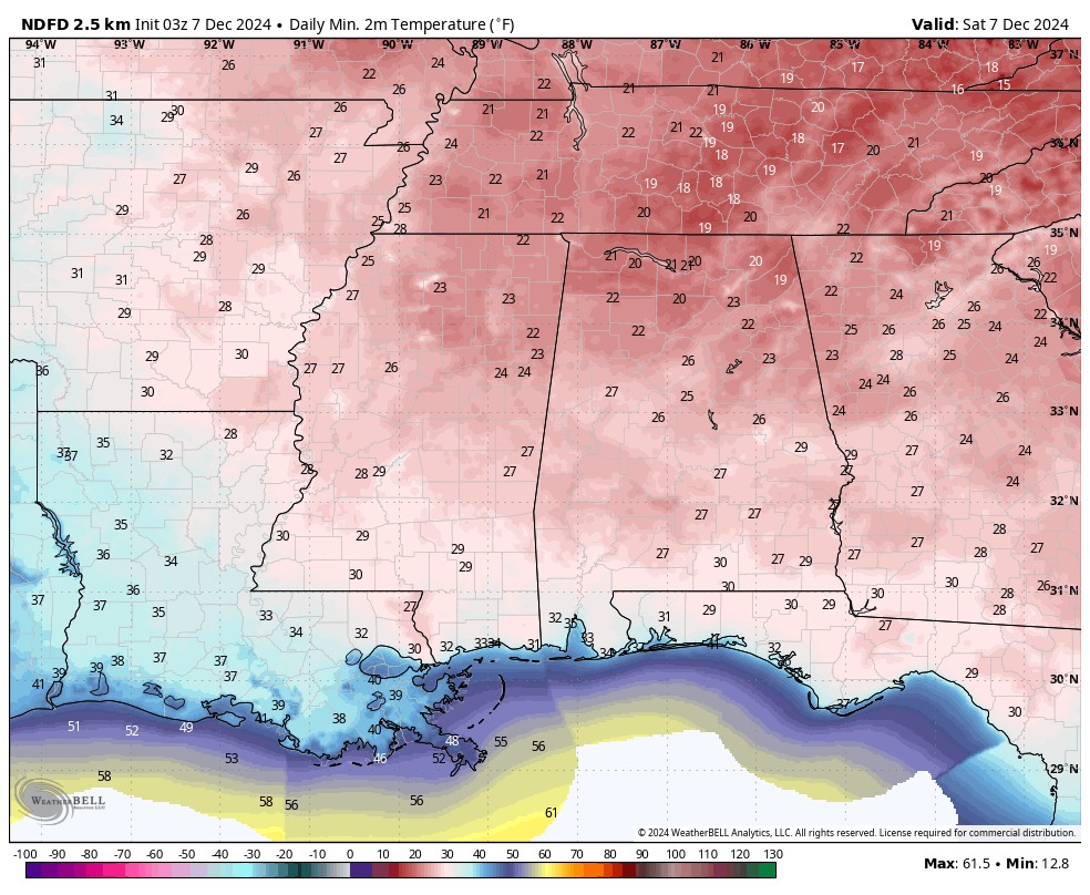
This morning’s projected lows.
THIS WEEKEND: Central Alabama is waking up in the deep freeze this morning as early morning lows bottomed out in the 20s throughout the area. A few of the usual colder spots may have even hit the upper 10s for a little bit. However, ridging will be centered over the Gulf of Mexico, allowing for a west-southwesterly flow across the area. Some high cirrus clouds will keep the skies from being completely clear, however, the bright sunshine will make those afternoon highs in the 50s feel much better than Friday.
A cold front heads our way on Sunday, and will eventually allow for showers to begin to move into the area by the late morning to early afternoon hours. And don’t expect those rain chances to end anytime soon, as the front washes out and will keep our weather active into the work week ahead. Highs will range from the lower 50s to the lower 60s.
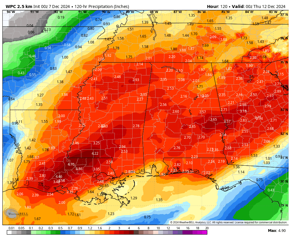
Projected rainfall totals through Wednesday.
THE WORK WEEK AHEAD: The good news on Monday is that temperatures will be much milder, and we will receive some much-needed rainfall. The only drawback I see is that we’ll have to drive in the rain during both rush hours. From midnight to lunchtime, we could receive up to or just over 1 inch of rainfall in the north and northwest, with totals decreasing as you move southeast. However, the rain will eventually spread southeastward. Highs in the 60s.
A much stronger cold front will be heading in our direction on Tuesday that will bring more lift for the development of even more showers and maybe some thunder. Temperatures will also remain mild ahead of the front, with highs reaching the mid to upper 60s.
The front passes through the state on Wednesday, bringing an end to our rain chances and resupplying Central Alabama with much cooler and drier air. Rain will end during the morning hours and afternoon highs will only reach the lower to mid 40s.
Surface high pressure will be located off to our northeast on Thursday and Friday, that will allow for plenty of sunshine with crisp, cool air on both days. Thursday’s highs will be in the mid 40s to the lower 50s. Friday’s highs in the upper 40s to the lower 50s.
Category: Alabama's Weather, ALL POSTS, Social Media, Weather Xtreme Videos
About the Author (Author Profile)
Scott Martin is an operational meteorologist, professional graphic artist, musician, husband, and father. Not only is Scott a member of the National Weather Association, but he is also the Central Alabama Chapter of the NWA president. Scott is also the co-founder of Racecast Weather, which provides forecasts for many racing series across the USA. He also supplies forecasts for the BassMaster Elite Series events including the BassMaster Classic.Subscribe
If you enjoyed this article, subscribe to receive more just like it.


