Special Weather Statement Issued for NW Alabama for a Strong Thunderstorm
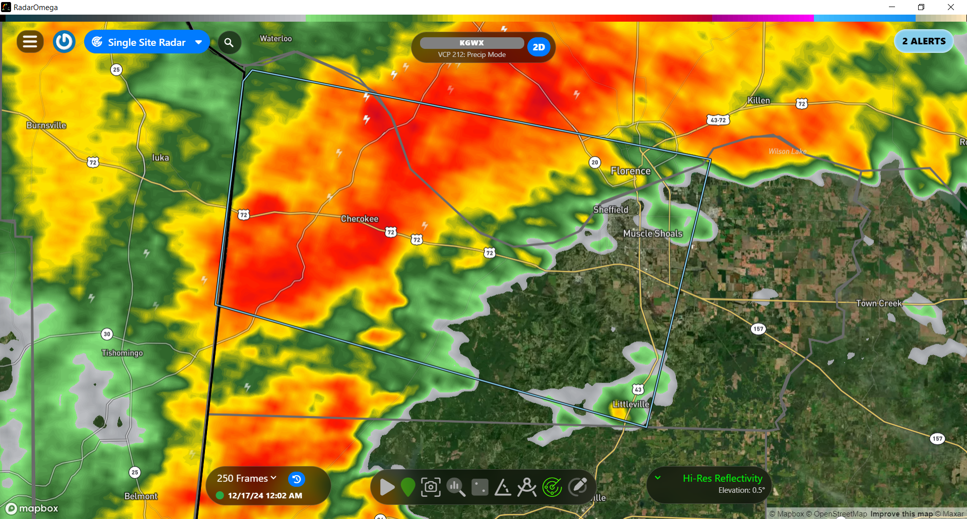
At 10:50pm, a strong thunderstorm was located over Cherokee, moving east at about 35mph. This thunderstorm is capable of producing heavy rain, lightning, and wind gusts up to 40mph. Some locations in the path include Florence, Sheffield, Muscle Shoals, and Tuscumbia.
Other strong storms are also moving into areas west of the US43 corridor including Red Bay and western Marion County. All storms are below severe limits and no severe weather is anticipated.
Category: Alabama's Weather, ALL POSTS, Social Media
About the Author (Author Profile)
Jack is a junior at Mississippi State University studying meteorology. He has several years of forecasting experience through a local group of forecasters in Maryland where he resides. Jack plans to become a broadcast meteorologist after graduation.Subscribe
If you enjoyed this article, subscribe to receive more just like it.


