Tornado Warning in Effect for Downtown Mobile Until 9:00pm CT
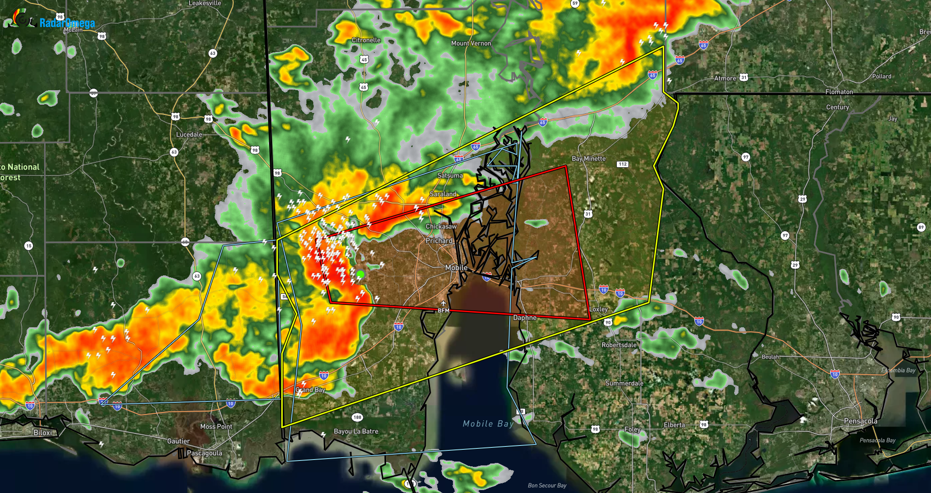
The NWS has issued a Tornado Warning for portions of Mobile and Baldwin counties until 9pm for a tornadic circulation located over the Mobile Airport.
* Tornado Warning for...
  Central Mobile County in southwestern Alabama...
  West central Baldwin County in southwestern Alabama...

* Until 900 PM CST.

* At 821 PM CST, a severe thunderstorm capable of producing a tornado
  was located over Mobile Regional Airport, or 7 miles west of
  Midtown Mobile, moving east at 30 mph.

  HAZARD...Tornado and quarter size hail.

  SOURCE...Radar indicated rotation.

  IMPACT...Flying debris will be dangerous to those caught without
           shelter. Mobile homes will be damaged or destroyed.
           Damage to roofs, windows, and vehicles will occur.  Tree
           damage is likely.

* This dangerous storm will be near...
  Mobile Regional Airport around 825 PM CST.
  Midtown Mobile around 830 PM CST.
  I65 And I165, Downtown Mobile, and Prichard around 840 PM CST.
  Chickasaw around 845 PM CST.

PRECAUTIONARY/PREPAREDNESS ACTIONS...

TAKE COVER NOW! Move to a basement or an interior room on the lowest
floor of a sturdy building. Avoid windows. If you are outdoors, in a
mobile home, or in a vehicle, move to the closest substantial shelter
and protect yourself from flying debris.
Category: Alabama's Weather, ALL POSTS, Social Media
About the Author (Author Profile)
Jack is a junior at Mississippi State University studying meteorology. He has several years of forecasting experience through a local group of forecasters in Maryland where he resides. Jack plans to become a broadcast meteorologist after graduation.Subscribe
If you enjoyed this article, subscribe to receive more just like it.


