Saturday Weather Briefing — Cool & Dry Today; Rain & Storms on Sunday
FIRST SATURDAY OF 2025: High pressure will be dominating our weather for today, as it will be centered over North Alabama. Skies will be mostly sunny with highs only reaching the mid 40s in the north to the lower 60s at the beach.
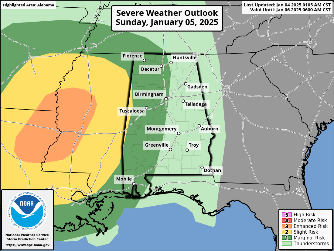
STRONG TO SEVERE STORMS POSSIBLE ON SUNDAY: A dynamic weather system will be moving through the southeast on Sunday that will bring the risk of severe storms, mainly Mississippi, Arkansas, and Louisiana. That risk does move into the western half of Alabama during the evening and overnight hours. The Storm Prediction Center has a Marginal Risk up for the western half of the state, except for the sliver of the locations closest to the AL/MS state line, which is under a Slight Risk. Threats will be from damaging winds and tornadoes.
As far as rainfall, scattered showers will become possible during the morning for Alabama, while the main line of storms and the cold front will start to move in by the evening, and finally exiting by midday Monday. The northern half may receive up to an inch and slightly over, while the southern half looks to get a half an inch to an inch of rainfall through the event. Highs will range from the upper 40s in the northeast to the lower 70s in the southwest.
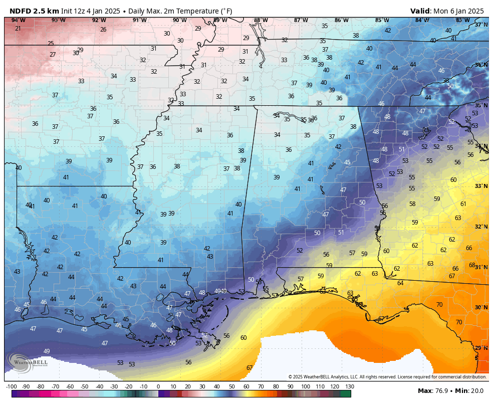
THE WORK WEEK AHEAD: Get ready for much colder weather after the rain ends and the cold front passes through on Monday. We’ll be on the backside of low pressure and our winds will mainly be out of the north. That will pull in an arctic blast as highs only reach the mid 30s in the northwest to the upper 50s in the south. The 540mb line continues to hang out over North Alabama, keeping our temperatures cold on Tuesday. Skies will be mostly sunny with highs in the upper 30s to the upper 40s. High pressure will be centered over the Alabama Gulf Coast on Wednesday, keeping us dry with sunny skies. However, it doesn’t help out in the temperature department, as highs only reach the upper 30s to the upper 40s. On Thursday, we start to see some activity forming over Mexico and South Texas that we will be talking about in a few seconds. For Alabama, high pressure will be just off to our north, helping to keep us chilly and sunny. Highs in the mid 30s to the upper 40s.
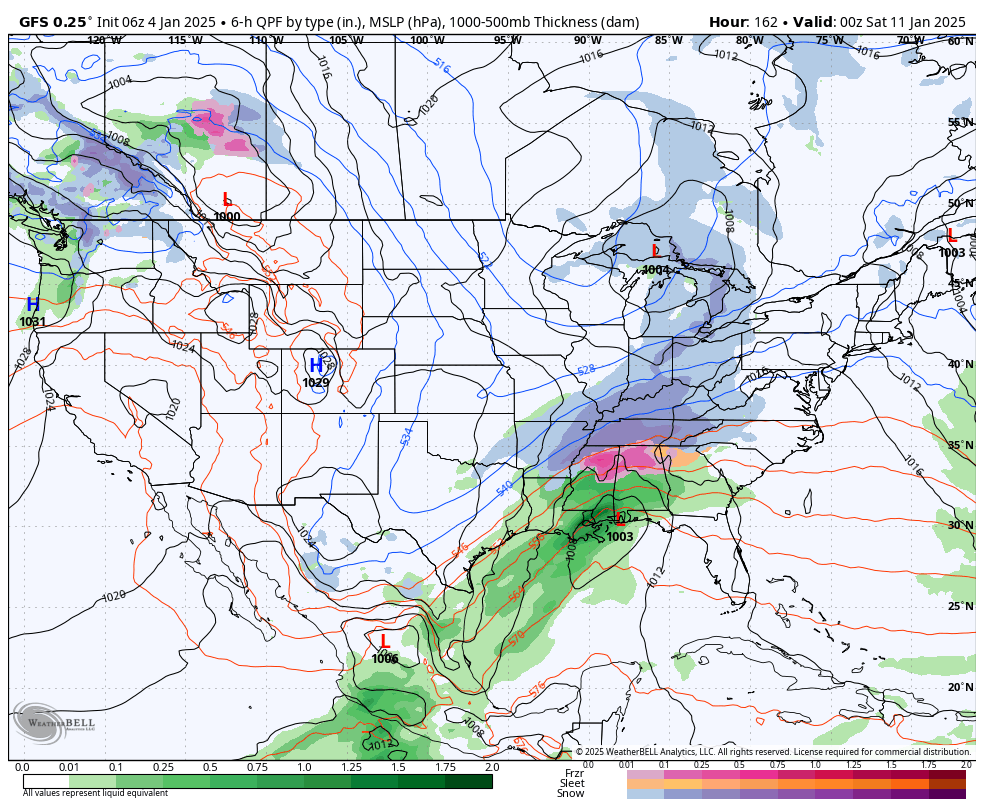
GFS valid at 6pm Friday.
WINTER MISCHIEF TO END THE WEEK?: The activity that I mentioned earlier gets it act together on Friday and heads our way. While it is still too early to determine exactly what is going to happen. The GFS is showing the system beginning to affect Alabama in the morning with rain in the south and a wintry mix in the north and northwest. By the time we reach the evening, the northern half of Alabama may be seeing a wintry mix or even freezing rain, while the south gets rain. The European model is very close to the GFS, but shows more of a snow event for the extreme northern locations of the state, with a wintry mix along and south of the Tennessee River. Rain looks to impact the rest of the state. Highs in the upper 30s to the upper 40s. We’ll keep you updated through the weekend and the work week ahead.
SEVERE WEATHER SAFETY
Weather can be unpredictable, often catching us off guard with sudden changes. From thunderstorms and tornadoes to flash floods, being prepared can truly save lives. Alabama’s varied climate brings its share of severe weather, making it crucial for everyone to have a solid safety plan in place. For valuable tips on staying safe when severe weather threatens, check out our Severe Weather Safety Guide. Stay ready, stay safe!
BEACH FORECAST
Visit our Beach Forecast Center to get the latest weather and rip current forecasts for beaches from Fort Morgan to Panama City. This page allows you to select forecasts tailored to your destination, ensuring you have the most accurate and relevant information for your beach plans. Stay informed and safe on your coastal getaway!
ADVERTISE ON THE BLOG
Don’t miss this opportunity! Let us create a customized package tailored to the unique needs of your organization. Our solutions are creative, flexible, and competitively priced. For more information or inquiries, please contact Bill Murray at (205) 687-0782.
E-FORECAST SIGN UP
Get the Alabama Weather Blog’s comprehensive Seven-Day Forecast delivered straight to your inbox twice daily. Known as the most detailed forecast available in Central Alabama, our service ensures you’re always informed and prepared. Subscribe now and gain access to this valuable resource for free!
Category: Alabama's Weather, ALL POSTS, Severe Weather, Social Media, Weather Xtreme Videos, Winter Weather
About the Author (Author Profile)
Scott Martin is an operational meteorologist, professional graphic artist, musician, husband, and father. Not only is Scott a member of the National Weather Association, but he is also the Central Alabama Chapter of the NWA president. Scott is also the co-founder of Racecast Weather, which provides forecasts for many racing series across the USA. He also supplies forecasts for the BassMaster Elite Series events including the BassMaster Classic.Subscribe
If you enjoyed this article, subscribe to receive more just like it.


