A Brief Weather Check on Alabama at 6pm
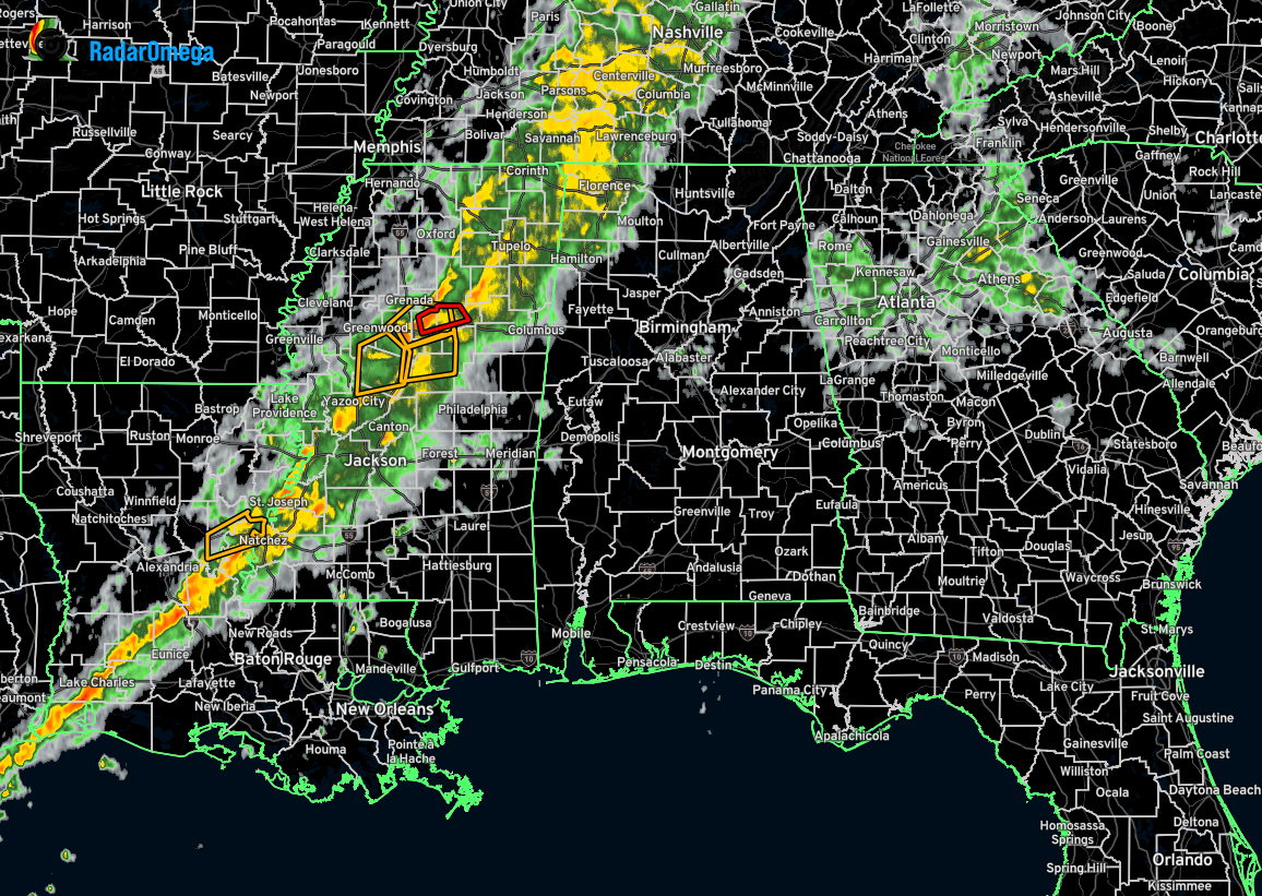
The line of rain and storms is approaching west Alabama with portions of the line moving into and through the northwestern corner of the state. While no severe weather is being experienced in Alabama, A few severe thunderstorm warnings have been issued, along with a tornado warning, back in Mississippi and down in Louisiana. The tornado warning is for portions of Montgomery and Webster counties in Mississippi for a severe thunderstorm capable of producing a tornado. The cell was moving northeast at 40 mph and the warning should expire at 6:30pm.
While severe storms are still possible over Mississippi and into Alabama this evening and tonight, but the overall trend is starting to show that the potential for severe weather in Alabama is decreasing. Here are the latest updates from the three NWS offices in Alabama.
The latest update from NWS Huntsville stated that after coordination with Birmingham and the SPC, a Watch is unlikely for the area. We’ll continue to monitor conditions and provide updates if anything changes, but the trend toward decreasing severe weather potential this evening remains consistent.
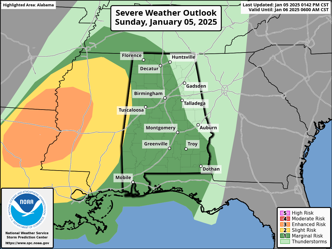
The latest update from NWS Birmingham stated that while severe storms and tornado debris signatures (TDSs) have been observed near the Mississippi River, this activity is expected to weaken significantly as it approaches Alabama this evening. With ample wind shear but minimal instability, the line should lose strength, though a marginal risk remains along and west of I-65 to account for any lingering potential during its weakening phase.
The latest update from NWS Mobile stated that confidence in the potential for severe weather tonight has decreased further since this morning. Despite the marginal risk being expanded eastward, severe storm potential east of southeastern Mississippi remains low, with only an isolated damaging wind gust or two expected at most. Regarding morning conditions, black ice is not anticipated as strong winds and a short duration of below-freezing temperatures will dry roads quickly. Additionally, a Gale Warning has been issued for tonight due to frequent gale-force gusts over offshore Gulf waters.
While this is reassuring news, it’s still important to remain weather aware through the evening and overnight hours. There is a chance of a warning or two, but the likelihood continues to decrease as the evening progresses..
Category: Alabama's Weather, ALL POSTS, Severe Weather, Social Media
About the Author (Author Profile)
Scott Martin is an operational meteorologist, professional graphic artist, musician, husband, and father. Not only is Scott a member of the National Weather Association, but he is also the Central Alabama Chapter of the NWA president. Scott is also the co-founder of Racecast Weather, which provides forecasts for many racing series across the USA. He also supplies forecasts for the BassMaster Elite Series events including the BassMaster Classic.Subscribe
If you enjoyed this article, subscribe to receive more just like it.


