A Brief Radar Check at 7:30PM
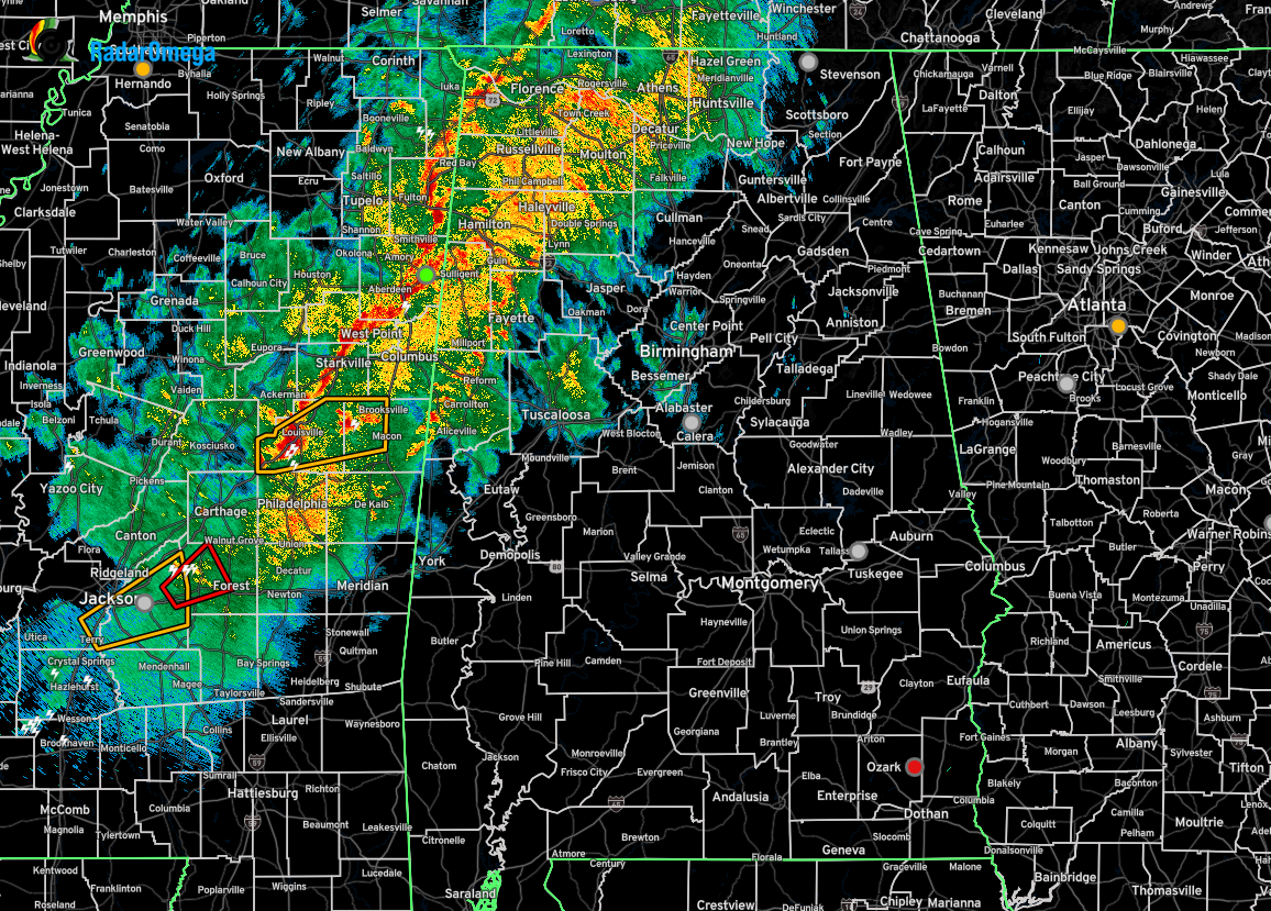
The main part of the line of storms is now approaching Lamar and Marion Counties in the western parts of Central Alabama. While a cell east of Amory, MS, is showing some spin aloft, but the potential to be surface-based is unlikely. For now, no warnings are planned on being issued on this cell unless something drastically changes.
Back to the southwest, storms continue to show signs of rotation and the potential for damaging winds, but those will be moving into much more stable air as they push eastward. For the northeastern parts of the line, gusty winds can be expected as the cold front pushes closer to the area. There is literally no surface-based instability over north Alabama, so it would be very difficult for severe storms to either develop or maintain their strength.
We’ll keep our eyes on radar and on NWS Chat to pass out any more information through the evening. Stay tuned!
Category: Alabama's Weather, ALL POSTS, Severe Weather, Social Media
About the Author (Author Profile)
Scott Martin is an operational meteorologist, professional graphic artist, musician, husband, and father. Not only is Scott a member of the National Weather Association, but he is also the Central Alabama Chapter of the NWA president. Scott is also the co-founder of Racecast Weather, which provides forecasts for many racing series across the USA. He also supplies forecasts for the BassMaster Elite Series events including the BassMaster Classic.Subscribe
If you enjoyed this article, subscribe to receive more just like it.


