Midday Nowcast: Rain Returns To Alabama Tonight; The Arctic Floodgates Open Sunday
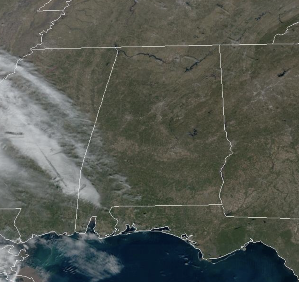
FINE FRIDAY: Today, southerly flow begins allowing temperatures to climb into the lower 60s for many locations. Clouds will begin to increase this afternoon, and periods of rain will move into Alabama tonight, lasting into tomorrow. A few rumbles of thunder are possible, but no severe weather. Rain amounts for much of the state will be in the one-half inch range. The rain will come to an end tomorrow afternoon and evening, with tomorrow’s highs near 60° once again.
BIRMINGHAM ALMANAC: For January 17th, the average high for Birmingham is 54° and the average low is 35°. The record high is 79° set in 1943, while the record low is 0° set in 1982. We average 0.15” of precipitation on this date and the record value is 2.67” set in 1925.
OPENING OF THE ARCTIC FLOODGATES: On Sunday, an Arctic front will come blowing through the state, bringing the coldest air so far this winter to Alabama. Sunday will be very cold with highs holding in the 30s all day across the northern half of the state, add in an icy north wind, and wind chills will be in the 20s all day. It will be a mainly cloudy day, and there will be snow flurries flying around in the sky as the moisture departs. Once temperature fall below freezing on Sunday, it will likely be Wednesday before temperatures climb back above freezing for most of North and Central Alabama. Plan now, for a prolonged period of time of sub-freezing temperatures.
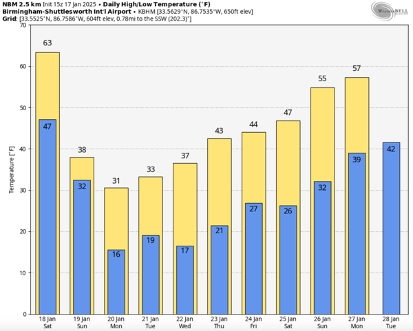
FRIGID AIR: Dangerously cold air will be in place across Alabama much of next week. With highs remaining below freezing for the northern half of the state for the first half of the week, we expect lows in the in the teens likely as well. We know for sure the cold air will be in place, but what about moisture, will it move into Alabama bringing us another round of winter weather precipitation, well that continues to be the unknown.
As we continue to look at model trends, which are not a forecast, the models are coming into better agreement and the potential for a winter storm across the southern U.S. during the mid-week period is increasing. It remains too early to know any details such as what will we see, where will we see it, and what impacts there could be?
For now, and this could certainly change, the better chance of winter weather precipitation is along and south of Interstate 20, over the southern two-thirds of the sate. Higher totals could actually be south of U.S. 80 (Demopolis to Montgomery to Opelika). With very cold air in place, there is no doubt there will be some very significant impacts, but it is still too early to be really specific. I think by Sunday, we can start diving into the details of the forecast for this event.
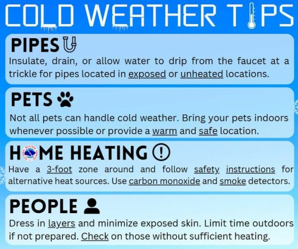
Winter storm or not, next week is going to be very cold, and now is the time to prepare for 4-5 days of frigid weather and for now, the very cold weather is the greatest concern, and over the next few days, please make any cold weather preparations that need to be taken.
WORLD TEMPERATURE EXTREMES: Over the last 24 hours, the highest observation outside the U.S. was 112.1F at Rivadavia, Argentina. The lowest observation was -74.4F at Summit, Greenland.
CONTIGUOUS TEMPERATURE EXTREMES: Over the last 24 hours, the highest observation was 78F at Tollenson, AZ. The lowest observation was -20F at Gunnison, CO.
Category: Alabama's Weather, ALL POSTS, Social Media
About the Author (Author Profile)
Macon, Georgia Television Chief Meteorologist, Birmingham native, and long time Contributor on AlabamaWX. Stormchaser. I did not choose Weather, it chose Me. College Football Fanatic. @Ryan_StinnetSubscribe
If you enjoyed this article, subscribe to receive more just like it.


