A Close Look at Tuesday’s Winter Weather Chances
Winter precipitation is expected to occur across some areas of central and southern Alabama on Tuesday. Uncertainty remains regarding the locations and amount of snowfall, but models are beginning to align in terms of timing. Currently, it appears that a large area of winter precipitation will move across southern Mississippi on Tuesday morning. Then, around lunchtime, this precipitation should begin to move into southern Alabama and continue to move across the state throughout the afternoon. By the early hours of Wednesday, most of the precipitation will have moved out of our area.
Currently, most models are showing snowfall amounts of less than an inch for areas in central Alabama. Further south, down to the coast, snow amount estimations generally increase – 1 to 3 inches of snow could occur in some areas. However, we are still a couple days out from this event, and this forecast will likely change. With this being said, continue to stay up to date with the latest information.
We expect the National Weather Service to begin issuing Winter Storm Watches sometime in the coming hours.
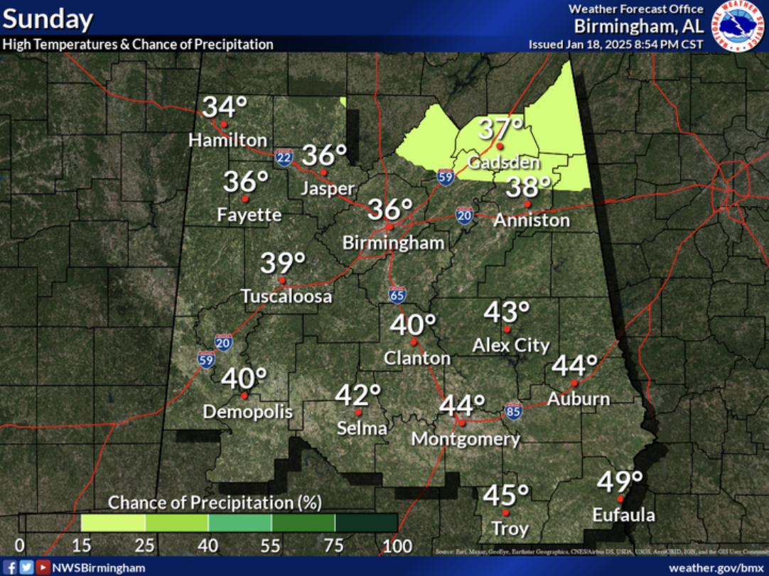
Be prepared for cold temperatures over the coming days. Tomorrow, highs across the state will be in the 30s and 40s.
Category: Alabama's Weather, ALL POSTS, Social Media, Winter Weather
About the Author (Author Profile)
Scott is a senior at Mississippi State University studying professional and broadcast meteorology.Subscribe
If you enjoyed this article, subscribe to receive more just like it.


