Update on Active Weather Alerts Across Central And Northern Alabama
The first order of business is the extreme cold we are anticipating to arrive on Monday, regardless of any snow that may come on Tuesday.
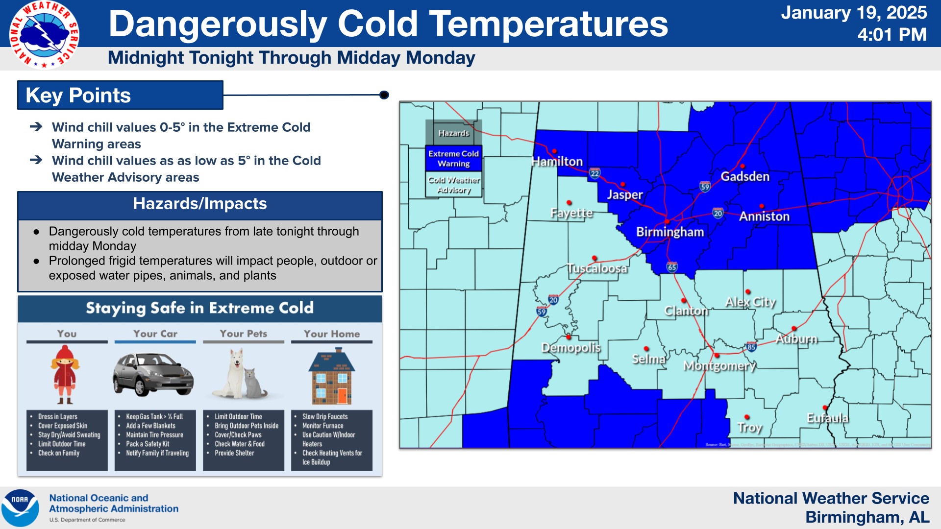
Currently, there are extreme cold warnings in effect for portions of Central, Northern, and Northeastern Alabama, as well as the southwestern portion of the state. This includes places like Hamilton, Jasper, Cullman, Birmingham, Calera, Anniston, and Gadsden. Here, wind chills could drop to as low as 5 below 0 in the coldest spots.
For the middle section of the state as well as northwestern AL, including places like Fayette, Tuscaloosa, Demopolis, Selma, Clanton, Auburn, and Troy, there is a cold weather advisory. Here, wind chills are expected to range from 0 to 10 degrees on Monday.
This type of cold is hazardous, and can result in frostbite and hypothermia quickly if precautions are not taken. Be sure to dress appropriately and in layers, and check up on the more vulnerable populations and never leave pets outdoors unattended in this type of cold. Water pipes are also at risk of bursting, so precautions should be close to finished at this point.
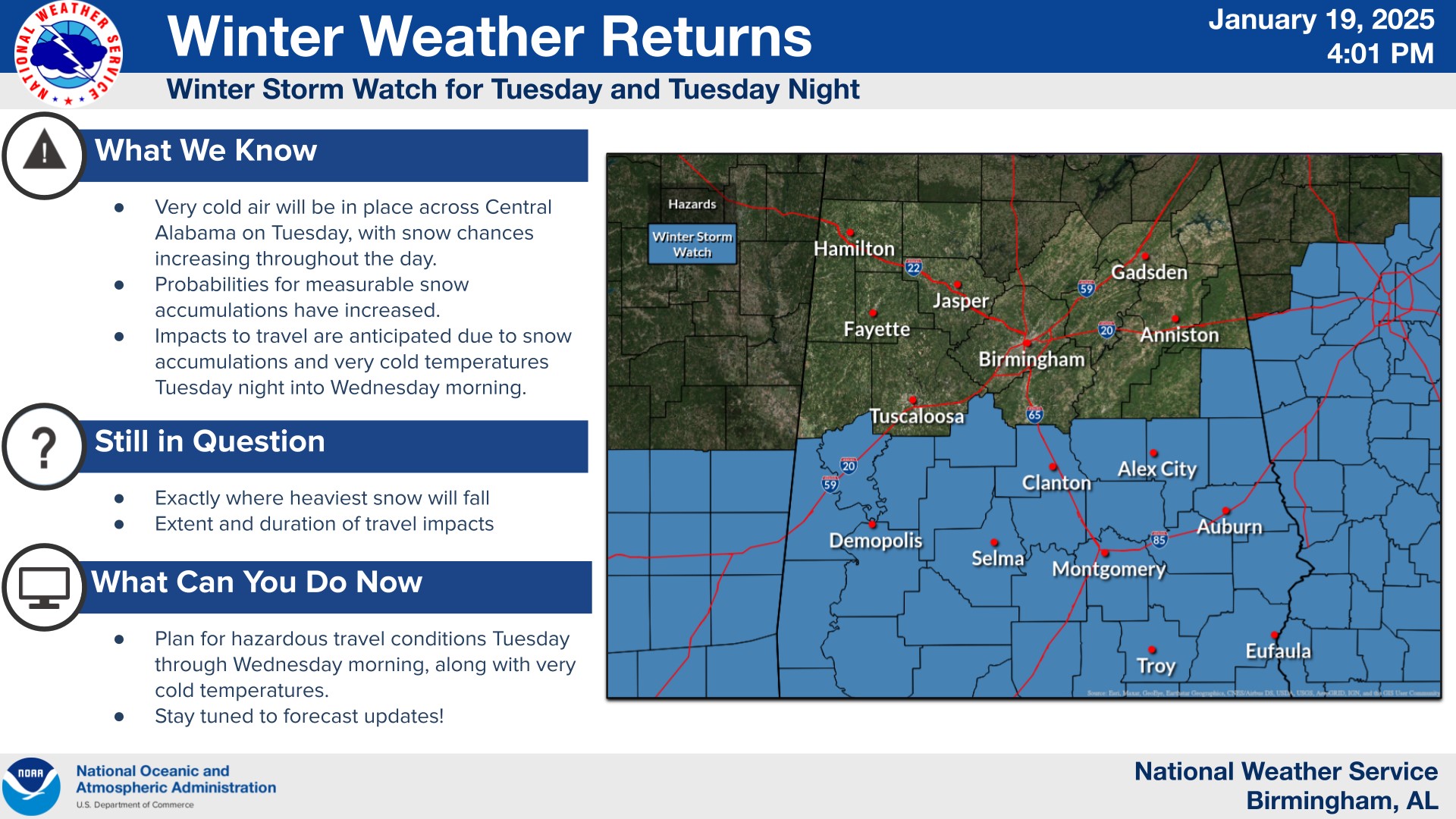
There is also a winter storm watch in effect for the southern half of the state. This includes counties along and south of Sumter, Greene, Hale, Bibb, Chilton, Coosa, Tallapoosa, and Randolph. Within the winter storm watch, accumulating snow has the potential to lead to significant delays and travel disruptions, as well as closures. The winter storm watch is in effect from 6am Tuesday until 6am Wednesday. While light snow may make it as far north as I-20, the confidence in accumulating and more highly impactful accumulations will be south of that corridor, over the southern third of the state.
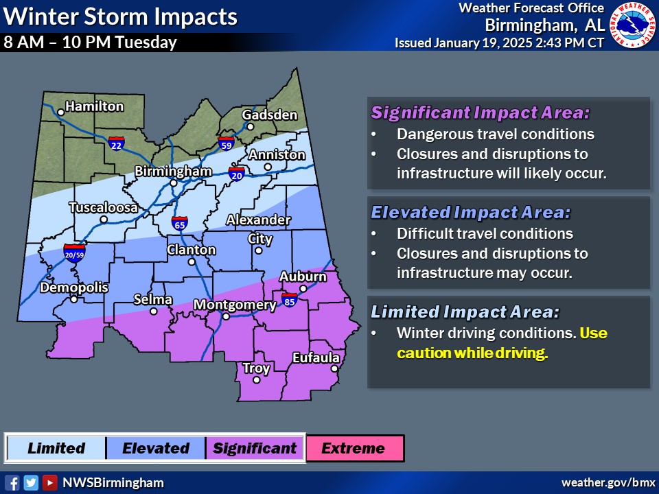
This is highlighted well in this graphic created by NWS Birmingham, showing elevated to significant impacts mainly south of the I-20 corridor. These impacts could include closures and delays as well as snow covered roads resulting in hazardous travel conditions. For the Birmingham and Tuscaloosa metros, the risk is limited, although travel impacts cannot be ruled out if snow does indeed occur, as the ground will be very cold.
While the exact amount of accumulation is still uncertain, especially the further north you go, a general 1-3″ seems likely in the winter storm watch area. Now is the time to prepare for potential travel disruptions and closures on Tuesday and Wednesday.
Category: Alabama's Weather, ALL POSTS, Social Media
About the Author (Author Profile)
Jack is a junior at Mississippi State University studying meteorology. He has several years of forecasting experience through a local group of forecasters in Maryland where he resides. Jack plans to become a broadcast meteorologist after graduation.Subscribe
If you enjoyed this article, subscribe to receive more just like it.


