Wintry Precipitation Reported in Northwest Alabama, Where Temperatures Are Dropping Below Freezing
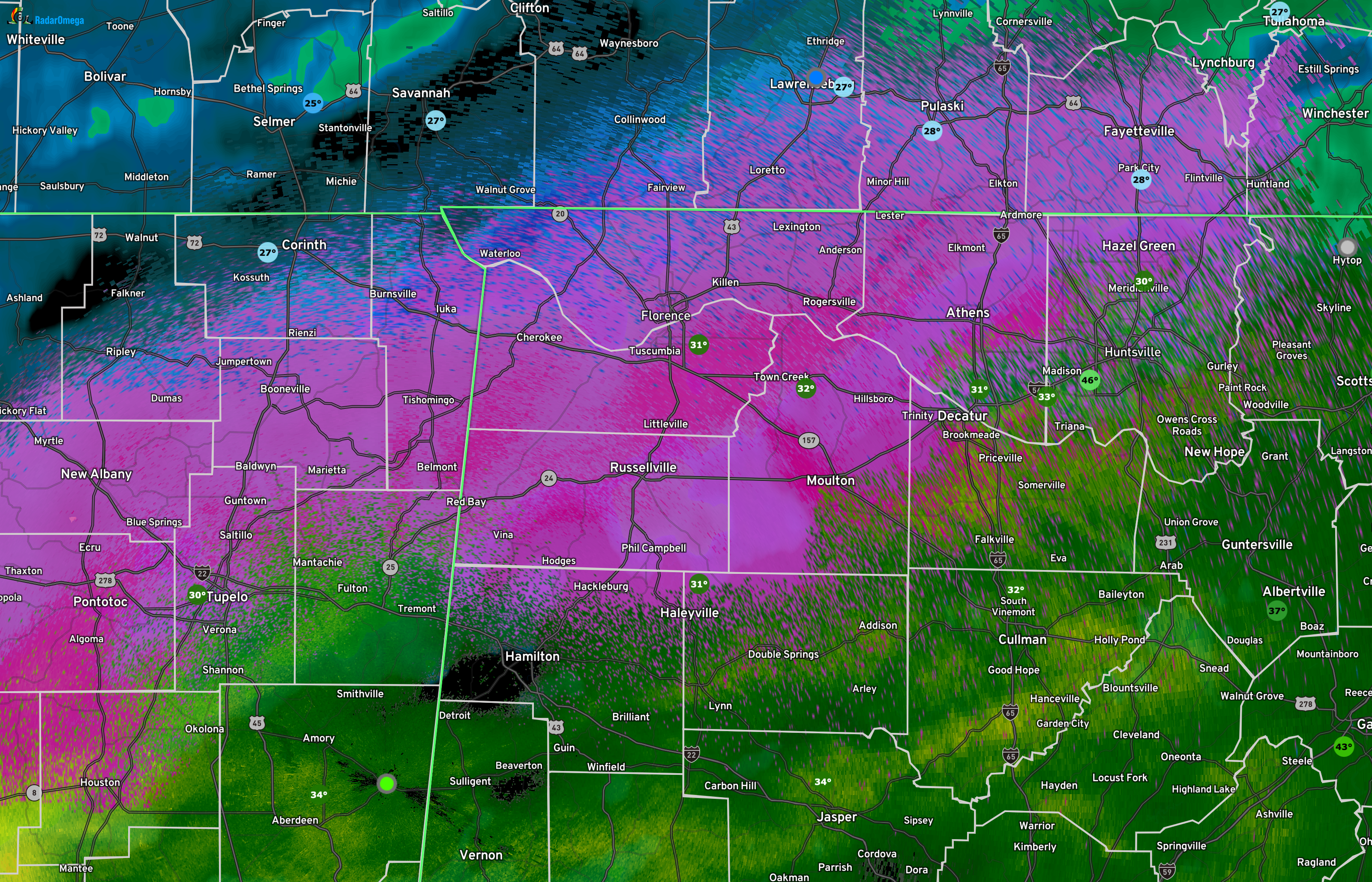
Northwest Alabama Radar as of 3:22AM.
As we approach the 4AM hour in Alabama, all remains rather quiet on the roadways as most locations continue to remain above freezing in the zone along and north of US-278. However, temperatures are starting to reach and even dip below freezing in the northwest corner of the state, where we are already receiving reports of sleet and snow falling. Locations along and north of a line from Haleyville to Decatur to Hazel Green are currently seeing temperatures in the 30-32 degree range. No travel issues have been reported on NWS chat and on social media. We’ll keep our eyes open for any reports and share them as quickly as possible on the blog.
South of a line from Hamilton to Huntsville, where there is precipitation, it is in the form of rainfall as temperatures are above freezing. However, the cold front is moving eastward and will eventually drop those temperatures closer to freezing, and we’ll have to watch the northern fringes of Central Alabama and all the way through North Alabama for accumulating snowfall and any ice accumulation that could cause travel issues.
The big story for everyone will be the big chill that will impact the state through the remainder of the week as early morning lows on Thursday will drop to the mid-teens to the lower 30s across the state, and into the lower teens to the mid 20s on Friday morning. This is the type of cold where you have to protect the pipes, the plants, the pets, and the people who may not be able to find a warm place to stay. Those early morning lows will stay below freezing for much of the state through the weekend, as afternoon highs will make it into the upper 40s to the lower 60s from north to south.
Category: Alabama's Weather, ALL POSTS, Social Media, Winter Weather
About the Author (Author Profile)
Scott Martin is an operational meteorologist, professional graphic artist, musician, husband, and father. Not only is Scott a member of the National Weather Association, but he is also the Central Alabama Chapter of the NWA president. Scott is also the co-founder of Racecast Weather, which provides forecasts for many racing series across the USA. He also supplies forecasts for the BassMaster Elite Series events including the BassMaster Classic.Subscribe
If you enjoyed this article, subscribe to receive more just like it.


